
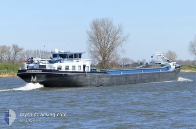
SCALDIS
Other Type
Current Trip
| Time Travelled | 17 h, 12 mins |
|---|---|
| Remaining Time | 3 h, 49 mins |
| Distance Travelled | 53.43 морская миля |
| Remaining Distance | 52.63 морская миля |
| AVG Speed | 7.2 Узлы |
| MAX Speed | 9.7 Узлы |
| AVG Wind | 7.4 knots |
| MAX Wind | 12 knots |
| MIN Temp | 6.9°C / 44.42°F |
| MAX Temp | 9.2°C / 48.56°F |
| Осадка | 0.2 м |
| Позиция Получена | 7 h, 17 m тому назад |
Current Position
| Долгота | 4.39132° |
|---|---|
| Широта | 51.64507° |
| Статус | Under way using engine |
| Скорость | 5.1 Узлы |
| Курс | 109° |
| Район | North Sea |
| Станция | T-AIS |
| Позиция Получена | 7 h, 17 m тому назад |
Info
Information
The current position of SCALDIS is in North Sea with coordinates 51.64507° / 4.39132° as reported on 2024-04-23 18:03 by AIS to our vessel tracker app. The vessel's current speed is 5.1 Узлы and is heading at the port of BRESKENS. The estimated time of arrival as calculated by MyShipTracking vessel tracking app is 2024-04-24 05:10 LT
The vessel SCALDIS (MMSI: 244740167) is a Other Type It's sailing under the flag of [NL] Netherlands.
In this page you can find informations about the vessels current position, last detected port calls, and current voyage information. If the vessels is not in coverage by AIS you will find the latest position.
The current position of SCALDIS is detected by our AIS receivers and we are not responsible for the reliability of the data. The last position was recorded while the vessel was in Coverage by the Ais receivers of our vessel tracking app.
The current draught of SCALDIS as reported by AIS is 0.2 meters
Weather
| Temperature | 5.3°C / 41.54°F |
|---|---|
| Wind Speed | 9 knots |
| Direction | 330° NNW |
| Pressure | 1014 hPa |
| Humidity | 77.5 % |
| Cloud Coverage | 100 % |
Featured Company
Last Port Calls
| Port | Arrival | Departure | Time In Port |
|---|---|---|---|
| 2024-04-22 20:33 | 2024-04-23 08:09 | 11 h | |
| 2024-04-22 16:25 | 2024-04-22 19:28 | 3 h | |
| 2024-04-22 12:45 | 2024-04-22 15:05 | 2 h | |
| 2024-04-19 16:37 | 2024-04-19 18:46 | 2 h | |
| 2024-04-18 13:11 | 2024-04-19 15:37 | 1 d | |
| 2024-04-16 22:33 | 2024-04-17 10:56 | 12 h | |
| 2024-04-12 12:12 | 2024-04-12 13:53 | 1 h | |
| 2024-04-11 13:42 | 2024-04-12 04:59 | 15 h | |
| 2024-04-10 18:39 | 2024-04-11 09:56 | 15 h | |
| 2024-04-09 18:50 | 2024-04-10 05:58 | 11 h |
Last Trips
| Origin | Departure | Destination | Arrival | Distance | |
|---|---|---|---|---|---|
| 2024-04-22 21:28 | 2024-04-22 22:33 | 10.77 морская миля | |||
| 2024-04-22 17:05 | 2024-04-22 18:25 | 10.05 морская миля | |||
| 2024-04-19 20:46 | 2024-04-22 14:45 | 52.32 морская миля | |||
| 2024-04-19 17:37 | 2024-04-19 18:37 | 8.16 морская миля | |||
| 2024-04-17 12:56 | 2024-04-18 15:11 | 116.73 морская миля | |||
| 2024-04-12 15:53 | 2024-04-17 00:33 | 103.91 морская миля | |||
| 2024-04-12 06:59 | 2024-04-12 14:12 | 39.94 морская миля | |||
| 2024-04-11 11:56 | 2024-04-11 15:42 | 31.78 морская миля | |||
| 2024-04-10 07:58 | 2024-04-10 20:39 | 57.79 морская миля | |||
| 2024-04-08 14:23 | 2024-04-09 20:50 | 65.07 морская миля |
Events
| Время | Событие | Детали | Позиция / Направление | Информация |
|---|---|---|---|---|
| 2024-04-23 19:20 | Окончание движения | 2.14 nm, East of STAMPERSGAT |
51.61134 / 4.49814
NLBRS131G1CITYX00010
|
Скорость: 0.3 kn Курс: -1° |
| 2024-04-23 18:11 | Статус изменился | Default Under way using engine |
51.63714 / 4.40224
NLBRS131G1CITYX00010
|
Скорость: 5.1 kn Курс: 109° |
| 2024-04-23 18:03 | Статус изменился | Under way using engine Default |
51.64507 / 4.39132
NLBRS131G1CITYX00010
|
Скорость: 6 kn Курс: 124° |
| 2024-04-23 18:03 | Вне покрытия |
51.64507 / 4.39132
North Sea
|
Скорость: 5.1 kn Курс: 109° |
|
| 2024-04-23 17:44 | В покрытии |
51.64507 / 4.39132
North Sea
|
Скорость: 5.1 kn Курс: 109° |
|
| 2024-04-23 16:50 | Статус изменился | Default Under way using engine |
51.65315 / 4.19974
NLBRS131G1CITYX00010
|
Скорость: 7.1 kn Курс: 131° |
| 2024-04-23 16:45 | Вне покрытия |
51.65977 / 4.18845
North Sea
|
Скорость: 7.1 kn Курс: 131° |
|
| 2024-04-23 16:38 | Начало движения | 2.82 nm, North of SINT PHILIPSLAND |
51.66198 / 4.16754
NLBRS131G1CITYX00010
|
Скорость: 6.2 kn Курс: 90.3° |
| 2024-04-23 16:35 | Статус изменился | Under way using engine Default |
51.66200 / 4.16097
NLBRS131G1CITYX00010
|
Скорость: Курс: -1° |
| 2024-04-23 16:15 | Статус изменился | Default Under way using engine |
51.66198 / 4.16040
NLBRS131G1CITYX00010
|
Скорость: 1 kn Курс: 511° |