
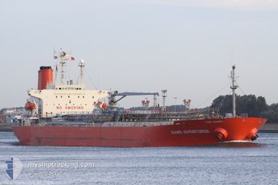
SAAMIS ADVENTURER
Oil/Chemical Tanker
Current Trip
CILACAP
| Time Travelled | 2 days |
|---|---|
| Remaining Time | --- |
| Distance Travelled | 285.10 морская миля |
| Remaining Distance | --- |
| AVG Speed | 9 Узлы |
| MAX Speed | 10.8 Узлы |
| AVG Wind | 6.9 knots |
| MAX Wind | 15.8 knots |
| MIN Temp | 23.9°C / 75.02°F |
| MAX Temp | 30.1°C / 86.18°F |
| Осадка | 7.5 м |
| Позиция Получена | 6 d тому назад |
Current Position
| Долгота | 110.91872° |
|---|---|
| Широта | -6.20125° |
| Статус | Under way using engine |
| Скорость | 10.8 Узлы |
| Курс | 89° |
| Район | Java Sea |
| Станция | T-AIS |
| Позиция Получена | 6 d тому назад |
Info
Information
The current position of SAAMIS ADVENTURER is in Java Sea with coordinates -6.20125° / 110.91872° as reported on 2024-04-11 18:53 by AIS to our vessel tracker app. The vessel's current speed is 10.8 Узлы
The vessel SAAMIS ADVENTURER (IMO: 9126285, MMSI: 525020420) is a Oil/Chemical Tanker that was built in 1996 ( 28 лет ). It's sailing under the flag of [ID] Indonesia.
In this page you can find informations about the vessels current position, last detected port calls, and current voyage information. If the vessels is not in coverage by AIS you will find the latest position.
The current position of SAAMIS ADVENTURER is detected by our AIS receivers and we are not responsible for the reliability of the data. The last position was recorded while the vessel was in Coverage by the Ais receivers of our vessel tracking app.
The current draught of SAAMIS ADVENTURER as reported by AIS is 7.5 meters
Weather
| Temperature | 30.1°C / 86.18°F |
|---|---|
| Wind Speed | 6 knots |
| Direction | 188° S |
| Pressure | 1006 hPa |
| Humidity | 68.5 % |
| Cloud Coverage | 100 % |
Featured Company
Most Visited Ports (Last year)
| Port | Arrivals | |
|---|---|---|
| 14 | ||
| 5 | ||
| 4 | ||
| 3 | ||
| 2 | ||
| 1 |
Last Trips
| Origin | Departure | Destination | Arrival | Distance | |
|---|---|---|---|---|---|
| 2024-04-05 21:56 | 2024-04-14 15:46 | 1005.26 морская миля | |||
| 2024-02-16 08:33 | 2024-04-04 07:32 | 1130.64 морская миля | |||
| 2024-02-10 08:13 | 2024-02-14 15:51 | 907.34 морская миля | |||
| 2024-01-15 08:58 | 2024-02-08 10:33 | 1563.52 морская миля |
Events
| Время | Событие | Детали | Позиция / Направление | Информация |
|---|---|---|---|---|
| 2024-04-17 04:55 | Окончание движения | 3.11 nm, West of MEKAR PUTIH |
-4.04725 / 115.98844
CILACAP
|
Скорость: 0.2 kn Курс: 195° |
| 2024-04-15 22:50 | Начало движения | 0.66 nm, South East of MANGGIS |
-8.52172 / 115.51987
CILACAP
|
Скорость: 3.4 kn Курс: 120° |
| 2024-04-15 22:40 | ПОРТ ОТПРАВЛЕНИЯ |
|
-8.51761 / 115.51608
CILACAP
|
Скорость: Курс: 117° |
| 2024-04-14 08:10 | Окончание движения |
-8.51291 / 115.51375
[ID] MANGGIS
|
Скорость: 0.2 kn Курс: 107° |
|
| 2024-04-14 07:46 | Порт |
|
-8.51435 / 115.51366
[ID] MANGGIS
|
Скорость: 4 kn Курс: 308° |
| 2024-04-14 07:17 | Начало движения | 0.96 nm, South East of MANGGIS |
-8.52340 / 115.52617
CILACAP
|
Скорость: 4.1 kn Курс: 302° |
| 2024-04-13 05:45 | Окончание движения | 1.35 nm, East of MANGGIS |
-8.51536 / 115.53741
CILACAP
|
Скорость: Курс: 300° |
| 2024-04-11 19:17 | Статус изменился | Default Under way using engine |
-6.20419 / 110.99048
CILACAP
|
Скорость: 10.8 kn Курс: 89° |
| 2024-04-11 18:53 | Вне покрытия |
-6.20125 / 110.91872
Java Sea
|
Скорость: 10.8 kn Курс: 89° |
|
| 2024-04-11 18:29 | Статус изменился | Under way using engine Default |
-6.20138 / 110.84884
CILACAP
|
Скорость: 10.3 kn Курс: 86° |