
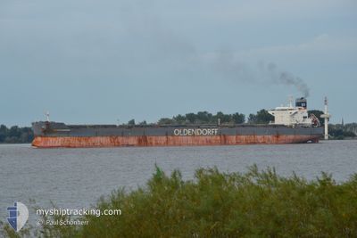
ROLAND OLDENDORFF
Bulk Carrier
Current Trip
CN TXG
| Time Travelled | 3 days |
|---|---|
| Remaining Time | --- |
| Distance Travelled | 800.28 морская миля |
| Remaining Distance | --- |
| AVG Speed | 11.5 Узлы |
| MAX Speed | 13.8 Узлы |
| AVG Wind | 10.4 knots |
| MAX Wind | 26.2 knots |
| MIN Temp | 8.9°C / 48.02°F |
| MAX Temp | 17.2°C / 62.96°F |
| Осадка | 14.9 м |
| Позиция Получена | 2 d тому назад |
Current Position
| Долгота | 118.79862° |
|---|---|
| Широта | 38.77526° |
| Статус | Under way using engine |
| Скорость | 12.2 Узлы |
| Курс | 100.1° |
| Район | Yellow Sea |
| Станция | T-AIS |
| Позиция Получена | 2 d тому назад |
Info
Information
The current position of ROLAND OLDENDORFF is in Yellow Sea with coordinates 38.77526° / 118.79862° as reported on 2024-04-22 08:37 by AIS to our vessel tracker app. The vessel's current speed is 12.2 Узлы
The vessel ROLAND OLDENDORFF (IMO: 9463633, MMSI: 636092816) is a Bulk Carrier that was built in 2011 ( 13 лет ). It's sailing under the flag of [LR] Liberia.
In this page you can find informations about the vessels current position, last detected port calls, and current voyage information. If the vessels is not in coverage by AIS you will find the latest position.
The current position of ROLAND OLDENDORFF is detected by our AIS receivers and we are not responsible for the reliability of the data. The last position was recorded while the vessel was in Coverage by the Ais receivers of our vessel tracking app.
The current draught of ROLAND OLDENDORFF as reported by AIS is 14.9 meters
Weather
| Temperature | 17.3°C / 63.14°F |
|---|---|
| Wind Speed | 8 knots |
| Direction | 88° E |
| Pressure | 1013.5 hPa |
| Humidity | 64.4 % |
| Cloud Coverage | 100 % |
Featured Company
Last Port Calls
| Port | Arrival | Departure | Time In Port |
|---|---|---|---|
| 2024-04-21 20:36 | |||
| 2024-04-09 15:37 | 2024-04-12 16:30 | 3 d | |
| 2024-03-01 23:45 | 2024-03-07 06:24 | 5 d |
Last Trips
| Origin | Departure | Destination | Arrival | Distance | |
|---|---|---|---|---|---|
| 2024-03-07 08:24 | 2024-04-09 23:37 | 7693.91 морская миля | |||
| 2024-01-19 19:10 | 2024-03-02 01:45 | 4683.69 морская миля |
Events
| Время | Событие | Детали | Позиция / Направление | Информация |
|---|---|---|---|---|
| 2024-04-22 08:43 | Статус изменился | Default Under way using engine |
38.77136 / 118.82790
CN TXG
|
Скорость: 12.2 kn Курс: 100.1° |
| 2024-04-22 08:37 | Вне покрытия |
38.77526 / 118.79862
Yellow Sea
|
Скорость: 12.2 kn Курс: 100.1° |
|
| 2024-04-22 07:50 | Статус изменился | Under way using engine Default |
38.79955 / 118.59917
CN TXG
|
Скорость: 11.8 kn Курс: 96° |
| 2024-04-22 07:44 | В покрытии |
38.79955 / 118.59917
Yellow Sea
|
Скорость: 11.9 kn Курс: 97° |
|
| 2024-04-22 06:04 | Начало движения | 20.55 nm, South West of CAOFEIDIAN |
38.84157 / 118.20200
CN TXG
|
Скорость: 4.7 kn Курс: 95° |
| 2024-04-21 22:32 | Окончание движения | 20.67 nm, South West of CAOFEIDIAN |
38.84139 / 118.19920
CN TXG
|
Скорость: 0.1 kn Курс: 294° |
| 2024-04-21 20:36 | ПОРТ ОТПРАВЛЕНИЯ |
|
38.95569 / 117.88372
CN TXG
|
Скорость: 11.4 kn Курс: 103° |
| 2024-04-21 20:08 | Начало движения |
38.96990 / 117.79125
[CN] TIANJIN
|
Скорость: 3.9 kn Курс: 101° |
|
| 2024-04-17 07:08 | Начало движения |
38.08865 / 124.01324
CN TXG
|
Скорость: 6.6 kn Курс: 207° |
|
| 2024-04-17 05:51 | Окончание движения |
38.09053 / 124.02468
CN TXG
|
Скорость: 0.3 kn Курс: 135° |