
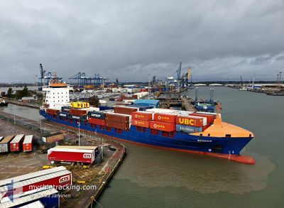
RANGER
Container Ship
Current Trip
| Time Travelled | 2 days |
|---|---|
| Remaining Time | --- |
| Distance Travelled | 338.00 морская миля |
| Remaining Distance | --- |
| AVG Speed | 14 Узлы |
| MAX Speed | 20.3 Узлы |
| AVG Wind | 18.6 knots |
| MAX Wind | 34 knots |
| MIN Temp | 10.2°C / 50.36°F |
| MAX Temp | 14°C / 57.2°F |
| Осадка | 7.7 м |
| Позиция Получена | 1 d тому назад |
Current Position
| Долгота | --- |
|---|---|
| Широта | --- |
| Статус | Under way using engine |
| Скорость | 16.5 Узлы |
| Курс | 235.9° |
| Район | North Sea |
| Станция | T-AIS |
| Позиция Получена | 1 d тому назад |
Info
Information
The current position of RANGER is in North Sea with coordinates 51.09651° / 1.53470° as reported on 2025-12-07 23:04 by AIS to our vessel tracker app. The vessel's current speed is 16.5 Узлы
The vessel RANGER (IMO: 9322542, MMSI: 209696000) is a Container Ship that was built in 2005 ( 20 лет ). It's sailing under the flag of [CY] Cyprus.
In this page you can find informations about the vessels current position, last detected port calls, and current voyage information. If the vessels is not in coverage by AIS you will find the latest position.
The current position of RANGER is detected by our AIS receivers and we are not responsible for the reliability of the data. The last position was recorded while the vessel was in Coverage by the Ais receivers of our vessel tracking app.
The current draught of RANGER as reported by AIS is 7.7 meters
Weather
| Temperature | 13.9°C / 57.02°F |
|---|---|
| Wind Speed | 22 knots |
| Direction | 223° SW |
| Pressure | 1007.6 hPa |
| Humidity | 86 % |
| Cloud Coverage | 100 % |
Featured Company
Last Port Calls
| Port | Arrival | Departure | Time In Port |
|---|---|---|---|
| 2025-12-05 22:56 | 2025-12-07 15:18 | 1 d | |
| 2025-12-01 02:52 | 2025-12-02 11:02 | 1 d | |
| 2025-11-27 16:55 | 2025-11-29 12:22 | 1 d | |
| 2025-11-24 07:52 | 2025-11-25 18:33 | 1 d | |
| 2025-11-21 03:02 | 2025-11-22 14:13 | 1 d | |
| 2025-11-17 08:57 | 2025-11-18 15:24 | 1 d | |
| 2025-11-14 01:23 | 2025-11-15 18:27 | 1 d | |
| 2025-11-11 00:54 | 2025-11-12 08:51 | 1 d | |
| 2025-11-06 19:10 | 2025-11-08 21:19 | 2 d | |
| 2025-11-03 06:27 | 2025-11-05 00:54 | 1 d |
Most Visited Ports (Last year)
| Port | Arrivals | |
|---|---|---|
| 48 | ||
| 47 | ||
| 7 | ||
| 3 | ||
| 1 | ||
| 1 |
Last Trips
| Origin | Departure | Destination | Arrival | Distance | |
|---|---|---|---|---|---|
| 2025-12-02 11:02 | 2025-12-05 22:56 | 660.51 морская миля | |||
| 2025-11-29 12:22 | 2025-12-01 02:52 | 640.62 морская миля | |||
| 2025-11-25 18:33 | 2025-11-27 16:55 | 654.55 морская миля | |||
| 2025-11-22 14:13 | 2025-11-24 07:52 | 639.13 морская миля | |||
| 2025-11-18 15:24 | 2025-11-21 03:02 | 656.22 морская миля | |||
| 2025-11-15 18:27 | 2025-11-17 08:57 | 640.99 морская миля | |||
| 2025-11-12 08:51 | 2025-11-14 01:23 | 653.77 морская миля | |||
| 2025-11-08 21:19 | 2025-11-11 00:54 | 647.92 морская миля | |||
| 2025-11-05 00:54 | 2025-11-06 19:10 | 648.86 морская миля | |||
| 2025-11-01 08:03 | 2025-11-03 06:27 | 639.54 морская миля |
Events
| Время | Событие | Детали | Позиция / Направление | Информация |
|---|---|---|---|---|
| 2025-12-08 10:57 | Окончание движения | 12.34 nm, East of ILE DE TATIHOU |
49.59867 / -.93367
IEDUB
|
Скорость: 0.3 kn Курс: 265° |
| 2025-12-07 23:09 | Статус изменился | Default Under way using engine |
51.08481 / 1.50686
IEDUB
|
Скорость: 16.5 kn Курс: 235.9° |
| 2025-12-07 23:04 | Вне покрытия |
51.09651 / 1.53470
North Sea
IEDUB
|
Скорость: 16.5 kn Курс: 235.9° |
|
| 2025-12-07 21:36 | ETA изменился | 2025/12/09 04:00 2025/12/09 09:00 |
51.42500 / 1.97728
IEDUB
|
Скорость: 17.7 kn Курс: 220.5° |
| 2025-12-07 21:29 | Изменение морского района | United Kingdom part of the North Sea Dutch part of the North Sea |
51.45218 / 2.01462
North Sea
IEDUB
|
Скорость: 17.3 kn Курс: 220.7° |
| 2025-12-07 21:29 | Статус изменился | Under way using engine Default |
51.45218 / 2.01462
IEDUB
|
Скорость: 16.8 kn Курс: 221° |
| 2025-12-07 21:29 | В покрытии |
51.45218 / 2.01462
North Sea
IEDUB
|
Скорость: 17.3 kn Курс: 220.7° |
|
| 2025-12-07 16:21 | Статус изменился | Default Under way using engine |
52.06230 / 3.80846
IEDUB
|
Скорость: 16.4 kn Курс: 278.3° |
| 2025-12-07 16:14 | Вне покрытия |
52.05731 / 3.85811
North Sea
IEDUB
|
Скорость: 16.4 kn Курс: 278.3° |
|
| 2025-12-07 14:18 | ПОРТ ОТПРАВЛЕНИЯ |
|
51.89446 / 4.39708
IEDUB
|
Скорость: 9.2 kn Курс: 313° |