
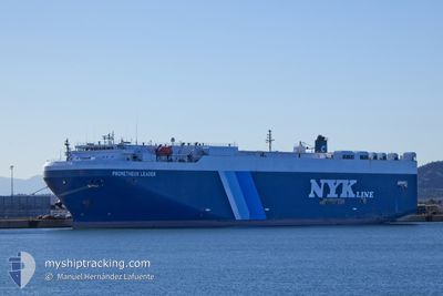
PROMETHEUS LEADER
Vehicles Carrier
Current Trip
Current Position
| Долгота | 103.89819° |
|---|---|
| Широта | 1.20970° |
| Статус | Under way using engine |
| Скорость | 14.4 Узлы |
| Курс | 67.5° |
| Район | Singapore Strait |
| Станция | T-AIS |
| Позиция Получена | 1 m тому назад |
Info
Information
The current position of PROMETHEUS LEADER is in Singapore Strait with coordinates 1.20970° / 103.89819° as reported on 2024-04-25 10:52 by AIS to our vessel tracker app. The vessel's current speed is 14.4 Узлы and is heading at the port of NANSHA. The estimated time of arrival as calculated by MyShipTracking vessel tracking app is 2024-04-29 23:21 LT
The vessel PROMETHEUS LEADER (IMO: 9338888, MMSI: 565835000) is a Vehicles Carrier that was built in 2008 ( 16 лет ). It's sailing under the flag of [SG] Singapore.
In this page you can find informations about the vessels current position, last detected port calls, and current voyage information. If the vessels is not in coverage by AIS you will find the latest position.
The current position of PROMETHEUS LEADER is detected by our AIS receivers and we are not responsible for the reliability of the data. The last position was recorded while the vessel was in Coverage by the Ais receivers of our vessel tracking app.
The current draught of PROMETHEUS LEADER as reported by AIS is 7.5 meters
Weather
| Temperature | 30.6°C / 87.08°F |
|---|---|
| Wind Speed | 10 knots |
| Direction | 85° E |
| Pressure | 1005 hPa |
| Humidity | 70.2 % |
| Cloud Coverage | 19 % |
Featured Company
Last Port Calls
| Port | Arrival | Departure | Time In Port |
|---|---|---|---|
| 2024-04-18 01:49 | |||
| 2024-04-10 21:49 | 2024-04-14 01:24 | 3 d | |
| 2024-03-28 02:12 | 2024-03-28 15:13 | 13 h | |
| 2024-03-22 22:52 | 2024-03-23 10:50 | 11 h | |
| 2024-03-19 01:04 | 2024-03-19 17:18 | 16 h | |
| 2024-03-12 23:39 | 2024-03-13 05:55 | 6 h | |
| 2024-03-10 10:20 | 2024-03-10 18:52 | 8 h | |
| 2024-03-07 23:07 | 2024-03-08 12:58 | 13 h | |
| 2024-02-27 00:31 | 2024-02-27 12:15 | 11 h | |
| 2024-02-23 21:39 | 2024-02-24 11:39 | 13 h |
Most Visited Ports (Last year)
| Port | Arrivals | |
|---|---|---|
| 7 | ||
| 6 | ||
| 6 | ||
| 3 | ||
| 3 | ||
| 3 |
Last Trips
| Origin | Departure | Destination | Arrival | Distance | |
|---|---|---|---|---|---|
| 2024-04-14 04:24 | 2024-04-18 07:19 | 1383.74 морская миля | |||
| 2024-03-28 20:43 | 2024-04-11 00:49 | 2827.46 морская миля | |||
| 2024-03-23 18:50 | 2024-03-28 07:42 | 1650.93 морская миля | |||
| 2024-03-20 00:18 | 2024-03-23 06:52 | 831.35 морская миля | |||
| 2024-03-13 12:55 | 2024-03-19 08:04 | 31.16 морская миля | |||
| 2024-03-11 02:52 | 2024-03-13 06:39 | 818.64 морская миля | |||
| 2024-03-08 19:58 | 2024-03-10 18:20 | 719.35 морская миля | |||
| 2024-02-27 19:15 | 2024-03-08 06:07 | 2975.21 морская миля | |||
| 2024-02-24 19:39 | 2024-02-27 07:31 | 810.20 морская миля | |||
| 2024-02-24 04:10 | 2024-02-24 05:39 | 11.79 морская миля |
Events
| Время | Событие | Детали | Позиция / Направление | Информация |
|---|---|---|---|---|
| 2024-04-25 09:29 | ETA изменился | 2024/04/29 01:00 2024/04/29 00:00 |
1.04260 / 103.63867
CN NSA
|
Скорость: 14.3 kn Курс: 105.8° |
| 2024-04-25 08:37 | Изменение морского района | Indonesian part of the Singapore Strait Indonesian part of the Malacca Strait |
1.15618 / 103.44444
Singapore Strait
CN NSA
|
Скорость: 15.7 kn Курс: 117.2° |
| 2024-04-25 08:23 | Изменение морского района | Indonesian part of the Malacca Strait Indian part of the Laccadive Sea |
1.19247 / 103.39404
Malacca Strait
CN NSA
|
Скорость: 16 kn Курс: 128.2° |
| 2024-04-25 08:23 | Статус изменился | Under way using engine Default |
1.19247 / 103.39404
CN NSA
|
Скорость: 15.9 kn Курс: 128° |
| 2024-04-25 08:23 | В покрытии |
1.19247 / 103.39404
Malacca Strait
CN NSA
|
Скорость: 16 kn Курс: 128.2° |
|
| 2024-04-21 04:24 | Статус изменился | Default Under way using engine |
7.23334 / 77.52750
CN NSA
|
Скорость: 17 kn Курс: 132.3° |
| 2024-04-21 04:07 | Вне покрытия |
7.29089 / 77.46439
Laccadive Sea
CN NSA
|
Скорость: 17 kn Курс: 132.3° |
|
| 2024-04-21 00:05 | Осадка изменилась | 7.5 7.2 |
8.08432 / 76.58361
CN NSA
|
Скорость: 17.2 kn Курс: 132.4° |
| 2024-04-21 00:05 | Пункт назначения изменился | CN NSA IN PAV |
8.08432 / 76.58361
CN NSA
|
Скорость: 17.2 kn Курс: 132.4° |
| 2024-04-21 00:05 | ETA изменился | 2024/04/29 00:00 2024/04/17 12:30 |
8.08432 / 76.58361
CN NSA
|
Скорость: 17.2 kn Курс: 132.4° |