
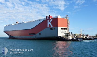
POLARIS HIGHWAY
Cargo
Current Trip
| Time Travelled | 7 days |
|---|---|
| Remaining Time | 4 days |
| Distance Travelled | 1940.33 морская миля |
| Remaining Distance | 1683.50 морская миля |
| AVG Speed | 11.8 Узлы |
| MAX Speed | 17.4 Узлы |
| AVG Wind | 13.2 knots |
| MAX Wind | 27.3 knots |
| MIN Temp | 8.7°C / 47.66°F |
| MAX Temp | 14.2°C / 57.56°F |
| Осадка | 9.3 м |
| Позиция Получена | 5 d тому назад |
Current Position
| Долгота | -7.66195° |
|---|---|
| Широта | 49.74668° |
| Статус | Under way using engine |
| Скорость | 10.4 Узлы |
| Курс | 272.7° |
| Район | Celtic Sea |
| Станция | T-AIS |
| Позиция Получена | 5 d тому назад |
Info
Information
The current position of POLARIS HIGHWAY is in Celtic Sea with coordinates 49.74668° / -7.66195° as reported on 2024-04-14 14:00 by AIS to our vessel tracker app. The vessel's current speed is 10.4 Узлы and is heading at the port of BALTIMORE. The estimated time of arrival as calculated by MyShipTracking vessel tracking app is 2024-04-24 14:12 LT
The vessel POLARIS HIGHWAY (IMO: 9728095, MMSI: 356874000) is a Cargo It's sailing under the flag of [PA] Panama.
In this page you can find informations about the vessels current position, last detected port calls, and current voyage information. If the vessels is not in coverage by AIS you will find the latest position.
The current position of POLARIS HIGHWAY is detected by our AIS receivers and we are not responsible for the reliability of the data. The last position was recorded while the vessel was in Coverage by the Ais receivers of our vessel tracking app.
The current draught of POLARIS HIGHWAY as reported by AIS is 9.3 meters
Weather
| Temperature | 8.7°C / 47.66°F |
|---|---|
| Wind Speed | 9 knots |
| Direction | 286° WNW |
| Pressure | 1007.2 hPa |
| Humidity | 68 % |
| Cloud Coverage | 100 % |
Featured Company
Last Port Calls
| Port | Arrival | Departure | Time In Port |
|---|---|---|---|
| 2024-04-10 17:28 | 2024-04-12 22:06 | 2 d | |
| 2024-04-06 19:04 | 2024-04-09 14:27 | 2 d | |
| 2024-04-05 23:59 | 2024-04-06 14:32 | 14 h | |
| 2024-04-04 06:21 | 2024-04-04 19:27 | 13 h | |
| 2024-03-24 12:48 | 2024-03-25 11:30 | 22 h | |
| 2024-03-22 08:42 | 2024-03-23 22:57 | 1 d | |
| 2024-03-17 23:43 | 2024-03-18 17:22 | 17 h | |
| 2024-03-17 07:39 | 2024-03-17 23:41 | 16 h | |
| 2024-03-16 17:26 | 2024-03-17 06:28 | 13 h | |
| 2024-03-02 19:22 | 2024-03-03 15:35 | 20 h |
Most Visited Ports (Last year)
| Port | Arrivals | |
|---|---|---|
| 5 | ||
| 4 | ||
| 3 | ||
| 3 | ||
| 3 | ||
| 3 |
Last Trips
| Origin | Departure | Destination | Arrival | Distance | |
|---|---|---|---|---|---|
| 2024-04-09 16:27 | 2024-04-10 19:28 | 338.81 морская миля | |||
| 2024-04-06 16:32 | 2024-04-06 21:04 | 66.13 морская миля | |||
| 2024-04-04 20:27 | 2024-04-06 01:59 | 479.77 морская миля | |||
| 2024-03-25 07:30 | 2024-04-04 07:21 | 3769.76 морская миля | |||
| 2024-03-23 18:57 | 2024-03-24 08:48 | 166.83 морская миля | |||
| 2024-03-18 13:22 | 2024-03-22 04:42 | 684.61 морская миля | |||
| 2024-03-17 19:41 | 2024-03-17 19:43 | 0.20 морская миля | |||
| 2024-03-17 02:28 | 2024-03-17 03:39 | 5.41 морская миля | |||
| 2024-03-03 15:35 | 2024-03-16 13:26 | 4610.11 морская миля | |||
| 2024-03-01 03:20 | 2024-03-02 19:22 | 499.17 морская миля |
Events
| Время | Событие | Детали | Позиция / Направление | Информация |
|---|---|---|---|---|
| 2024-04-14 14:00 | Вне покрытия |
49.74668 / -7.66195
Celtic Sea
USBAL
|
Скорость: 10.4 kn Курс: 272.7° |
|
| 2024-04-14 14:00 | В покрытии |
49.74668 / -7.66195
Celtic Sea
USBAL
|
Скорость: 10.4 kn Курс: 272.7° |
|
| 2024-04-14 08:20 | Статус изменился | Default Under way using engine |
49.73165 / -6.14892
USBAL
|
Скорость: 13.4 kn Курс: 262.5° |
| 2024-04-14 08:15 | Статус изменился | Under way using engine Default |
49.73379 / -6.12050
USBAL
|
Скорость: 14.2 kn Курс: 263° |
| 2024-04-14 08:15 | Вне покрытия |
49.73379 / -6.12050
Celtic Sea
USBAL
|
Скорость: 13.4 kn Курс: 262.5° |
|
| 2024-04-14 08:00 | Статус изменился | Default Under way using engine |
49.74058 / -6.02924
USBAL
|
Скорость: 15 kn Курс: 264.3° |
| 2024-04-14 07:59 | Статус изменился | Under way using engine Default |
49.74089 / -6.02427
USBAL
|
Скорость: 15.1 kn Курс: 265° |
| 2024-04-14 07:28 | Статус изменился | Default Under way using engine |
49.75305 / -5.82460
USBAL
|
Скорость: 14.9 kn Курс: 264.6° |
| 2024-04-14 07:23 | Статус изменился | Under way using engine Default |
49.75498 / -5.79294
USBAL
|
Скорость: 15.1 kn Курс: 264° |
| 2024-04-14 07:04 | Статус изменился | Default Under way using engine |
49.76211 / -5.67379
USBAL
|
Скорость: 14.5 kn Курс: 265.1° |