
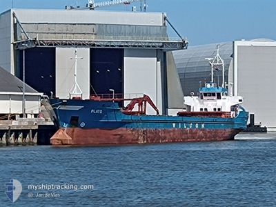
PLATO
General Cargo
Current Trip
| Time Travelled | 1 day |
|---|---|
| Remaining Time | 1 day |
| Distance Travelled | 332.31 морская миля |
| Remaining Distance | 141.19 морская миля |
| AVG Speed | 8.7 Узлы |
| MAX Speed | 12.2 Узлы |
| AVG Wind | 17.4 knots |
| MAX Wind | 30.9 knots |
| MIN Temp | 1.7°C / 35.06°F |
| MAX Temp | 11.7°C / 53.06°F |
| Осадка | 4.9 м |
| Позиция Получена | 22 m тому назад |
Current Position
| Долгота | 8.97171° |
|---|---|
| Широта | 53.85417° |
| Статус | Under way using engine |
| Скорость | 6.2 Узлы |
| Курс | 71.1° |
| Район | North Sea |
| Станция | T-AIS |
| Позиция Получена | 22 m тому назад |
Info
Information
The current position of PLATO is in North Sea with coordinates 53.85417° / 8.97171° as reported on 2024-04-20 03:00 by AIS to our vessel tracker app. The vessel's current speed is 6.2 Узлы and is heading at the port of KOLDING. The estimated time of arrival as calculated by MyShipTracking vessel tracking app is 2024-04-21 03:31 LT
The vessel PLATO (IMO: 8822636, MMSI: 314189000) is a General Cargo that was built in 1989 ( 35 лет ). It's sailing under the flag of [BB] Barbados.
In this page you can find informations about the vessels current position, last detected port calls, and current voyage information. If the vessels is not in coverage by AIS you will find the latest position.
The current position of PLATO is detected by our AIS receivers and we are not responsible for the reliability of the data. The last position was recorded while the vessel was in Coverage by the Ais receivers of our vessel tracking app.
The current draught of PLATO as reported by AIS is 4.9 meters
Weather
| Temperature | 1.7°C / 35.06°F |
|---|---|
| Wind Speed | 6 knots |
| Direction | 358° N |
| Pressure | 1013.6 hPa |
| Humidity | 90.5 % |
| Cloud Coverage | 48 % |
Featured Company
Last Port Calls
| Port | Arrival | Departure | Time In Port |
|---|---|---|---|
| 2024-04-17 01:47 | 2024-04-18 11:29 | 1 d | |
| 2024-04-10 12:11 | 2024-04-13 01:00 | 2 d | |
| 2024-04-04 06:07 | 2024-04-05 23:59 | 1 d | |
| 2024-04-01 18:33 | 2024-04-01 19:28 | 54 m | |
| 2024-03-30 01:41 | 2024-03-31 18:09 | 1 d | |
| 2024-03-26 15:57 | 2024-03-27 13:56 | 21 h | |
| 2024-03-24 04:03 | 2024-03-26 13:12 | 2 d | |
| 2024-03-23 03:29 | 2024-03-23 04:01 | 32 m | |
| 2024-03-20 13:37 | 2024-03-20 13:56 | 19 m | |
| 2024-03-17 13:00 | 2024-03-20 00:13 | 2 d |
Last Trips
| Origin | Departure | Destination | Arrival | Distance | |
|---|---|---|---|---|---|
| 2024-04-13 02:00 | 2024-04-17 03:47 | 732.45 морская миля | |||
| 2024-04-06 01:59 | 2024-04-10 13:11 | 714.89 морская миля | |||
| 2024-04-01 21:28 | 2024-04-04 08:07 | 423.40 морская миля | |||
| 2024-03-31 20:09 | 2024-04-01 20:33 | 222.39 морская миля | |||
| 2024-03-27 14:56 | 2024-03-30 02:41 | 534.63 морская миля | |||
| 2024-03-26 14:12 | 2024-03-26 16:57 | 13.05 морская миля | |||
| 2024-03-23 04:01 | 2024-03-24 05:03 | 195.59 морская миля | |||
| 2024-03-20 13:56 | 2024-03-23 03:29 | 0.46 морская миля | |||
| 2024-03-20 00:13 | 2024-03-20 13:37 | 13.83 морская миля | |||
| 2024-03-16 01:52 | 2024-03-17 13:00 | 230.93 морская миля |
Events
| Время | Событие | Детали | Позиция / Направление | Информация |
|---|---|---|---|---|
| 2024-04-20 03:08 | Статус изменился | Default Under way using engine |
53.85839 / 8.99330
DKKOL VIA NOK
|
Скорость: 6.2 kn Курс: 71.1° |
| 2024-04-20 00:11 | Статус изменился | Under way using engine Default |
53.96333 / 8.56811
DKKOL VIA NOK
|
Скорость: 7.4 kn Курс: 102° |
| 2024-04-20 00:04 | В покрытии |
53.96333 / 8.56811
North Sea
DKKOL VIA NOK
|
Скорость: 7.3 kn Курс: 100.5° |
|
| 2024-04-19 19:44 | Статус изменился | Default Under way using engine |
53.91167 / 7.60500
DKKOL VIA NOK
|
Скорость: 7.7 kn Курс: 81.2° |
| 2024-04-19 19:43 | Вне покрытия |
53.91189 / 7.60152
North Sea
DKKOL VIA NOK
|
Скорость: 7.7 kn Курс: 81.2° |
|
| 2024-04-19 14:31 | Изменение морского района | German part of the North Sea Dutch part of the North Sea |
53.73929 / 6.41672
North Sea
DKKOL VIA NOK
|
Скорость: 8.1 kn Курс: 76.1° |
| 2024-04-19 14:30 | В покрытии |
53.73929 / 6.41672
North Sea
DKKOL VIA NOK
|
Скорость: 8.1 kn Курс: 76.1° |
|
| 2024-04-19 11:40 | Вне покрытия |
53.63099 / 5.83250
North Sea
DKKOL VIA NOK
|
Скорость: 7.2 kn Курс: 72° |
|
| 2024-04-19 07:22 | Пункт назначения изменился | DKKOL VIA NOK DKKOL |
53.46363 / 4.92523
DKKOL VIA NOK
|
Скорость: 8.5 kn Курс: 72.8° |
| 2024-04-19 07:22 | ETA изменился | 2024/04/21 01:00 2024/04/21 20:00 |
53.46363 / 4.92523
DKKOL VIA NOK
|
Скорость: 8.5 kn Курс: 72.8° |