
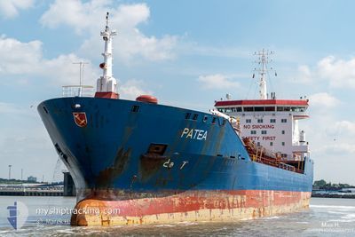
SONGA AURORA
Oil/Chemical Tanker
Current Trip
| Time Travelled | 6 days |
|---|---|
| Remaining Time | 5 h, 2 mins |
| Distance Travelled | 1283.24 морская миля |
| Remaining Distance | 58.36 морская миля |
| AVG Speed | 9.9 Узлы |
| MAX Speed | 15.4 Узлы |
| AVG Wind | 11.5 knots |
| MAX Wind | 32.4 knots |
| MIN Temp | 4.1°C / 39.38°F |
| MAX Temp | 17.8°C / 64.04°F |
| Осадка | 6.5 м |
| Позиция Получена | 1 m тому назад |
Current Position
| Долгота | 13.49110° |
|---|---|
| Широта | 54.74607° |
| Статус | Under way using engine |
| Скорость | 11.4 Узлы |
| Курс | 92.2° |
| Район | Baltic Sea |
| Станция | T-AIS |
| Позиция Получена | 1 m тому назад |
Info
Information
The current position of SONGA AURORA is in Baltic Sea with coordinates 54.74607° / 13.49110° as reported on 2024-04-19 08:50 by AIS to our vessel tracker app. The vessel's current speed is 11.4 Узлы and is heading at the port of SWINOUJSCIE. The estimated time of arrival as calculated by MyShipTracking vessel tracking app is 2024-04-19 13:53 LT
The vessel SONGA AURORA (IMO: 9373632, MMSI: 255806341) is a Oil/Chemical Tanker that was built in 2008 ( 16 лет ). It's sailing under the flag of [PT] Portugal.
In this page you can find informations about the vessels current position, last detected port calls, and current voyage information. If the vessels is not in coverage by AIS you will find the latest position.
The current position of SONGA AURORA is detected by our AIS receivers and we are not responsible for the reliability of the data. The last position was recorded while the vessel was in Coverage by the Ais receivers of our vessel tracking app.
The current draught of SONGA AURORA as reported by AIS is 6.5 meters
Weather
| Temperature | 4.5°C / 40.1°F |
|---|---|
| Wind Speed | 14 knots |
| Direction | 190° S |
| Pressure | 1003.2 hPa |
| Humidity | 94.5 % |
| Cloud Coverage | 100 % |
Featured Company
Last Port Calls
| Port | Arrival | Departure | Time In Port |
|---|---|---|---|
| 2024-04-12 11:19 | 2024-04-12 11:24 | 5 m | |
| 2024-04-11 06:21 | 2024-04-11 06:46 | 25 m | |
| 2024-04-05 03:08 | 2024-04-07 14:19 | 2 d | |
| 2024-03-31 23:25 | 2024-04-03 12:12 | 2 d | |
| 2024-03-29 08:21 | 2024-03-30 21:16 | 1 d | |
| 2024-03-22 10:44 | 2024-03-24 11:59 | 2 d | |
| 2024-03-14 20:49 | 2024-03-16 14:28 | 1 d | |
| 2024-03-11 10:27 | 2024-03-12 05:26 | 18 h | |
| 2024-03-08 00:03 | 2024-03-08 00:05 | 2 m | |
| 2024-03-04 01:12 | 2024-03-05 04:23 | 1 d |
Last Trips
| Origin | Departure | Destination | Arrival | Distance | |
|---|---|---|---|---|---|
| 2024-04-11 08:46 | 2024-04-12 13:19 | 1.29 морская миля | |||
| 2024-04-07 16:19 | 2024-04-11 08:21 | 789.25 морская миля | |||
| 2024-04-03 13:12 | 2024-04-05 05:08 | 264.79 морская миля | |||
| 2024-03-30 22:16 | 2024-04-01 00:25 | 267.61 морская миля | |||
| 2024-03-24 11:59 | 2024-03-29 09:21 | 241.84 морская миля | |||
| 2024-03-16 15:28 | 2024-03-22 10:44 | 227.25 морская миля | |||
| 2024-03-12 06:26 | 2024-03-14 21:49 | 596.39 морская миля | |||
| 2024-03-08 01:05 | 2024-03-11 11:27 | 725.86 морская миля | |||
| 2024-03-05 05:23 | 2024-03-08 01:03 | 577.41 морская миля | |||
| 2024-03-03 04:21 | 2024-03-04 02:12 | 57.83 морская миля |
Events
| Время | Событие | Детали | Позиция / Направление | Информация |
|---|---|---|---|---|
| 2024-04-19 03:52 | Обнаружено в море | German part of the Baltic Sea |
54.40323 / 12.08847
Baltic Sea
PLSWI
|
Скорость: 11.7 kn Курс: 91.1° |
| 2024-04-19 01:47 | Изменение морского района | Danish part of the Baltic Sea German part of the Baltic Sea |
54.50523 / 11.43510
Baltic Sea
PLSWI
|
Скорость: 11.6 kn Курс: 112.6° |
| 2024-04-18 23:44 | Изменение морского района | German part of the Baltic Sea Danish part of the Baltic Sea |
54.56508 / 10.78162
Baltic Sea
PLSWI
|
Скорость: 12.2 kn Курс: 91.8° |
| 2024-04-18 23:14 | Изменение морского района | Danish part of the Baltic Sea German part of the Baltic Sea |
54.56007 / 10.60652
Baltic Sea
PLSWI
|
Скорость: 11.9 kn Курс: 84° |
| 2024-04-18 22:05 | Изменение морского района | German part of the Baltic Sea German part of the North Sea |
54.46238 / 10.26073
Baltic Sea
PLSWI
|
Скорость: 11.1 kn Курс: 34.6° |
| 2024-04-18 21:53 | ETA изменился | 2024/04/19 16:00 2024/04/19 17:00 |
54.42398 / 10.21783
PLSWI
|
Скорость: 12.7 kn Курс: 25.4° |
| 2024-04-18 21:23 | Начало движения | 1.33 nm, South West of STICKENHΟRN SPORT |
54.36515 / 10.14505
PLSWI
|
Скорость: 3.1 kn Курс: 106° |
| 2024-04-18 20:06 | Окончание движения | 1.98 nm, South West of STICKENHΟRN SPORT |
54.36918 / 10.11663
PLSWI
|
Скорость: 0.3 kn Курс: 109° |
| 2024-04-18 15:13 | Начало движения | 2.57 nm, North East of FISCHERHUTTE |
54.17142 / 9.43995
PLSWI
|
Скорость: 4.4 kn Курс: 59° |
| 2024-04-18 14:47 | Окончание движения | 2.45 nm, North East of FISCHERHUTTE |
54.17052 / 9.43698
PLSWI
|
Скорость: 0.3 kn Курс: 69° |