
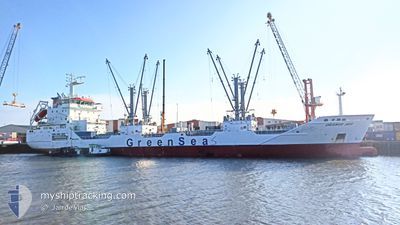
ORANGE SEA
Cargo
Current Trip
MRNDB
| Time Travelled | 11 days |
|---|---|
| Remaining Time | --- |
| Distance Travelled | 2449.25 морская миля |
| Remaining Distance | --- |
| AVG Speed | 13 Узлы |
| MAX Speed | 18.4 Узлы |
| AVG Wind | 7.6 knots |
| MAX Wind | 15.8 knots |
| MIN Temp | 23.5°C / 74.3°F |
| MAX Temp | 30.4°C / 86.72°F |
| Осадка | 5.8 м |
| Позиция Получена | Сейчас |
Current Position
| Долгота | -17.72903° |
|---|---|
| Широта | 12.78588° |
| Статус | Under way using engine |
| Скорость | 11.8 Узлы |
| Курс | 355° |
| Район | North Atlantic Ocean |
| Станция | T-AIS |
| Позиция Получена | Сейчас |
Info
Information
The current position of ORANGE SEA is in North Atlantic Ocean with coordinates 12.78588° / -17.72903° as reported on 2024-04-18 23:36 by AIS to our vessel tracker app. The vessel's current speed is 11.8 Узлы
The vessel ORANGE SEA (IMO: 9795971, MMSI: 311000713) is a Cargo It's sailing under the flag of [BS] Bahamas.
In this page you can find informations about the vessels current position, last detected port calls, and current voyage information. If the vessels is not in coverage by AIS you will find the latest position.
The current position of ORANGE SEA is detected by our AIS receivers and we are not responsible for the reliability of the data. The last position was recorded while the vessel was in Coverage by the Ais receivers of our vessel tracking app.
The current draught of ORANGE SEA as reported by AIS is 5.8 meters
Weather
| Temperature | 23.9°C / 75.02°F |
|---|---|
| Wind Speed | 10 knots |
| Direction | 337° NNW |
| Pressure | 1009.7 hPa |
| Humidity | 75.8 % |
| Cloud Coverage | --- |
Featured Company
Most Visited Ports (Last year)
| Port | Arrivals | |
|---|---|---|
| 2 | ||
| 1 | ||
| 1 | ||
| 1 | ||
| 1 | ||
| 1 |
Events
| Время | Событие | Детали | Позиция / Направление | Информация |
|---|---|---|---|---|
| 2024-04-18 23:32 | Статус изменился | Under way using engine Default |
12.77110 / -17.72765
MRNDB
|
Скорость: 11.3 kn Курс: 355° |
| 2024-04-18 23:11 | Статус изменился | Default Under way using engine |
12.70370 / -17.72180
MRNDB
|
Скорость: 12.3 kn Курс: 353.6° |
| 2024-04-18 20:53 | Статус изменился | Under way using engine Default |
12.23190 / -17.67965
MRNDB
|
Скорость: 12 kn Курс: 358° |
| 2024-04-18 20:45 | Статус изменился | Default Under way using engine |
12.20410 / -17.67805
MRNDB
|
Скорость: 12.4 kn Курс: 357.3° |
| 2024-04-18 19:48 | Статус изменился | Under way using engine Default |
12.00862 / -17.66388
MRNDB
|
Скорость: 12.4 kn Курс: 353° |
| 2024-04-18 19:15 | Статус изменился | Default Under way using engine |
11.89665 / -17.65218
MRNDB
|
Скорость: 12.3 kn Курс: 355.9° |
| 2024-04-18 18:50 | Изменение морского района | Senegalese part of the North Atlantic Ocean Guinea Bissau part of the North Atlantic Ocean |
11.81142 / -17.64415
North Atlantic Ocean
|
Скорость: 12.1 kn Курс: 358.3° |
| 2024-04-18 16:33 | Статус изменился | Under way using engine Default |
11.34440 / -17.60475
MRNDB
|
Скорость: 12.1 kn Курс: 354° |
| 2024-04-18 16:29 | Статус изменился | Default Under way using engine |
11.33087 / -17.60337
MRNDB
|
Скорость: 12.2 kn Курс: 353.5° |
| 2024-04-18 16:12 | Статус изменился | Under way using engine Default |
11.27465 / -17.59763
MRNDB
|
Скорость: 11.9 kn Курс: 358° |