
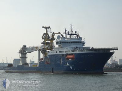
NORTH SEA ATLANTIC
Offshore Supply Ship
Current Trip
| Time Travelled | 5 days |
|---|---|
| Remaining Time | 1 day |
| Distance Travelled | 1730.22 морская миля |
| Remaining Distance | 418.86 морская миля |
| AVG Speed | 13.4 Узлы |
| MAX Speed | 16.5 Узлы |
| AVG Wind | 14 knots |
| MAX Wind | 21 knots |
| MIN Temp | 6.6°C / 43.88°F |
| MAX Temp | 19.9°C / 67.82°F |
| Осадка | 6.7 м |
| Позиция Получена | 2 h, 36 m тому назад |
Current Position
| Долгота | 2.74573° |
|---|---|
| Широта | 52.21672° |
| Статус | Under way using engine |
| Скорость | 14 Узлы |
| Курс | 24.7° |
| Район | North Sea |
| Станция | T-AIS |
| Позиция Получена | 2 h, 36 m тому назад |
Info
Information
The current position of NORTH SEA ATLANTIC is in North Sea with coordinates 52.21672° / 2.74573° as reported on 2024-04-24 16:35 by AIS to our vessel tracker app. The vessel's current speed is 14 Узлы and is heading at the port of TANANGER. The estimated time of arrival as calculated by MyShipTracking vessel tracking app is 2024-04-25 22:27 LT
The vessel NORTH SEA ATLANTIC (IMO: 9665073, MMSI: 258955000) is a Offshore Supply Ship that was built in 2014 ( 10 лет ). It's sailing under the flag of [NO] Norway.
In this page you can find informations about the vessels current position, last detected port calls, and current voyage information. If the vessels is not in coverage by AIS you will find the latest position.
The current position of NORTH SEA ATLANTIC is detected by our AIS receivers and we are not responsible for the reliability of the data. The last position was recorded while the vessel was in Coverage by the Ais receivers of our vessel tracking app.
The current draught of NORTH SEA ATLANTIC as reported by AIS is 6.7 meters
Weather
| Temperature | 7.7°C / 45.86°F |
|---|---|
| Wind Speed | 21 knots |
| Direction | 343° NNW |
| Pressure | 1011.5 hPa |
| Humidity | 68.7 % |
| Cloud Coverage | 25 % |
Featured Company
Last Port Calls
| Port | Arrival | Departure | Time In Port |
|---|---|---|---|
| 2024-04-18 22:44 | 2024-04-19 00:07 | 1 h | |
| 2024-03-22 20:45 |
Most Visited Ports (Last year)
| Port | Arrivals | |
|---|---|---|
| 7 | ||
| 5 | ||
| 3 | ||
| 2 | ||
| 2 | ||
| 2 |
Last Trips
| Origin | Departure | Destination | Arrival | Distance | |
|---|---|---|---|---|---|
| 2024-03-22 17:45 | 2024-04-18 23:44 | 3781.99 морская миля |
Events
| Время | Событие | Детали | Позиция / Направление | Информация |
|---|---|---|---|---|
| 2024-04-24 16:35 | Вне покрытия |
52.21672 / 2.74573
North Sea
ES LPA>NO TAE
|
Скорость: 14 kn Курс: 24.7° |
|
| 2024-04-24 15:41 | Изменение морского района | United Kingdom part of the North Sea Dutch part of the North Sea |
52.01572 / 2.65646
North Sea
ES LPA>NO TAE
|
Скорость: 14.2 kn Курс: 10.5° |
| 2024-04-24 15:18 | Начало движения |
51.92775 / 2.62885
ES LPA>NO TAE
|
Скорость: 14.3 kn Курс: 10° |
|
| 2024-04-24 15:17 | Окончание движения |
51.92579 / 2.62825
ES LPA>NO TAE
|
Скорость: Курс: 0° |
|
| 2024-04-24 15:07 | Начало движения |
51.88500 / 2.61436
ES LPA>NO TAE
|
Скорость: 13.7 kn Курс: 12.8° |
|
| 2024-04-24 15:06 | Окончание движения |
51.88130 / 2.61307
ES LPA>NO TAE
|
Скорость: Курс: 0° |
|
| 2024-04-24 15:00 | Начало движения |
51.86110 / 2.60525
ES LPA>NO TAE
|
Скорость: 13.8 kn Курс: 15.7° |
|
| 2024-04-24 14:59 | Окончание движения |
51.85856 / 2.60410
ES LPA>NO TAE
|
Скорость: Курс: 0° |
|
| 2024-04-24 14:56 | Изменение морского района | Dutch part of the North Sea Belgian part of the North Sea |
51.84534 / 2.59795
North Sea
ES LPA>NO TAE
|
Скорость: 13.6 kn Курс: 17.2° |
| 2024-04-24 13:20 | Изменение морского района | Belgian part of the North Sea French part of the North Sea |
51.54141 / 2.26062
North Sea
ES LPA>NO TAE
|
Скорость: 14 kn Курс: 39.4° |