
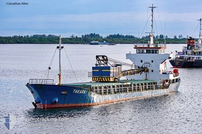
MV.TAKARA
Cargo
Current Trip
BJM
| Time Travelled | --- |
|---|---|
| Remaining Time | --- |
| Distance Travelled | 1162.36 морская миля |
| Remaining Distance | --- |
| AVG Speed | 6.8 Узлы |
| MAX Speed | 10.1 Узлы |
| AVG Wind | 5.2 knots |
| MAX Wind | 14 knots |
| MIN Temp | 22.3°C / 72.14°F |
| MAX Temp | 30.2°C / 86.36°F |
| Осадка | 4.2 м |
| Позиция Получена | 2024-03-01 03:13 |
Current Position
| Долгота | 117.04843° |
|---|---|
| Широта | -1.39443° |
| Статус | Under way using engine |
| Скорость | 7.8 Узлы |
| Курс | 193.1° |
| Район | Makassar Strait |
| Станция | T-AIS |
| Позиция Получена | 2024-03-01 03:13 |
Info
Information
The current position of MV.TAKARA is in Makassar Strait with coordinates -1.39443° / 117.04843° as reported on 2024-03-01 03:13 by AIS to our vessel tracker app. The vessel's current speed is 7.8 Узлы
The vessel MV.TAKARA (IMO: 8859433, MMSI: 525022213) is a Cargo It's sailing under the flag of [ID] Indonesia.
In this page you can find informations about the vessels current position, last detected port calls, and current voyage information. If the vessels is not in coverage by AIS you will find the latest position.
The current position of MV.TAKARA is detected by our AIS receivers and we are not responsible for the reliability of the data. The last position was recorded while the vessel was in Coverage by the Ais receivers of our vessel tracking app.
The current draught of MV.TAKARA as reported by AIS is 4.2 meters
Weather
| Temperature | 25.8°C / 78.44°F |
|---|---|
| Wind Speed | 2 knots |
| Direction | 297° WNW |
| Pressure | 1007.5 hPa |
| Humidity | 87.6 % |
| Cloud Coverage | 100 % |
Featured Company
Most Visited Ports (Last year)
| Port | Arrivals | |
|---|---|---|
| 4 | ||
| 2 | ||
| 1 |
Events
| Время | Событие | Детали | Позиция / Направление | Информация |
|---|---|---|---|---|
| 2024-04-19 15:37 | Окончание движения | 1.79 nm, East of LANGADAI |
-3.27931 / 116.14312
BJM
|
Скорость: 0.2 kn Курс: -1° |
| 2024-04-18 13:56 | Окончание движения | 1.79 nm, East of LANGADAI |
-3.27927 / 116.14318
BJM
|
Скорость: 0.2 kn Курс: -1° |
| 2024-04-18 07:19 | Окончание движения | 1.72 nm, East of LANGADAI |
-3.27989 / 116.14195
BJM
|
Скорость: 0.2 kn Курс: -1° |
| 2024-04-17 11:23 | Окончание движения | 1.77 nm, East of LANGADAI |
-3.27908 / 116.14279
BJM
|
Скорость: 0.3 kn Курс: -1° |
| 2024-04-17 07:50 | Окончание движения | 1.71 nm, East of LANGADAI |
-3.27940 / 116.14178
BJM
|
Скорость: 0.3 kn Курс: -1° |
| 2024-04-16 12:03 | Окончание движения | 1.77 nm, East of LANGADAI |
-3.27954 / 116.14285
BJM
|
Скорость: Курс: -1° |
| 2024-04-15 10:05 | Окончание движения | 1.77 nm, East of LANGADAI |
-3.27944 / 116.14280
BJM
|
Скорость: 0.2 kn Курс: -1° |
| 2024-04-14 13:00 | Окончание движения | 1.78 nm, East of LANGADAI |
-3.27929 / 116.14306
BJM
|
Скорость: 0.3 kn Курс: -1° |
| 2024-04-13 17:02 | Окончание движения | 1.73 nm, East of LANGADAI |
-3.27965 / 116.14214
BJM
|
Скорость: 0.2 kn Курс: -1° |
| 2024-04-12 08:56 | Окончание движения | 1.77 nm, East of LANGADAI |
-3.27916 / 116.14275
BJM
|
Скорость: 0.2 kn Курс: -1° |