
MOONLIGHT II
Yacht
Current Trip
DUBAI
| Time Travelled | --- |
|---|---|
| Remaining Time | --- |
| Distance Travelled | --- |
| Remaining Distance | --- |
| AVG Speed | --- |
| MAX Speed | --- |
| AVG Wind | --- |
| MAX Wind | --- |
| MIN Temp | --- |
| MAX Temp | --- |
| Осадка | 4.2 м |
| Позиция Получена | 3 m тому назад |
Current Position
| Долгота | 55.14567° |
|---|---|
| Широта | 25.09894° |
| Статус | Moored |
| Скорость | 0.1 Узлы |
| Курс | 128° |
| Район | Persian Gulf |
| Станция | T-AIS |
| Позиция Получена | 3 m тому назад |
Info
Information
The current position of MOONLIGHT II is in Persian Gulf with coordinates 25.09894° / 55.14567° as reported on 2024-04-20 00:31 by AIS to our vessel tracker app. The vessel's current speed is 0.1 Узлы
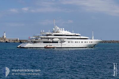
The vessel MOONLIGHT II (IMO: 9288215, MMSI: 215934000) is a Yacht that was built in 2004 ( 20 лет ). It's sailing under the flag of [MT] Malta.
In this page you can find informations about the vessels current position, last detected port calls, and current voyage information. If the vessels is not in coverage by AIS you will find the latest position.
The current position of MOONLIGHT II is detected by our AIS receivers and we are not responsible for the reliability of the data. The last position was recorded while the vessel was in Coverage by the Ais receivers of our vessel tracking app.
The current draught of MOONLIGHT II as reported by AIS is 4.2 meters
Weather
| Temperature | 24.3°C / 75.74°F |
|---|---|
| Wind Speed | 3 knots |
| Direction | 25° NNE |
| Pressure | 1007.1 hPa |
| Humidity | 51.9 % |
| Cloud Coverage | --- |
Featured Company
Last Port Calls
Most Visited Ports (Last year)
| Port | Arrivals | |
|---|---|---|
| 2 |
Last Trips
| Origin | Departure | Destination | Arrival | Distance |
|---|
Events
| Время | Событие | Детали | Позиция / Направление | Информация |
|---|---|---|---|---|
| 2024-04-18 07:13 | Статус изменился | Moored Under way using engine |
25.09894 / 55.14567
DUBAI
|
Скорость: Курс: 134° |
| 2024-04-18 06:43 | Окончание движения | 1.24 nm, North of DUBAI MARINA |
25.09827 / 55.14719
DUBAI
|
Скорость: 0.3 kn Курс: 221° |
| 2024-04-18 05:09 | Начало движения | 2.2 nm, South West of UMM SUQEIM |
25.13484 / 55.16243
DUBAI
|
Скорость: 4.8 kn Курс: 335° |
| 2024-04-18 05:02 | Статус изменился | Under way using engine At anchor |
25.13347 / 55.16365
DUBAI
|
Скорость: 0.7 kn Курс: 225° |
| 2024-04-17 06:38 | Статус изменился | At anchor Under way using engine |
25.13335 / 55.16365
DUBAI
|
Скорость: 0.3 kn Курс: 270° |
| 2024-04-17 06:38 | Окончание движения | 2.19 nm, South West of UMM SUQEIM |
25.13337 / 55.16366
DUBAI
|
Скорость: 0.3 kn Курс: 270° |
| 2024-04-17 06:26 | Статус изменился | Under way using engine Moored |
25.14410 / 55.15310
DUBAI
|
Скорость: 7.4 kn Курс: 125.8° |
| 2024-04-17 05:27 | Начало движения | 1.43 nm, North of DUBAI MARINA |
25.10260 / 55.14073
DUBAI
|
Скорость: 3.1 kn Курс: 226° |
| 2024-04-16 11:23 | В покрытии |
25.09897 / 55.14567
Persian Gulf
|
Скорость: Курс: 238° |
|
| 2024-04-16 10:14 | Вне покрытия |
25.09896 / 55.14566
Persian Gulf
|
Скорость: Курс: 215° |