
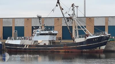
MFV Z67 RUBENS
Fishing
Current Trip
FISHING GROUNDS
| Time Travelled | 9 days |
|---|---|
| Remaining Time | --- |
| Distance Travelled | 780.12 морская миля |
| Remaining Distance | --- |
| AVG Speed | 4.4 Узлы |
| MAX Speed | 4.4 Узлы |
| AVG Wind | 24.4 knots |
| MAX Wind | 42 knots |
| MIN Temp | 7.2°C / 44.96°F |
| MAX Temp | 11.8°C / 53.24°F |
| Осадка | 4.5 м |
| Позиция Получена | 9 h, 30 m тому назад |
Current Position
| Долгота | -5.66619° |
|---|---|
| Широта | 50.82794° |
| Статус | Engaged in Fishing |
| Скорость | 4.2 Узлы |
| Курс | 283.6° |
| Район | Celtic Sea |
| Станция | T-AIS |
| Позиция Получена | 9 h, 30 m тому назад |
Info
Information
The current position of MFV Z67 RUBENS is in Celtic Sea with coordinates 50.82794° / -5.66619° as reported on 2024-04-16 06:36 by AIS to our vessel tracker app. The vessel's current speed is 4.2 Узлы
The vessel MFV Z67 RUBENS (IMO: 8410017, MMSI: 205155000) is a Fishing It's sailing under the flag of [BE] Belgium.
In this page you can find informations about the vessels current position, last detected port calls, and current voyage information. If the vessels is not in coverage by AIS you will find the latest position.
The current position of MFV Z67 RUBENS is detected by our AIS receivers and we are not responsible for the reliability of the data. The last position was recorded while the vessel was in Coverage by the Ais receivers of our vessel tracking app.
The current draught of MFV Z67 RUBENS as reported by AIS is 4.5 meters
Weather
| Temperature | 9.4°C / 48.92°F |
|---|---|
| Wind Speed | 26 knots |
| Direction | 315° NW |
| Pressure | 1019.3 hPa |
| Humidity | 78.8 % |
| Cloud Coverage | 84 % |
Featured Company
Last Port Calls
| Port | Arrival | Departure | Time In Port |
|---|---|---|---|
| 2024-04-05 12:00 | 2024-04-07 13:28 | 2 d | |
| 2024-03-27 16:37 | 2024-03-28 20:55 | 1 d | |
| 2024-03-17 06:19 | 2024-03-20 21:34 | 3 d | |
| 2024-03-07 10:17 | 2024-03-08 08:10 | 21 h | |
| 2024-02-27 09:05 | 2024-02-28 10:16 | 1 d | |
| 2024-02-18 10:56 | 2024-02-20 09:26 | 1 d | |
| 2024-02-08 12:49 | 2024-02-09 12:57 | 1 d |
Last Trips
| Origin | Departure | Destination | Arrival | Distance | |
|---|---|---|---|---|---|
| 2024-03-28 21:55 | 2024-04-05 13:00 | 290.72 морская миля | |||
| 2024-03-20 22:34 | 2024-03-27 17:37 | 605.20 морская миля | |||
| 2024-03-08 09:10 | 2024-03-17 07:19 | 879.32 морская миля | |||
| 2024-02-28 11:16 | 2024-03-07 11:17 | 458.95 морская миля | |||
| 2024-02-20 10:26 | 2024-02-27 10:05 | 666.89 морская миля | |||
| 2024-02-09 13:57 | 2024-02-18 11:56 | 885.29 морская миля | |||
| 2024-01-30 14:42 | 2024-02-08 13:49 | 901.51 морская миля |
Events
| Время | Событие | Детали | Позиция / Направление | Информация |
|---|---|---|---|---|
| 2024-04-16 06:36 | Вне покрытия |
50.82794 / -5.66619
Celtic Sea
|
Скорость: 4.2 kn Курс: 283.6° |
|
| 2024-04-15 09:16 | Начало движения | 17.01 nm, North West of PADSTOW |
50.77146 / -5.19411
FISHING GROUNDS
|
Скорость: 4.1 kn Курс: 97° |
| 2024-04-15 09:11 | Окончание движения | 17.13 nm, North West of PADSTOW |
50.77210 / -5.19826
FISHING GROUNDS
|
Скорость: 0.2 kn Курс: 80° |
| 2024-04-15 02:41 | Начало движения | 16.18 nm, North West of PADSTOW |
50.77189 / -5.15381
FISHING GROUNDS
|
Скорость: 3.3 kn Курс: 56° |
| 2024-04-15 02:34 | Окончание движения | 16.24 nm, North West of PADSTOW |
50.77188 / -5.15685
FISHING GROUNDS
|
Скорость: 0.2 kn Курс: 56° |
| 2024-04-14 16:27 | В покрытии |
50.86326 / -5.45030
Celtic Sea
|
Скорость: 5.2 kn Курс: 126.6° |
|
| 2024-04-14 12:57 | Вне покрытия |
50.94816 / -5.53594
Celtic Sea
|
Скорость: 4.5 kn Курс: 348.2° |
|
| 2024-04-14 11:05 | Начало движения |
50.83984 / -5.39941
FISHING GROUNDS
|
Скорость: 4.4 kn Курс: 336° |
|
| 2024-04-14 10:57 | Окончание движения |
50.83745 / -5.39836
FISHING GROUNDS
|
Скорость: 0.3 kn Курс: 297° |
|
| 2024-04-14 01:29 | Начало движения | 14.59 nm, North West of PORT ISAAC |
50.78798 / -5.06464
FISHING GROUNDS
|
Скорость: 4.5 kn Курс: 243° |