
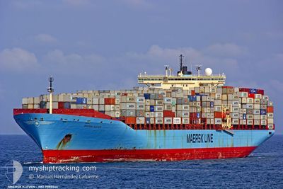
KLEVEN
Container Ship
Current Trip
| Time Travelled | 9 h, 17 mins |
|---|---|
| Remaining Time | 51 mins |
| Distance Travelled | 87.09 морская миля |
| Remaining Distance | 31.60 морская миля |
| AVG Speed | 13.1 Узлы |
| MAX Speed | 16.5 Узлы |
| AVG Wind | 16.1 knots |
| MAX Wind | 18.3 knots |
| MIN Temp | 19.4°C / 66.92°F |
| MAX Temp | 20.6°C / 69.08°F |
| Осадка | 12.5 м |
| Позиция Получена | 2 m тому назад |
Current Position
| Долгота | -80.48080° |
|---|---|
| Широта | 31.98056° |
| Статус | At anchor |
| Скорость | |
| Курс | 192° |
| Район | North Atlantic Ocean |
| Станция | T-AIS |
| Позиция Получена | 2 m тому назад |
Info
Information
The current position of KLEVEN is in North Atlantic Ocean with coordinates 31.98056° / -80.48080° as reported on 2024-04-25 09:16 by AIS to our vessel tracker app. The vessel's current speed is 0 Узлы and is heading at the port of SAVANNAH. The estimated time of arrival as calculated by MyShipTracking vessel tracking app is 2024-04-25 10:10 LT
The vessel KLEVEN (IMO: 9085546, MMSI: 636018912) is a Container Ship that was built in 1996 ( 28 лет ). It's sailing under the flag of [LR] Liberia.
In this page you can find informations about the vessels current position, last detected port calls, and current voyage information. If the vessels is not in coverage by AIS you will find the latest position.
The current position of KLEVEN is detected by our AIS receivers and we are not responsible for the reliability of the data. The last position was recorded while the vessel was in Coverage by the Ais receivers of our vessel tracking app.
The current draught of KLEVEN as reported by AIS is 12.5 meters
Weather
| Temperature | 19.6°C / 67.28°F |
|---|---|
| Wind Speed | 13 knots |
| Direction | 245° WSW |
| Pressure | 1018.9 hPa |
| Humidity | 80.8 % |
| Cloud Coverage | 2 % |
Featured Company
Last Port Calls
| Port | Arrival | Departure | Time In Port |
|---|---|---|---|
| 2024-04-24 00:53 | 2024-04-25 00:02 | 23 h | |
| 2024-04-20 14:05 | 2024-04-21 11:36 | 21 h | |
| 2024-04-19 02:06 | 2024-04-19 16:17 | 14 h | |
| 2024-04-16 08:26 | 2024-04-17 22:43 | 1 d | |
| 2024-04-13 21:37 | 2024-04-14 16:52 | 19 h | |
| 2024-03-31 14:26 | 2024-04-02 12:03 | 1 d | |
| 2024-03-25 04:21 | 2024-03-26 03:00 | 22 h | |
| 2024-03-21 03:51 | |||
| 2024-03-18 23:51 | 2024-03-19 22:36 | 22 h | |
| 2024-03-16 16:27 | 2024-03-17 04:51 | 12 h |
Most Visited Ports (Last year)
| Port | Arrivals | |
|---|---|---|
| 7 | ||
| 6 | ||
| 4 | ||
| 3 | ||
| 3 | ||
| 2 |
Last Trips
| Origin | Departure | Destination | Arrival | Distance | |
|---|---|---|---|---|---|
| 2024-04-21 07:36 | 2024-04-23 20:53 | 432.21 морская миля | |||
| 2024-04-19 12:17 | 2024-04-20 10:05 | 249.74 морская миля | |||
| 2024-04-17 18:43 | 2024-04-18 22:06 | 255.06 морская миля | |||
| 2024-04-14 12:52 | 2024-04-16 04:26 | 387.59 морская миля | |||
| 2024-04-02 13:03 | 2024-04-13 17:37 | 3128.44 морская миля | |||
| 2024-03-26 04:00 | 2024-03-31 15:26 | 1366.60 морская миля | |||
| 2024-03-20 01:36 | 2024-03-21 05:51 | 362.25 морская миля | |||
| 2024-03-17 06:51 | 2024-03-19 02:51 | 621.49 морская миля | |||
| 2024-03-14 18:49 | 2024-03-16 18:27 | 421.57 морская миля | |||
| 2024-03-13 17:57 | 2024-03-14 04:34 | 114.39 морская миля |
Events
| Время | Событие | Детали | Позиция / Направление | Информация |
|---|---|---|---|---|
| 2024-04-25 07:01 | Статус изменился | At anchor Under way using engine |
31.97888 / -80.48024
USSAV
|
Скорость: 0.2 kn Курс: 237° |
| 2024-04-25 06:57 | Окончание движения |
31.97892 / -80.48057
USSAV
|
Скорость: 0.3 kn Курс: 232° |
|
| 2024-04-25 03:51 | Статус изменился | Under way using engine Default |
32.20674 / -79.84511
USSAV
|
Скорость: 14.8 kn Курс: 234° |
| 2024-04-25 03:50 | Статус изменился | Default Under way using engine |
32.20838 / -79.84243
USSAV
|
Скорость: 15.1 kn Курс: 232.7° |
| 2024-04-25 03:41 | Статус изменился | Under way using engine Default |
32.23032 / -79.80726
USSAV
|
Скорость: 15.2 kn Курс: 233° |
| 2024-04-25 03:30 | В покрытии |
32.22929 / -79.80884
North Atlantic Ocean
USSAV
|
Скорость: 15.1 kn Курс: 232.7° |
|
| 2024-04-25 00:50 | Статус изменился | Default Under way using engine |
32.63900 / -79.63539
USSAV
|
Скорость: 15.9 kn Курс: 119.4° |
| 2024-04-25 00:44 | Вне покрытия |
32.65329 / -79.66405
North Atlantic Ocean
USSAV
|
Скорость: 15.9 kn Курс: 119.4° |
|
| 2024-04-25 00:12 | Статус изменился | Under way using engine Default |
32.72174 / -79.81006
USSAV
|
Скорость: 14.2 kn Курс: 121° |
| 2024-04-25 00:02 | ПОРТ ОТПРАВЛЕНИЯ |
|
32.74142 / -79.84908
USSAV
|
Скорость: 13.5 kn Курс: 138° |