
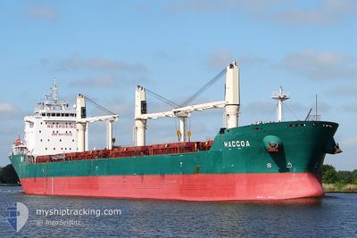
MACCOA
Bulk Carrier
Current Trip
| Trip Time | 33 days |
|---|---|
| Trip Distance | 7918.78 морская миля |
| AVG Speed | 10.6 Узлы |
| MAX Speed | 14.7 Узлы |
| Осадка | 10 м |
| AVG Wind | 16.5 knots |
| MAX Wind | 39 knots |
| MIN Temp | -1.4°C / 29.48°F |
| MAX Temp | 27.6°C / 81.68°F |
| Позиция Получена | 7 d тому назад |
Current Position
| Долгота | -94.32568° |
|---|---|
| Широта | 20.22859° |
| Статус | Under way using engine |
| Скорость | 11.7 Узлы |
| Курс | 233.1° |
| Район | Gulf of Mexico |
| Станция | T-AIS |
| Позиция Получена | 7 d тому назад |
Info
Information
The current position of MACCOA is in Gulf of Mexico with coordinates 20.22859° / -94.32568° as reported on 2024-04-17 08:52 by AIS to our vessel tracker app. The vessel's current speed is 11.7 Узлы and is currently inside the port of VERACRUZ.
The vessel MACCOA (IMO: 9413913, MMSI: 212340000) is a Bulk Carrier that was built in 2009 ( 15 лет ). It's sailing under the flag of [CY] Cyprus.
In this page you can find informations about the vessels current position, last detected port calls, and current voyage information. If the vessels is not in coverage by AIS you will find the latest position.
The current position of MACCOA is detected by our AIS receivers and we are not responsible for the reliability of the data. The last position was recorded while the vessel was in Coverage by the Ais receivers of our vessel tracking app.
The current draught of MACCOA as reported by AIS is 10 meters
Weather
| Temperature | 24.6°C / 76.28°F |
|---|---|
| Wind Speed | 1 knots |
| Direction | 44° NE |
| Pressure | 1014 hPa |
| Humidity | 83.8 % |
| Cloud Coverage | 37 % |
Featured Company
Events
| Время | Событие | Детали | Позиция / Направление | Информация |
|---|---|---|---|---|
| 2024-04-18 00:13 | Окончание движения |
19.20990 / -96.13341
[MX] VERACRUZ
|
Скорость: 0.3 kn Курс: 332° |
|
| 2024-04-18 00:01 | Порт |
|
19.20333 / -96.12666
[MX] VERACRUZ
|
Скорость: 9.5 kn Курс: 273° |
| 2024-04-17 22:34 | Начало движения | 13.49 nm, East of VERACRUZ |
19.28667 / -95.90500
MX VER
|
Скорость: 8 kn Курс: 211° |
| 2024-04-17 22:13 | Окончание движения | 13.69 nm, North East of VERACRUZ |
19.29167 / -95.90334
MX VER
|
Скорость: Курс: -1° |
| 2024-04-17 21:46 | Начало движения | 13.05 nm, North East of VERACRUZ |
19.30020 / -95.91988
MX VER
|
Скорость: 5.3 kn Курс: 120° |
| 2024-04-17 18:16 | Окончание движения | 15.95 nm, East of VERACRUZ |
19.28500 / -95.85833
MX VER
|
Скорость: Курс: -1° |
| 2024-04-17 08:55 | Статус изменился | Default Under way using engine |
20.22167 / -94.33334
MX VER
|
Скорость: 11.7 kn Курс: 233.1° |
| 2024-04-17 08:52 | Вне покрытия |
20.22859 / -94.32568
Gulf of Mexico
MX VER
|
Скорость: 11.7 kn Курс: 233.1° |
|
| 2024-04-17 08:49 | Статус изменился | Under way using engine Default |
20.23352 / -94.31863
MX VER
|
Скорость: 11.7 kn Курс: 234° |
| 2024-04-17 08:34 | Статус изменился | Default Under way using engine |
20.26348 / -94.27555
MX VER
|
Скорость: 11.8 kn Курс: 232.7° |