
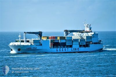
LUZON STRAIT
Reefer
Current Trip
| Time Travelled | 2 h, 24 mins |
|---|---|
| Remaining Time | --- |
| Distance Travelled | 47.34 морская миля |
| Remaining Distance | --- |
| AVG Speed | 20.6 Узлы |
| MAX Speed | 21.9 Узлы |
| AVG Wind | 16.4 knots |
| MAX Wind | 17 knots |
| MIN Temp | 27.2°C / 80.96°F |
| MAX Temp | 27.4°C / 81.32°F |
| Осадка | 7.8 м |
| Позиция Получена | Сейчас |
Current Position
| Долгота | --- |
|---|---|
| Широта | --- |
| Статус | Under way using engine |
| Скорость | 21.8 Узлы |
| Курс | 282° |
| Район | Caribbean Sea |
| Станция | T-AIS |
| Позиция Получена | Сейчас |
Info
Information
The current position of LUZON STRAIT is in Caribbean Sea with coordinates 12.29081° / -69.75140° as reported on 2025-12-07 22:15 by AIS to our vessel tracker app. The vessel's current speed is 21.8 Узлы and is heading at the port of ROSEAU. The estimated time of arrival as calculated by MyShipTracking vessel tracking app is 2025-12-05 14:00 LT
The vessel LUZON STRAIT (IMO: 9204960, MMSI: 636019776) is a Reefer that was built in 2002 ( 23 лет ). It's sailing under the flag of [LR] Liberia.
In this page you can find informations about the vessels current position, last detected port calls, and current voyage information. If the vessels is not in coverage by AIS you will find the latest position.
The current position of LUZON STRAIT is detected by our AIS receivers and we are not responsible for the reliability of the data. The last position was recorded while the vessel was in Coverage by the Ais receivers of our vessel tracking app.
The current draught of LUZON STRAIT as reported by AIS is 7.8 meters
Weather
| Temperature | 27.2°C / 80.96°F |
|---|---|
| Wind Speed | 16 knots |
| Direction | 82° E |
| Pressure | 1010.8 hPa |
| Humidity | 81.7 % |
| Cloud Coverage | 52 % |
Featured Company
Last Port Calls
| Port | Arrival | Departure | Time In Port |
|---|---|---|---|
| 2025-12-07 05:39 | 2025-12-07 15:52 | 10 h | |
| 2025-12-05 14:34 | 2025-12-05 22:21 | 7 h | |
| 2025-12-05 00:26 | 2025-12-05 09:38 | 9 h | |
| 2025-12-03 21:16 | 2025-12-04 05:46 | 8 h | |
| 2025-12-02 06:51 | 2025-12-03 13:23 | 1 d | |
| 2025-11-22 09:08 | 2025-11-23 23:01 | 1 d | |
| 2025-11-20 04:49 | 2025-11-21 20:04 | 1 d | |
| 2025-11-08 20:42 | 2025-11-10 14:06 | 1 d | |
| 2025-11-07 00:26 | 2025-11-07 11:33 | 11 h | |
| 2025-11-03 22:45 | 2025-11-06 10:02 | 2 d |
Most Visited Ports (Last year)
| Port | Arrivals | |
|---|---|---|
| 12 | ||
| 11 | ||
| 11 | ||
| 10 | ||
| 10 | ||
| 10 |
Last Trips
| Origin | Departure | Destination | Arrival | Distance | |
|---|---|---|---|---|---|
| 2025-12-05 22:21 | 2025-12-07 05:39 | 493.90 морская миля | |||
| 2025-12-05 09:38 | 2025-12-05 14:34 | 88.05 морская миля | |||
| 2025-12-04 05:46 | 2025-12-05 00:26 | 140.31 морская миля | |||
| 2025-12-03 13:23 | 2025-12-03 21:16 | 150.21 морская миля | |||
| 2025-11-23 23:01 | 2025-12-02 06:51 | 3692.37 морская миля | |||
| 2025-11-21 20:04 | 2025-11-22 09:08 | 212.36 морская миля | |||
| 2025-11-10 14:06 | 2025-11-20 04:49 | 4092.41 морская миля | |||
| 2025-11-07 11:33 | 2025-11-08 20:42 | 652.96 морская миля | |||
| 2025-11-06 10:02 | 2025-11-07 00:26 | 279.65 морская миля | |||
| 2025-11-02 17:27 | 2025-11-03 22:45 | 612.43 морская миля |
Events
| Время | Событие | Детали | Позиция / Направление | Информация |
|---|---|---|---|---|
| 2025-12-07 22:15 | Статус изменился | Under way using engine Default |
12.29081 / -69.75140
DMRSU
|
Скорость: 21.9 kn Курс: 287° |
| 2025-12-07 22:11 | Статус изменился | Default Under way using engine |
12.28424 / -69.72583
DMRSU
|
Скорость: 21.9 kn Курс: 286.2° |
| 2025-12-07 22:11 | Статус изменился | Under way using engine Default |
12.28352 / -69.72346
DMRSU
|
Скорость: 21.8 kn Курс: 286° |
| 2025-12-07 22:11 | Изменение морского района | Aruban part of the Caribbean Sea Curaçaoan part of the Caribbean Sea |
12.28352 / -69.72346
Caribbean Sea
|
Скорость: 21.9 kn Курс: 286.2° |
| 2025-12-07 22:01 | В покрытии |
12.28352 / -69.72346
Caribbean Sea
|
Скорость: 21.9 kn Курс: 286.2° |
|
| 2025-12-07 20:31 | Статус изменился | Default Under way using engine |
12.13346 / -69.13587
DMRSU
|
Скорость: 21.1 kn Курс: 282° |
| 2025-12-07 20:23 | Вне покрытия |
12.12315 / -69.09203
Caribbean Sea
|
Скорость: 21.1 kn Курс: 282° |
|
| 2025-12-07 19:52 | ПОРТ ОТПРАВЛЕНИЯ |
|
12.09925 / -68.94371
DMRSU
|
Скорость: 6.1 kn Курс: 222° |
| 2025-12-07 19:33 | Статус изменился | Under way using engine Default |
12.11778 / -68.92085
[CW] WILLEMSTAD
|
Скорость: 4.2 kn Курс: 282° |
| 2025-12-07 19:31 | Статус изменился | Default Moored |
12.11716 / -68.91804
[CW] WILLEMSTAD
|
Скорость: 1.3 kn Курс: 197° |