
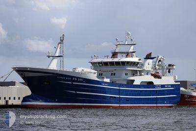
LUNAR BOW
Fishing
Current Position
| Долгота | --- |
|---|---|
| Широта | --- |
| Статус | Default |
| Скорость | |
| Курс | 342° |
| Район | North Sea |
| Станция | T-AIS |
| Позиция Получена | 1 m тому назад |
Info
Information
The current position of LUNAR BOW is in North Sea with coordinates 57.50147° / -1.77429° as reported on 2025-12-07 23:23 by AIS to our vessel tracker app. The vessel's current speed is 0 Узлы and is currently inside the port of PETERHEAD.
The vessel LUNAR BOW (IMO: 9842009, MMSI: 232025939) is a Fishing It's sailing under the flag of [GB] United Kingdom.
In this page you can find informations about the vessels current position, last detected port calls, and current voyage information. If the vessels is not in coverage by AIS you will find the latest position.
The current position of LUNAR BOW is detected by our AIS receivers and we are not responsible for the reliability of the data. The last position was recorded while the vessel was in Coverage by the Ais receivers of our vessel tracking app.
Weather
| Temperature | 7.7°C / 45.86°F |
|---|---|
| Wind Speed | 8 knots |
| Direction | 275° W |
| Pressure | 990.3 hPa |
| Humidity | 93.8 % |
| Cloud Coverage | 100 % |
Featured Company
Last Port Calls
| Port | Arrival | Departure | Time In Port |
|---|---|---|---|
| 2025-12-02 14:12 | |||
| 2025-11-30 18:37 | |||
| 2025-11-30 15:32 | |||
| 2025-11-17 10:39 | 2025-11-23 21:27 | 6 d | |
| 2025-11-11 07:18 | 2025-11-17 08:43 | 6 d | |
| 2025-11-04 09:41 | 2025-11-09 21:17 | 5 d | |
| 2025-10-29 07:03 | 2025-11-02 22:06 | 4 d | |
| 2025-10-20 23:59 | 2025-10-26 21:26 | 5 d | |
| 2025-10-17 01:25 | 2025-10-19 21:21 | 2 d | |
| 2025-10-15 04:26 | 2025-10-16 07:49 | 1 d |
Last Trips
| Origin | Departure | Destination | Arrival | Distance | |
|---|---|---|---|---|---|
| 2025-11-30 15:32 | 2025-11-30 18:37 | 2.80 морская миля | |||
| 2025-11-17 08:43 | 2025-11-17 10:39 | 12.07 морская миля | |||
| 2025-11-09 21:17 | 2025-11-11 07:18 | 39.79 морская миля | |||
| 2025-11-02 22:06 | 2025-11-04 09:41 | 21.48 морская миля | |||
| 2025-10-26 21:26 | 2025-10-29 07:03 | 32.81 морская миля | |||
| 2025-10-19 21:21 | 2025-10-20 23:59 | 21.98 морская миля | |||
| 2025-10-16 07:49 | 2025-10-17 01:25 | 22.63 морская миля | |||
| 2025-10-12 21:17 | 2025-10-15 04:26 | 369.96 морская миля | |||
| 2025-10-09 16:51 | 2025-10-11 05:56 | 37.98 морская миля | |||
| 2025-10-05 21:21 | 2025-10-08 06:14 | 35.45 морская миля |
Events
| Время | Событие | Детали | Позиция / Направление | Информация |
|---|---|---|---|---|
| 2025-12-02 14:25 | Окончание движения |
57.50163 / -1.77456
[GB] PETERHEAD
|
Скорость: 0.2 kn Курс: 345° |
|
| 2025-12-02 14:12 | Порт |
|
57.49695 / -1.77335
[GB] PETERHEAD
|
Скорость: 10.5 kn Курс: 303.1° |
| 2025-12-02 13:09 | Обнаружено в море | United Kingdom part of the North Sea |
57.52103 / -1.34997
North Sea
|
Скорость: 13.7 kn Курс: 264.2° |
| 2025-12-02 13:09 | В покрытии |
57.52103 / -1.34997
North Sea
|
Скорость: 13.7 kn Курс: 264.2° |
|
| 2025-12-01 21:19 | Вне покрытия |
57.62192 / 5.24869
North Sea
|
Скорость: 13.8 kn Курс: 269.7° |
|
| 2025-12-01 15:37 | Обнаружено в море | Norwegian part of the North Sea |
57.63928 / 7.63363
North Sea
|
Скорость: 13.7 kn Курс: 269.5° |
| 2025-12-01 14:27 | Обнаружено в море | Norwegian part of the Skaggerak |
57.63822 / 8.13378
Skaggerak
|
Скорость: 13.5 kn Курс: 273.1° |
| 2025-12-01 14:27 | В покрытии |
57.63822 / 8.13378
Skaggerak
|
Скорость: 13.5 kn Курс: 273.1° |
|
| 2025-11-30 17:37 | Вне покрытия |
57.59860 / 9.95864
Skaggerak
[DK] HIRTSHALS
|
Скорость: 7.1 kn Курс: 169° |
|
| 2025-11-30 17:37 | Порт |
|
57.59860 / 9.95864
[DK] HIRTSHALS
|
Скорость: 7.3 kn Курс: 178.5° |