
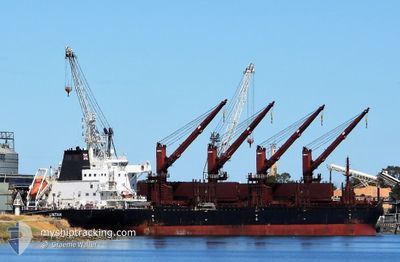
LINTAN
Cargo
Current Trip
| Time Travelled | 23 days |
|---|---|
| Remaining Time | --- |
| Distance Travelled | 6084.39 морская миля |
| Remaining Distance | --- |
| AVG Speed | 10.9 Узлы |
| MAX Speed | 14.3 Узлы |
| AVG Wind | 14.7 knots |
| MAX Wind | 28 knots |
| MIN Temp | 7.6°C / 45.68°F |
| MAX Temp | 28°C / 82.4°F |
| Осадка | 10.5 м |
| Позиция Получена | 6 h, 28 m тому назад |
Current Position
| Долгота | 14.70825° |
|---|---|
| Широта | 36.39549° |
| Статус | Under way using engine |
| Скорость | 11.9 Узлы |
| Курс | 110.2° |
| Район | Mediterranean Sea - Eastern Basin |
| Станция | T-AIS |
| Позиция Получена | 6 h, 28 m тому назад |
Info
Information
The current position of LINTAN is in Mediterranean Sea - Eastern Basin with coordinates 36.39549° / 14.70825° as reported on 2024-04-23 10:42 by AIS to our vessel tracker app. The vessel's current speed is 11.9 Узлы and is heading at the port of ABU QIR. The estimated time of arrival as calculated by MyShipTracking vessel tracking app is 2024-04-26 01:00 LT
The vessel LINTAN (IMO: 9715206, MMSI: 477737100) is a Cargo It's sailing under the flag of [HK] Hong Kong.
In this page you can find informations about the vessels current position, last detected port calls, and current voyage information. If the vessels is not in coverage by AIS you will find the latest position.
The current position of LINTAN is detected by our AIS receivers and we are not responsible for the reliability of the data. The last position was recorded while the vessel was in Coverage by the Ais receivers of our vessel tracking app.
The current draught of LINTAN as reported by AIS is 10.5 meters
Weather
| Temperature | 16.3°C / 61.34°F |
|---|---|
| Wind Speed | 24 knots |
| Direction | 300° WNW |
| Pressure | 1009.8 hPa |
| Humidity | 75.9 % |
| Cloud Coverage | --- |
Featured Company
Last Port Calls
| Port | Arrival | Departure | Time In Port |
|---|---|---|---|
| 2024-03-15 07:20 | 2024-03-30 21:40 | 15 d | |
| 2024-02-22 02:19 | 2024-02-23 14:43 | 1 d | |
| 2024-02-19 16:44 | 2024-02-20 18:21 | 1 d |
Most Visited Ports (Last year)
| Port | Arrivals | |
|---|---|---|
| 2 | ||
| 1 | ||
| 1 | ||
| 1 | ||
| 1 | ||
| 1 |
Last Trips
| Origin | Departure | Destination | Arrival | Distance | |
|---|---|---|---|---|---|
| 2024-02-23 09:43 | 2024-03-15 02:20 | 1659.03 морская миля | |||
| 2024-02-20 13:21 | 2024-02-21 21:19 | 294.08 морская миля | |||
| 2024-01-30 09:52 | 2024-02-19 11:44 | 4937.84 морская миля |
Events
| Время | Событие | Детали | Позиция / Направление | Информация |
|---|---|---|---|---|
| 2024-04-23 10:51 | Статус изменился | Default Under way using engine |
36.38405 / 14.74542
EG AKI
|
Скорость: 11.9 kn Курс: 110.2° |
| 2024-04-23 10:42 | Вне покрытия |
36.39549 / 14.70825
Mediterranean Sea - Eastern Basin
EG AKI
|
Скорость: 11.9 kn Курс: 110.2° |
|
| 2024-04-23 10:34 | Статус изменился | Under way using engine Default |
36.40381 / 14.68053
EG AKI
|
Скорость: 11.9 kn Курс: 105° |
| 2024-04-23 10:22 | Статус изменился | Default Under way using engine |
36.41768 / 14.63031
EG AKI
|
Скорость: 11.6 kn Курс: 94.6° |
| 2024-04-23 08:54 | Статус изменился | Under way using engine Default |
36.50894 / 14.33434
EG AKI
|
Скорость: 10 kn Курс: 115° |
| 2024-04-23 08:51 | Статус изменился | Default Under way using engine |
36.51167 / 14.32667
EG AKI
|
Скорость: 10.4 kn Курс: 114.6° |
| 2024-04-23 08:29 | Статус изменился | Under way using engine Default |
36.53914 / 14.25500
EG AKI
|
Скорость: 10 kn Курс: 117° |
| 2024-04-23 08:24 | В покрытии |
36.53914 / 14.25500
Mediterranean Sea - Eastern Basin
EG AKI
|
Скорость: 10.3 kn Курс: 117° |
|
| 2024-04-22 21:49 | Статус изменился | Default Under way using engine |
37.41714 / 12.21429
EG AKI
|
Скорость: 10.6 kn Курс: 129.8° |
| 2024-04-22 21:33 | Вне покрытия |
37.44947 / 12.16874
Mediterranean Sea - Eastern Basin
EG AKI
|
Скорость: 10.6 kn Курс: 129.8° |