
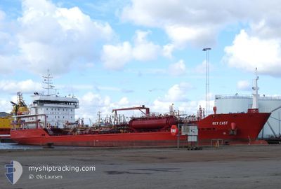
KEY EAST
Oil/Chemical Tanker
Current Trip
| Time Travelled | 2 days |
|---|---|
| Remaining Time | 4 h, 5 mins |
| Distance Travelled | 580.39 морская миля |
| Remaining Distance | 54.23 морская миля |
| AVG Speed | 7.5 Узлы |
| MAX Speed | 12.6 Узлы |
| AVG Wind | 20 knots |
| MAX Wind | 31.8 knots |
| MIN Temp | 1.4°C / 34.52°F |
| MAX Temp | 7°C / 44.6°F |
| Осадка | 6.9 м |
| Позиция Получена | 1 m тому назад |
Current Position
| Долгота | 8.83670° |
|---|---|
| Широта | 63.45213° |
| Статус | Under way using engine |
| Скорость | 12.3 Узлы |
| Курс | 69° |
| Район | Norwegian Sea |
| Станция | T-AIS |
| Позиция Получена | 1 m тому назад |
Info
Information
The current position of KEY EAST is in Norwegian Sea with coordinates 63.45213° / 8.83670° as reported on 2024-04-25 08:45 by AIS to our vessel tracker app. The vessel's current speed is 12.3 Узлы and is heading at the port of TRONDHEIM. The estimated time of arrival as calculated by MyShipTracking vessel tracking app is 2024-04-25 12:52 LT
The vessel KEY EAST (IMO: 9525584, MMSI: 229015000) is a Oil/Chemical Tanker that was built in 2011 ( 13 лет ). It's sailing under the flag of [MT] Malta.
In this page you can find informations about the vessels current position, last detected port calls, and current voyage information. If the vessels is not in coverage by AIS you will find the latest position.
The current position of KEY EAST is detected by our AIS receivers and we are not responsible for the reliability of the data. The last position was recorded while the vessel was in Coverage by the Ais receivers of our vessel tracking app.
The current draught of KEY EAST as reported by AIS is 6.9 meters
Weather
| Temperature | 3.7°C / 38.66°F |
|---|---|
| Wind Speed | 2 knots |
| Direction | 163° SSE |
| Pressure | 1005.4 hPa |
| Humidity | 66.8 % |
| Cloud Coverage | 100 % |
Featured Company
Last Port Calls
| Port | Arrival | Departure | Time In Port |
|---|---|---|---|
| 2024-04-22 03:30 | 2024-04-22 16:09 | 12 h | |
| 2024-04-17 21:45 | 2024-04-18 13:55 | 16 h | |
| 2024-04-17 21:34 | 2024-04-17 21:41 | 6 m | |
| 2024-04-16 20:23 | 2024-04-17 10:02 | 13 h | |
| 2024-04-15 21:20 | 2024-04-16 10:03 | 12 h | |
| 2024-04-11 19:05 | 2024-04-12 12:01 | 16 h | |
| 2024-04-11 02:30 | 2024-04-11 02:54 | 23 m | |
| 2024-04-10 08:15 | 2024-04-10 23:20 | 15 h | |
| 2024-04-06 12:58 | 2024-04-06 18:58 | 6 h | |
| 2024-04-01 14:35 | 2024-04-02 03:38 | 13 h |
Most Visited Ports (Last year)
| Port | Arrivals | |
|---|---|---|
| 82 | ||
| 17 | ||
| 16 | ||
| 15 | ||
| 3 | ||
| 3 |
Last Trips
| Origin | Departure | Destination | Arrival | Distance | |
|---|---|---|---|---|---|
| 2024-04-18 15:55 | 2024-04-22 05:30 | 687.20 морская миля | |||
| 2024-04-17 23:41 | 2024-04-17 23:45 | 0.02 морская миля | |||
| 2024-04-17 12:02 | 2024-04-17 23:34 | 123.95 морская миля | |||
| 2024-04-16 12:03 | 2024-04-16 22:23 | 125.34 морская миля | |||
| 2024-04-12 14:01 | 2024-04-15 23:20 | 681.75 морская миля | |||
| 2024-04-11 04:54 | 2024-04-11 21:05 | 43.74 морская миля | |||
| 2024-04-11 01:20 | 2024-04-11 04:30 | 35.14 морская миля | |||
| 2024-04-06 20:58 | 2024-04-10 10:15 | 796.72 морская миля | |||
| 2024-04-02 05:38 | 2024-04-06 14:58 | 875.78 морская миля | |||
| 2024-04-01 04:57 | 2024-04-01 16:35 | 122.83 морская миля |
Events
| Время | Событие | Детали | Позиция / Направление | Информация |
|---|---|---|---|---|
| 2024-04-25 06:58 | ETA изменился | 2024/04/25 15:00 2024/06/24 20:20 |
63.26459 / 8.14709
TRONDHEIM
|
Скорость: 12.5 kn Курс: 54° |
| 2024-04-25 06:09 | ETA изменился | 2024/06/24 20:20 2024/04/25 06:00 |
63.22441 / 7.80436
TRONDHEIM
|
Скорость: 11.7 kn Курс: 102° |
| 2024-04-24 19:53 | ETA изменился | 2024/04/25 06:00 2024/06/24 20:20 |
62.27966 / 4.97315
TRONDHEIM
|
Скорость: 9.4 kn Курс: 31° |
| 2024-04-24 16:43 | ETA изменился | 2024/06/24 20:20 2024/04/25 05:00 |
61.81655 / 4.47020
TRONDHEIM
|
Скорость: 9.8 kn Курс: 27° |
| 2024-04-24 12:07 | Пункт назначения изменился | TRONDHEIM TRODHEIM |
61.08635 / 4.39782
TRONDHEIM
|
Скорость: 8.7 kn Курс: 0° |
| 2024-04-24 12:07 | ETA изменился | 2024/04/25 05:00 2024/04/24 23:00 |
61.08635 / 4.39782
TRONDHEIM
|
Скорость: 8.7 kn Курс: 0° |
| 2024-04-24 11:32 | Изменение морского района | Norwegian part of the Norwegian Sea Norwegian part of the North Sea |
61.00332 / 4.40237
Norwegian Sea
TRODHEIM
|
Скорость: 8.7 kn Курс: 355° |
| 2024-04-23 05:56 | Обнаружено в море | Norwegian part of the North Sea |
57.92907 / 7.10734
North Sea
TRODHEIM
|
Скорость: 11.3 kn Курс: 272° |
| 2024-04-22 16:09 | ПОРТ ОТПРАВЛЕНИЯ |
|
59.32898 / 10.52248
TRODHEIM
|
Скорость: 5.4 kn Курс: 121° |
| 2024-04-22 16:07 | Начало движения |
59.32963 / 10.51715
[NO] SLAGEN
|
Скорость: 3.1 kn Курс: 82° |