
KANG SHENG KOU
Heavy Lift Vessel
Current Trip
| Time Travelled | 13 days |
|---|---|
| Remaining Time | 4 h, 4 mins |
| Distance Travelled | 2865.37 морская миля |
| Remaining Distance | 33.80 морская миля |
| AVG Speed | 8.9 Узлы |
| MAX Speed | 12 Узлы |
| AVG Wind | 10.2 knots |
| MAX Wind | 22.9 knots |
| MIN Temp | 22.6°C / 72.68°F |
| MAX Temp | 29.4°C / 84.92°F |
| Осадка | 6.8 м |
| Позиция Получена | 2 d тому назад |
Current Position
| Долгота | 37.33801° |
|---|---|
| Широта | 22.41381° |
| Статус | Under way using engine |
| Скорость | 9.5 Узлы |
| Курс | 333.6° |
| Район | Red Sea |
| Станция | T-AIS |
| Позиция Получена | 2 d тому назад |
Info
Information
The current position of KANG SHENG KOU is in Red Sea with coordinates 22.41381° / 37.33801° as reported on 2024-04-22 21:53 by AIS to our vessel tracker app. The vessel's current speed is 9.5 Узлы and is heading at the port of SUEZ CANAL. The estimated time of arrival as calculated by MyShipTracking vessel tracking app is 2024-04-25 12:35 LT
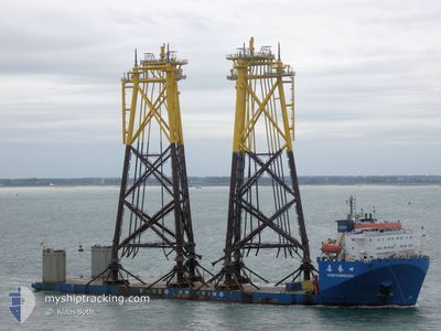
The vessel KANG SHENG KOU (IMO: 9223289, MMSI: 412055000) is a Heavy Lift Vessel that was built in 2003 ( 21 лет ). It's sailing under the flag of [CN] China.
In this page you can find informations about the vessels current position, last detected port calls, and current voyage information. If the vessels is not in coverage by AIS you will find the latest position.
The current position of KANG SHENG KOU is detected by our AIS receivers and we are not responsible for the reliability of the data. The last position was recorded while the vessel was in Coverage by the Ais receivers of our vessel tracking app.
The current draught of KANG SHENG KOU as reported by AIS is 6.8 meters
Weather
| Temperature | 28.2°C / 82.76°F |
|---|---|
| Wind Speed | 16 knots |
| Direction | 161° SSE |
| Pressure | 1005.4 hPa |
| Humidity | 33.7 % |
| Cloud Coverage | 100 % |
Featured Company
Last Trips
| Origin | Departure | Destination | Arrival | Distance |
|---|
Events
| Время | Событие | Детали | Позиция / Направление | Информация |
|---|---|---|---|---|
| 2024-04-23 10:20 | Начало движения |
23.97728 / 36.56217
SUEZ
|
Скорость: 3.8 kn Курс: 351° |
|
| 2024-04-23 09:40 | Окончание движения |
23.98244 / 36.56385
SUEZ
|
Скорость: 0.3 kn Курс: 48° |
|
| 2024-04-22 22:10 | Статус изменился | Default Under way using engine |
22.46333 / 37.31167
SUEZ
|
Скорость: 9.5 kn Курс: 333.6° |
| 2024-04-22 21:53 | Вне покрытия |
22.41381 / 37.33801
Red Sea
SUEZ
|
Скорость: 9.5 kn Курс: 333.6° |
|
| 2024-04-22 21:26 | Статус изменился | Under way using engine Default |
22.35780 / 37.36627
SUEZ
|
Скорость: 9 kn Курс: 335° |
| 2024-04-22 21:07 | Статус изменился | Default Under way using engine |
22.30833 / 37.38833
SUEZ
|
Скорость: 9.7 kn Курс: 337.4° |
| 2024-04-22 20:59 | Статус изменился | Under way using engine Default |
22.28573 / 37.39909
SUEZ
|
Скорость: 9.7 kn Курс: 338° |
| 2024-04-22 20:16 | Статус изменился | Default Under way using engine |
22.18021 / 37.44698
SUEZ
|
Скорость: 9.7 kn Курс: 335.8° |
| 2024-04-22 19:54 | Статус изменился | Under way using engine Default |
22.12477 / 37.47282
SUEZ
|
Скорость: 9 kn Курс: 336° |
| 2024-04-22 19:15 | Статус изменился | Default Under way using engine |
22.02959 / 37.51765
SUEZ
|
Скорость: 9.6 kn Курс: 335.7° |