
HAMBURG TEAM
Cargo
Current Trip
US CDE
| Time Travelled | 22 h, 58 mins |
|---|---|
| Remaining Time | --- |
| Distance Travelled | 276.30 морская миля |
| Remaining Distance | --- |
| AVG Speed | 11.6 Узлы |
| MAX Speed | 13.6 Узлы |
| AVG Wind | 15.8 knots |
| MAX Wind | 20.4 knots |
| MIN Temp | 12.1°C / 53.78°F |
| MAX Temp | 16.6°C / 61.88°F |
| Осадка | 9.6 м |
| Позиция Получена | 9 h, 46 m тому назад |
Current Position
| Долгота | -75.86658° |
|---|---|
| Широта | 36.86041° |
| Статус | Under way using engine |
| Скорость | 11.9 Узлы |
| Курс | 123.7° |
| Район | North Atlantic Ocean |
| Станция | T-AIS |
| Позиция Получена | 9 h, 46 m тому назад |
Info
Information
The current position of HAMBURG TEAM is in North Atlantic Ocean with coordinates 36.86041° / -75.86658° as reported on 2024-04-24 12:55 by AIS to our vessel tracker app. The vessel's current speed is 11.9 Узлы
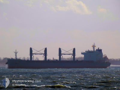
The vessel HAMBURG TEAM (IMO: 9855460, MMSI: 548995000) is a Cargo It's sailing under the flag of [PH] Philippines.
In this page you can find informations about the vessels current position, last detected port calls, and current voyage information. If the vessels is not in coverage by AIS you will find the latest position.
The current position of HAMBURG TEAM is detected by our AIS receivers and we are not responsible for the reliability of the data. The last position was recorded while the vessel was in Coverage by the Ais receivers of our vessel tracking app.
The current draught of HAMBURG TEAM as reported by AIS is 9.6 meters
Weather
| Temperature | 16.6°C / 61.88°F |
|---|---|
| Wind Speed | 15 knots |
| Direction | 223° SW |
| Pressure | 1017 hPa |
| Humidity | 80.9 % |
| Cloud Coverage | 43 % |
Featured Company
Last Port Calls
| Port | Arrival | Departure | Time In Port |
|---|---|---|---|
| 2024-04-22 06:03 | 2024-04-23 23:43 | 1 d | |
| 2024-03-27 16:22 | 2024-03-29 07:18 | 1 d | |
| 2024-03-17 00:35 | 2024-03-22 21:43 | 5 d | |
| 2024-02-03 16:51 | 2024-02-10 16:33 | 6 d |
Most Visited Ports (Last year)
| Port | Arrivals | |
|---|---|---|
| 3 | ||
| 2 | ||
| 2 | ||
| 2 | ||
| 1 | ||
| 1 |
Last Trips
| Origin | Departure | Destination | Arrival | Distance | |
|---|---|---|---|---|---|
| 2024-03-29 10:18 | 2024-04-22 02:03 | 5545.34 морская миля | |||
| 2024-03-22 23:43 | 2024-03-27 19:22 | 203.23 морская миля | |||
| 2024-02-10 10:33 | 2024-03-17 02:35 | 7648.23 морская миля | |||
| 2024-01-24 13:29 | 2024-02-03 10:51 | 575.77 морская миля |
Events
| Время | Событие | Детали | Позиция / Направление | Информация |
|---|---|---|---|---|
| 2024-04-24 13:02 | Статус изменился | Default Under way using engine |
36.84671 / -75.83944
US CDE
|
Скорость: 11.9 kn Курс: 123.7° |
| 2024-04-24 12:55 | Вне покрытия |
36.86041 / -75.86658
North Atlantic Ocean
US CDE
|
Скорость: 11.9 kn Курс: 123.7° |
|
| 2024-04-24 12:49 | Статус изменился | Under way using engine Default |
36.87139 / -75.88396
US CDE
|
Скорость: 11.7 kn Курс: 137° |
| 2024-04-24 12:42 | Статус изменился | Default Under way using engine |
36.88765 / -75.90196
US CDE
|
Скорость: 11.1 kn Курс: 136.8° |
| 2024-04-24 10:30 | Статус изменился | Under way using engine Default |
37.25662 / -76.12757
US CDE
|
Скорость: 12.7 kn Курс: 198° |
| 2024-04-24 10:14 | В покрытии |
37.25662 / -76.12757
North Atlantic Ocean
US CDE
|
Скорость: 12.7 kn Курс: 196.9° |
|
| 2024-04-24 06:59 | Статус изменился | Default Under way using engine |
37.92500 / -76.17333
US CDE
|
Скорость: 11.1 kn Курс: 160.6° |
| 2024-04-24 06:57 | Вне покрытия |
37.93405 / -76.17697
North Atlantic Ocean
US CDE
|
Скорость: 11.1 kn Курс: 160.6° |
|
| 2024-04-24 06:39 | Статус изменился | Under way using engine Default |
37.98504 / -76.19944
US CDE
|
Скорость: 11.3 kn Курс: 162° |
| 2024-04-24 06:38 | Статус изменился | Default Under way using engine |
37.99010 / -76.20158
US CDE
|
Скорость: 11.2 kn Курс: 169.4° |