
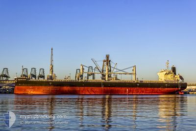
GLOBE ALIKI
Cargo
Current Trip
| Time Travelled | 8 days |
|---|---|
| Remaining Time | --- |
| Distance Travelled | 381.83 морская миля |
| Remaining Distance | --- |
| AVG Speed | 12 Узлы |
| MAX Speed | 13.6 Узлы |
| AVG Wind | 8.7 knots |
| MAX Wind | 24 knots |
| MIN Temp | 10.2°C / 50.36°F |
| MAX Temp | 16.4°C / 61.52°F |
| Осадка | 12.9 м |
| Позиция Получена | 7 d тому назад |
Current Position
| Долгота | 122.30473° |
|---|---|
| Широта | 34.30767° |
| Статус | Under way using engine |
| Скорость | 12 Узлы |
| Курс | 129.3° |
| Район | Yellow Sea |
| Станция | T-AIS |
| Позиция Получена | 7 d тому назад |
Info
Information
The current position of GLOBE ALIKI is in Yellow Sea with coordinates 34.30767° / 122.30473° as reported on 2024-04-16 01:18 by AIS to our vessel tracker app. The vessel's current speed is 12 Узлы
The vessel GLOBE ALIKI (IMO: 9687100, MMSI: 538005357) is a Cargo It's sailing under the flag of [MH] Marshall Is.
In this page you can find informations about the vessels current position, last detected port calls, and current voyage information. If the vessels is not in coverage by AIS you will find the latest position.
The current position of GLOBE ALIKI is detected by our AIS receivers and we are not responsible for the reliability of the data. The last position was recorded while the vessel was in Coverage by the Ais receivers of our vessel tracking app.
The current draught of GLOBE ALIKI as reported by AIS is 12.9 meters
Weather
| Temperature | 15.5°C / 59.9°F |
|---|---|
| Wind Speed | 10 knots |
| Direction | 273° W |
| Pressure | 1010.9 hPa |
| Humidity | 89.9 % |
| Cloud Coverage | 100 % |
Featured Company
Last Port Calls
| Port | Arrival | Departure | Time In Port |
|---|---|---|---|
| 2024-04-13 02:22 | 2024-04-15 12:22 | 2 d | |
| 2024-02-09 06:16 | 2024-02-09 10:14 | 3 h | |
| 2024-02-01 22:24 |
Most Visited Ports (Last year)
| Port | Arrivals | |
|---|---|---|
| 2 | ||
| 2 | ||
| 1 | ||
| 1 | ||
| 1 | ||
| 1 |
Last Trips
| Origin | Departure | Destination | Arrival | Distance | |
|---|---|---|---|---|---|
| 2024-02-09 04:14 | 2024-04-13 10:22 | 10829.17 морская миля | |||
| 2024-02-01 16:24 | 2024-02-09 00:16 | 30.68 морская миля |
Events
| Время | Событие | Детали | Позиция / Направление | Информация |
|---|---|---|---|---|
| 2024-04-16 19:34 | Окончание движения |
31.16035 / 122.71279
CN RZH
|
Скорость: 0.1 kn Курс: 92° |
|
| 2024-04-16 01:20 | Статус изменился | Default Under way using engine |
34.30345 / 122.31255
CN RZH
|
Скорость: 12 kn Курс: 129.3° |
| 2024-04-16 01:18 | Вне покрытия |
34.30767 / 122.30473
Yellow Sea
|
Скорость: 12 kn Курс: 129.3° |
|
| 2024-04-16 01:12 | Статус изменился | Under way using engine Default |
34.31999 / 122.28849
CN RZH
|
Скорость: 12 kn Курс: 123° |
| 2024-04-16 00:59 | В покрытии |
34.31999 / 122.28849
Yellow Sea
|
Скорость: 12 kn Курс: 130.4° |
|
| 2024-04-15 23:33 | Статус изменился | Default Under way using engine |
34.50473 / 121.96525
CN RZH
|
Скорость: 11.7 kn Курс: 106.6° |
| 2024-04-15 23:27 | Изменение морского района | Chinese part of the Yellow Sea Malaysian part of the Singapore Strait |
34.50762 / 121.94237
Yellow Sea
|
Скорость: 11.7 kn Курс: 106.6° |
| 2024-04-15 23:27 | Статус изменился | Under way using engine Default |
34.50762 / 121.94237
CN RZH
|
Скорость: 11.9 kn Курс: 126° |
| 2024-04-15 23:27 | В покрытии |
34.50762 / 121.94237
Yellow Sea
|
Скорость: 11.7 kn Курс: 106.6° |
|
| 2024-04-15 23:27 | Вне покрытия |
34.50762 / 121.94237
Yellow Sea
|
Скорость: 11.7 kn Курс: 106.6° |