
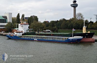
FLOKI
General Cargo
Current Trip
| Time Travelled | 1 day |
|---|---|
| Remaining Time | 14 h, 47 mins |
| Distance Travelled | 122.66 морская миля |
| Remaining Distance | 151.91 морская миля |
| AVG Speed | 6.8 Узлы |
| MAX Speed | 8.2 Узлы |
| AVG Wind | 11.9 knots |
| MAX Wind | 26 knots |
| MIN Temp | 9.2°C / 48.56°F |
| MAX Temp | 15.9°C / 60.62°F |
| Осадка | 0 м |
| Позиция Получена | 7 h, 31 m тому назад |
Current Position
| Долгота | --- |
|---|---|
| Широта | --- |
| Статус | Under way using engine |
| Скорость | 5.9 Узлы |
| Курс | 69.6° |
| Район | Sea of Marmara |
| Станция | T-AIS |
| Позиция Получена | 7 h, 31 m тому назад |
Info
Information
The current position of FLOKI is in Sea of Marmara with coordinates 40.20344° / 26.41413° as reported on 2025-12-07 10:26 by AIS to our vessel tracker app. The vessel's current speed is 5.9 Узлы and is heading at the port of DILISKELESI. The estimated time of arrival as calculated by MyShipTracking vessel tracking app is 2025-12-08 08:44 LT
The vessel FLOKI (IMO: 8503096, MMSI: 511100860) is a General Cargo that was built in 1985 ( 40 лет ). It's sailing under the flag of [PW] Palau.
In this page you can find informations about the vessels current position, last detected port calls, and current voyage information. If the vessels is not in coverage by AIS you will find the latest position.
The current position of FLOKI is detected by our AIS receivers and we are not responsible for the reliability of the data. The last position was recorded while the vessel was in Coverage by the Ais receivers of our vessel tracking app.
Weather
| Temperature | 10.1°C / 50.18°F |
|---|---|
| Wind Speed | 3 knots |
| Direction | 349° N |
| Pressure | 1012.6 hPa |
| Humidity | 85.1 % |
| Cloud Coverage | 100 % |
Featured Company
Last Port Calls
| Port | Arrival | Departure | Time In Port |
|---|---|---|---|
| 2025-12-05 13:38 | 2025-12-06 16:57 | 1 d | |
| 2025-11-25 23:19 | 2025-11-28 21:30 | 2 d | |
| 2025-11-24 04:19 | 2025-11-24 15:43 | 11 h | |
| 2025-11-22 16:15 | 2025-11-23 11:52 | 19 h | |
| 2025-11-15 12:23 | 2025-11-18 15:14 | 3 d | |
| 2025-11-13 05:28 | 2025-11-14 05:28 | 23 h | |
| 2025-11-08 09:38 | 2025-11-09 00:56 | 15 h | |
| 2025-11-03 05:06 | 2025-11-06 03:56 | 2 d | |
| 2025-10-31 06:44 | 2025-11-01 13:49 | 1 d | |
| 2025-10-24 16:02 | 2025-10-27 14:53 | 2 d |
Last Trips
| Origin | Departure | Destination | Arrival | Distance | |
|---|---|---|---|---|---|
| 2025-11-28 23:30 | 2025-12-05 16:38 | 264.42 морская миля | |||
| 2025-11-24 18:43 | 2025-11-26 01:19 | 226.74 морская миля | |||
| 2025-11-23 14:52 | 2025-11-24 07:19 | 0.97 морская миля | |||
| 2025-11-18 17:14 | 2025-11-22 19:15 | 304.30 морская миля | |||
| 2025-11-14 07:28 | 2025-11-15 14:23 | 247.02 морская миля | |||
| 2025-11-09 03:56 | 2025-11-13 07:28 | 391.07 морская миля | |||
| 2025-11-06 05:56 | 2025-11-08 12:38 | 331.57 морская миля | |||
| 2025-11-01 16:49 | 2025-11-03 07:06 | 272.88 морская миля | |||
| 2025-10-27 17:53 | 2025-10-31 09:44 | 224.17 морская миля | |||
| 2025-10-23 17:29 | 2025-10-24 19:02 | 184.06 морская миля |
Events
| Время | Событие | Детали | Позиция / Направление | Информация |
|---|---|---|---|---|
| 2025-12-07 10:31 | Статус изменился | Default Under way using engine |
40.20622 / 26.42642
TR DIL
|
Скорость: 5.9 kn Курс: 69.6° |
| 2025-12-07 10:26 | Вне покрытия |
40.20344 / 26.41413
Sea of Marmara
TR DIL
|
Скорость: 5.9 kn Курс: 69.6° |
|
| 2025-12-07 08:46 | Обнаружено в море | Turkish part of the Sea of Marmara |
40.06880 / 26.32637
Sea of Marmara
TR DIL
|
Скорость: 5.9 kn Курс: 40.7° |
| 2025-12-07 08:46 | Статус изменился | Under way using engine Default |
40.06880 / 26.32637
TR DIL
|
Скорость: 6.1 kn Курс: 50° |
| 2025-12-07 08:46 | В покрытии |
40.06880 / 26.32637
Sea of Marmara
TR DIL
|
Скорость: 5.9 kn Курс: 40.7° |
|
| 2025-12-07 02:30 | Статус изменился | Default Under way using engine |
39.64133 / 25.94869
TR DIL
|
Скорость: 7.5 kn Курс: 343.4° |
| 2025-12-07 01:53 | Вне покрытия |
39.56772 / 25.97417
Aegean Sea
TR DIL
|
Скорость: 7.5 kn Курс: 343.4° |
|
| 2025-12-06 23:28 | Пункт назначения изменился | TR DIL RO CNB |
39.43104 / 26.28761
TR DIL
|
Скорость: 8 kn Курс: 268.2° |
| 2025-12-06 23:28 | ETA изменился | 2025/12/08 05:00 2025/11/30 22:00 |
39.43104 / 26.28761
TR DIL
|
Скорость: 8 kn Курс: 268.2° |
| 2025-12-06 23:20 | Обнаружено в море | Turkish part of the Aegean Sea |
39.42864 / 26.31221
Aegean Sea
|
Скорость: 8.1 kn Курс: 288.6° |