
ETAGAS
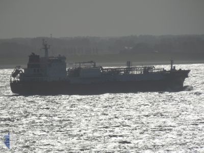
Tanker
Current Trip
| Time Travelled | 1 day |
|---|---|
| Remaining Time | --- |
| Distance Travelled | 37.72 морская миля |
| Remaining Distance | --- |
| AVG Speed | 10.7 Узлы |
| MAX Speed | 12.1 Узлы |
| AVG Wind | 11.6 knots |
| MAX Wind | 17.8 knots |
| MIN Temp | 22.8°C / 73.04°F |
| MAX Temp | 25.8°C / 78.44°F |
| Осадка | 8.9 м |
| Позиция Получена | 42 m тому назад |
Current Position
| Долгота | -94.54460° |
|---|---|
| Широта | 29.22102° |
| Статус | Under way using engine |
| Скорость | 10.8 Узлы |
| Курс | 134.3° |
| Район | Gulf of Mexico |
| Станция | T-AIS |
| Позиция Получена | 42 m тому назад |
Info
Information
The current position of ETAGAS is in Gulf of Mexico with coordinates 29.22102° / -94.54460° as reported on 2024-04-19 05:38 by AIS to our vessel tracker app. The vessel's current speed is 10.8 Узлы and is heading at the port of BOLIVAR. The estimated time of arrival as calculated by MyShipTracking vessel tracking app is 2024-04-17 21:00 LT
The vessel ETAGAS (IMO: 9553634, MMSI: 305369000) is a Tanker It's sailing under the flag of [AG] Antigua Barbuda.
In this page you can find informations about the vessels current position, last detected port calls, and current voyage information. If the vessels is not in coverage by AIS you will find the latest position.
The current position of ETAGAS is detected by our AIS receivers and we are not responsible for the reliability of the data. The last position was recorded while the vessel was in Coverage by the Ais receivers of our vessel tracking app.
The current draught of ETAGAS as reported by AIS is 8.9 meters
Weather
| Temperature | 23.1°C / 73.58°F |
|---|---|
| Wind Speed | 8 knots |
| Direction | 169° S |
| Pressure | 1015.1 hPa |
| Humidity | 96.4 % |
| Cloud Coverage | 100 % |
Featured Company
Last Port Calls
| Port | Arrival | Departure | Time In Port |
|---|---|---|---|
| 2024-04-16 17:16 | 2024-04-17 19:46 | 1 d | |
| 2024-04-14 00:28 | 2024-04-14 03:52 | 3 h | |
| 2024-04-12 13:56 | 2024-04-14 00:20 | 1 d | |
| 2024-04-12 09:27 | 2024-04-12 13:28 | 4 h | |
| 2024-04-09 16:19 | 2024-04-10 13:04 | 20 h | |
| 2024-04-06 07:27 | 2024-04-07 07:29 | 1 d | |
| 2024-04-02 16:12 | 2024-04-04 12:38 | 1 d | |
| 2024-03-15 13:38 | |||
| 2024-02-24 10:00 | 2024-02-26 20:11 | 2 d | |
| 2024-02-03 09:34 |
Most Visited Ports (Last year)
| Port | Arrivals | |
|---|---|---|
| 7 | ||
| 3 | ||
| 3 | ||
| 2 | ||
| 2 | ||
| 2 |
Last Trips
| Origin | Departure | Destination | Arrival | Distance | |
|---|---|---|---|---|---|
| 2024-04-13 22:52 | 2024-04-16 12:16 | 438.21 морская миля | |||
| 2024-04-13 19:20 | 2024-04-13 19:28 | 1.93 морская миля | |||
| 2024-04-12 08:28 | 2024-04-12 08:56 | 2.39 морская миля | |||
| 2024-04-10 08:04 | 2024-04-12 04:27 | 521.51 морская миля | |||
| 2024-04-07 01:29 | 2024-04-09 11:19 | 415.44 морская миля | |||
| 2024-04-04 06:38 | 2024-04-06 01:27 | 14.00 морская миля | |||
| 2024-02-26 17:11 | 2024-03-15 10:38 | 2970.19 морская миля | |||
| 2024-02-03 03:34 | 2024-02-24 07:00 | 4752.92 морская миля |
Events
| Время | Событие | Детали | Позиция / Направление | Информация |
|---|---|---|---|---|
| 2024-04-19 06:09 | Статус изменился | Default Under way using engine |
29.15667 / -94.46087
US HOU BOLIVAR
|
Скорость: 10.8 kn Курс: 134.3° |
| 2024-04-19 05:38 | Статус изменился | Under way using engine Default |
29.22102 / -94.54460
US HOU BOLIVAR
|
Скорость: 9.1 kn Курс: 153° |
| 2024-04-19 05:38 | В покрытии |
29.22102 / -94.54460
Gulf of Mexico
|
Скорость: 10.8 kn Курс: 134.3° |
|
| 2024-04-19 04:55 | Статус изменился | Default Under way using engine |
29.30941 / -94.64146
US HOU BOLIVAR
|
Скорость: 0.3 kn Курс: 252° |
| 2024-04-19 04:55 | Начало движения | 8.08 nm, East of GALVESTON |
29.30941 / -94.64146
US HOU BOLIVAR
|
Скорость: 9.1 kn Курс: 153° |
| 2024-04-19 04:14 | Вне покрытия |
29.34821 / -94.74867
Gulf of Mexico
|
Скорость: 0.3 kn Курс: 40.1° |
|
| 2024-04-19 04:13 | Статус изменился | Under way using engine At anchor |
29.34820 / -94.74868
US HOU BOLIVAR
|
Скорость: 0.1 kn Курс: 254° |
| 2024-04-19 04:02 | Статус изменился | At anchor Default |
29.34809 / -94.74892
US HOU BOLIVAR
|
Скорость: 0.1 kn Курс: 238° |
| 2024-04-19 04:02 | В покрытии |
29.34809 / -94.74892
Gulf of Mexico
|
Скорость: 0.1 kn Курс: 77.5° |
|
| 2024-04-19 03:53 | Осадка изменилась | 8.9 8.8 |
29.34851 / -94.74891
US HOU BOLIVAR
|
Скорость: 0.1 kn Курс: 238° |