
SINBAD
Tanker
Current Trip
| Time Travelled | 9 days |
|---|---|
| Remaining Time | --- |
| Distance Travelled | 2850.70 морская миля |
| Remaining Distance | --- |
| AVG Speed | 12.5 Узлы |
| MAX Speed | 12.5 Узлы |
| AVG Wind | 7.2 knots |
| MAX Wind | 16.1 knots |
| MIN Temp | 26.2°C / 79.16°F |
| MAX Temp | 30.2°C / 86.36°F |
| Осадка | 12 м |
| Позиция Получена | 4 h, 54 m тому назад |
Current Position
| Долгота | 97.09805° |
|---|---|
| Широта | 6.08520° |
| Статус | Under way using engine |
| Скорость | 12.5 Узлы |
| Курс | 97° |
| Район | Malacca Strait |
| Станция | T-AIS |
| Позиция Получена | 4 h, 54 m тому назад |
Info
Information
The current position of SINBAD is in Malacca Strait with coordinates 6.08520° / 97.09805° as reported on 2024-04-18 02:14 by AIS to our vessel tracker app. The vessel's current speed is 12.5 Узлы and is heading at the port of GULEI.
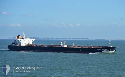
The vessel SINBAD (MMSI: 636019327) is a Tanker It's sailing under the flag of [LR] Liberia.
In this page you can find informations about the vessels current position, last detected port calls, and current voyage information. If the vessels is not in coverage by AIS you will find the latest position.
The current position of SINBAD is detected by our AIS receivers and we are not responsible for the reliability of the data. The last position was recorded while the vessel was in Coverage by the Ais receivers of our vessel tracking app.
The current draught of SINBAD as reported by AIS is 12 meters
Weather
| Temperature | 29.4°C / 84.92°F |
|---|---|
| Wind Speed | 5 knots |
| Direction | 357° N |
| Pressure | 1010.3 hPa |
| Humidity | 69.4 % |
| Cloud Coverage | 100 % |
Featured Company
Last Port Calls
| Port | Arrival | Departure | Time In Port |
|---|---|---|---|
| 2024-04-04 23:12 | 2024-04-08 22:39 | 3 d | |
| 2024-02-26 13:11 | 2024-02-28 11:35 | 1 d | |
| 2024-02-11 03:24 | 2024-02-11 13:16 | 9 h |
Most Visited Ports (Last year)
| Port | Arrivals | |
|---|---|---|
| 5 | ||
| 2 | ||
| 1 | ||
| 1 | ||
| 1 | ||
| 1 |
Last Trips
| Origin | Departure | Destination | Arrival | Distance | |
|---|---|---|---|---|---|
| 2024-02-28 17:05 | 2024-04-05 03:12 | 7524.72 морская миля | |||
| 2024-01-17 22:54 | 2024-02-26 18:41 | 9841.64 морская миля | |||
| 2024-01-17 22:54 | 2024-02-11 05:24 | 6804.38 морская миля |
Events
| Время | Событие | Детали | Позиция / Направление | Информация |
|---|---|---|---|---|
| 2024-04-18 02:16 | Статус изменился | Default Under way using engine |
6.08333 / 97.10333
GULEI
|
Скорость: 12.5 kn Курс: 97° |
| 2024-04-18 02:14 | Вне покрытия |
6.08520 / 97.09805
Malacca Strait
|
Скорость: 12.5 kn Курс: 97° |
|
| 2024-04-18 01:14 | Осадка изменилась | 12 12.1 |
6.11250 / 96.88256
GULEI
|
Скорость: 13.1 kn Курс: 98° |
| 2024-04-18 01:07 | Изменение морского района | Indonesian part of the Malacca Strait Indian part of the Laccadive Sea |
6.11644 / 96.85565
Malacca Strait
GULEI
|
Скорость: 13.2 kn Курс: 99° |
| 2024-04-18 01:07 | Статус изменился | Under way using engine Default |
6.11644 / 96.85565
GULEI
|
Скорость: 13.3 kn Курс: 98° |
| 2024-04-18 00:49 | В покрытии |
6.11644 / 96.85565
Malacca Strait
GULEI
|
Скорость: 13.2 kn Курс: 99° |
|
| 2024-04-14 00:31 | Статус изменился | Default Under way using engine |
7.37667 / 76.99333
GULEI
|
Скорость: 13.1 kn Курс: 124.8° |
| 2024-04-14 00:30 | Статус изменился | Under way using engine Default |
7.37980 / 76.98991
GULEI
|
Скорость: 13 kn Курс: 124° |
| 2024-04-14 00:30 | Вне покрытия |
7.37980 / 76.98991
Laccadive Sea
GULEI
|
Скорость: 13.1 kn Курс: 124.8° |
|
| 2024-04-14 00:30 | Изменение морского района | Indian part of the Laccadive Sea Omani part of the Gulf of Oman |
7.37980 / 76.98991
Laccadive Sea
GULEI
|
Скорость: 13.1 kn Курс: 124.8° |