
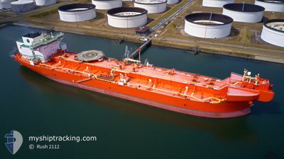
EAGLE BARENTS
Tanker
Current Trip
| Time Travelled | 48 days |
|---|---|
| Remaining Time | 1 day |
| Distance Travelled | 3961.98 морская миля |
| Remaining Distance | 421.36 морская миля |
| AVG Speed | 9.5 Узлы |
| MAX Speed | 16.1 Узлы |
| AVG Wind | 19 knots |
| MAX Wind | 34.3 knots |
| MIN Temp | 0.8°C / 33.44°F |
| MAX Temp | 14.7°C / 58.46°F |
| Осадка | 14.7 м |
| Позиция Получена | 4 h, 32 m тому назад |
Current Position
| Долгота | --- |
|---|---|
| Широта | --- |
| Статус | Under way using engine |
| Скорость | 12.4 Узлы |
| Курс | 200.6° |
| Район | Norwegian Sea |
| Станция | T-AIS |
| Позиция Получена | 4 h, 32 m тому назад |
Info
Information
The current position of EAGLE BARENTS is in Norwegian Sea with coordinates 67.74955° / 9.37859° as reported on 2025-12-07 14:53 by AIS to our vessel tracker app. The vessel's current speed is 12.4 Узлы and is heading at the port of MONGSTAD . The estimated time of arrival as calculated by MyShipTracking vessel tracking app is 2025-12-09 06:50 LT
The vessel EAGLE BARENTS (IMO: 9676125, MMSI: 257980000) is a Tanker It's sailing under the flag of [NO] Norway.
In this page you can find informations about the vessels current position, last detected port calls, and current voyage information. If the vessels is not in coverage by AIS you will find the latest position.
The current position of EAGLE BARENTS is detected by our AIS receivers and we are not responsible for the reliability of the data. The last position was recorded while the vessel was in Coverage by the Ais receivers of our vessel tracking app.
The current draught of EAGLE BARENTS as reported by AIS is 14.7 meters
Weather
| Temperature | 5.8°C / 42.44°F |
|---|---|
| Wind Speed | 16 knots |
| Direction | 106° ESE |
| Pressure | 1006.9 hPa |
| Humidity | 72.1 % |
| Cloud Coverage | 100 % |
Featured Company
Last Port Calls
| Port | Arrival | Departure | Time In Port |
|---|---|---|---|
| 2025-10-19 03:04 | 2025-10-20 18:11 | 1 d |
Most Visited Ports (Last year)
| Port | Arrivals | |
|---|---|---|
| 8 | ||
| 2 | ||
| 1 | ||
| 1 | ||
| 1 | ||
| 1 |
Last Trips
| Origin | Departure | Destination | Arrival | Distance | |
|---|---|---|---|---|---|
| 2025-08-14 09:15 | 2025-10-19 03:04 | 3334.46 морская миля |
Events
| Время | Событие | Детали | Позиция / Направление | Информация |
|---|---|---|---|---|
| 2025-12-07 14:53 | Вне покрытия |
67.74955 / 9.37859
Norwegian Sea
NOMON
|
Скорость: 12.4 kn Курс: 200.6° |
|
| 2025-12-07 10:10 | Статус изменился | Under way using engine Default |
68.50293 / 10.86023
NOMON
|
Скорость: 11 kn Курс: 226° |
| 2025-12-07 09:59 | Статус изменился | Default Under way using engine |
68.52500 / 10.92666
NOMON
|
Скорость: 11.8 kn Курс: 226.1° |
| 2025-12-07 09:48 | Статус изменился | Under way using engine Default |
68.55334 / 11.00542
NOMON
|
Скорость: 11 kn Курс: 225° |
| 2025-12-07 09:39 | Статус изменился | Default Under way using engine |
68.57333 / 11.06333
NOMON
|
Скорость: 12 kn Курс: 224.8° |
| 2025-12-06 20:23 | Статус изменился | Under way using engine Default |
70.38720 / 16.67272
NOMON
|
Скорость: 12.3 kn Курс: 230° |
| 2025-12-06 20:18 | Статус изменился | Default Under way using engine |
70.39792 / 16.70993
NOMON
|
Скорость: 12.3 kn Курс: 228.5° |
| 2025-12-06 20:10 | Статус изменился | Under way using engine Default |
70.41573 / 16.77115
NOMON
|
Скорость: 12.2 kn Курс: 229° |
| 2025-12-06 20:07 | Статус изменился | Default Under way using engine |
70.42101 / 16.78909
NOMON
|
Скорость: 11.8 kn Курс: 222.2° |
| 2025-12-06 19:15 | Статус изменился | Under way using engine Default |
70.54532 / 17.13792
NOMON
|
Скорость: 10 kn Курс: 223° |