
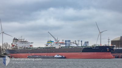
CLARET PRINCE
Crude Oil Tanker
Current Trip
| Time Travelled | 18 days |
|---|---|
| Remaining Time | --- |
| Distance Travelled | 3549.43 морская миля |
| Remaining Distance | --- |
| AVG Speed | 11.8 Узлы |
| MAX Speed | 16.4 Узлы |
| AVG Wind | 14 knots |
| MAX Wind | 27.9 knots |
| MIN Temp | 15.1°C / 59.18°F |
| MAX Temp | 29.9°C / 85.82°F |
| Осадка | 13.7 м |
| Позиция Получена | 7 d тому назад |
Current Position
| Долгота | -79.78175° |
|---|---|
| Широта | 26.22592° |
| Статус | Under way using engine |
| Скорость | 16.4 Узлы |
| Курс | 5.7° |
| Район | North Atlantic Ocean |
| Станция | T-AIS |
| Позиция Получена | 7 d тому назад |
Info
Information
The current position of CLARET PRINCE is in North Atlantic Ocean with coordinates 26.22592° / -79.78175° as reported on 2024-04-16 15:08 by AIS to our vessel tracker app. The vessel's current speed is 16.4 Узлы and is heading at the port of ROTTERDAM. The estimated time of arrival as calculated by MyShipTracking vessel tracking app is 2024-04-30 00:01 LT
The vessel CLARET PRINCE (IMO: 9437983, MMSI: 538008071) is a Crude Oil Tanker that was built in 2010 ( 14 лет ). It's sailing under the flag of [MH] Marshall Is.
In this page you can find informations about the vessels current position, last detected port calls, and current voyage information. If the vessels is not in coverage by AIS you will find the latest position.
The current position of CLARET PRINCE is detected by our AIS receivers and we are not responsible for the reliability of the data. The last position was recorded while the vessel was in Coverage by the Ais receivers of our vessel tracking app.
The current draught of CLARET PRINCE as reported by AIS is 13.7 meters
Weather
| Temperature | 15.2°C / 59.36°F |
|---|---|
| Wind Speed | 2 knots |
| Direction | 263° W |
| Pressure | 1030.7 hPa |
| Humidity | 98.1 % |
| Cloud Coverage | 100 % |
Featured Company
Last Port Calls
| Port | Arrival | Departure | Time In Port |
|---|---|---|---|
| 2024-04-03 15:51 | 2024-04-05 13:41 | 1 d | |
| 2024-03-05 00:28 | 2024-03-06 07:40 | 1 d | |
| 2024-02-26 01:29 | 2024-02-29 23:42 | 3 d | |
| 2024-02-18 16:07 | 2024-02-20 14:09 | 1 d | |
| 2024-02-09 11:32 |
Most Visited Ports (Last year)
| Port | Arrivals | |
|---|---|---|
| 3 | ||
| 2 | ||
| 2 | ||
| 1 | ||
| 1 | ||
| 1 |
Last Trips
| Origin | Departure | Destination | Arrival | Distance | |
|---|---|---|---|---|---|
| 2024-03-06 01:40 | 2024-04-03 10:51 | 4894.82 морская миля | |||
| 2024-02-29 17:42 | 2024-03-04 18:28 | 859.82 морская миля | |||
| 2024-02-20 08:09 | 2024-02-25 19:29 | 828.39 морская миля | |||
| 2024-02-09 05:32 | 2024-02-18 10:07 | 1569.37 морская миля |
Events
| Время | Событие | Детали | Позиция / Направление | Информация |
|---|---|---|---|---|
| 2024-04-18 18:50 | Начало движения |
31.79167 / -70.42500
NL RTM
|
Скорость: 12 kn Курс: 53° |
|
| 2024-04-18 16:08 | Окончание движения |
31.68500 / -70.59834
NL RTM
|
Скорость: Курс: -1° |
|
| 2024-04-16 15:14 | Статус изменился | Default Under way using engine |
26.25167 / -79.77834
NL RTM
|
Скорость: 16.4 kn Курс: 5.7° |
| 2024-04-16 15:08 | Вне покрытия |
26.22592 / -79.78175
North Atlantic Ocean
NL RTM
|
Скорость: 16.4 kn Курс: 5.7° |
|
| 2024-04-16 12:42 | Осадка изменилась | 13.7 8.2 |
25.58974 / -79.91366
NL RTM
|
Скорость: 15.3 kn Курс: 10.6° |
| 2024-04-16 12:42 | ETA изменился | 2024/04/30 00:01 2024/04/06 04:00 |
25.58974 / -79.91366
NL RTM
|
Скорость: 15.3 kn Курс: 10.6° |
| 2024-04-16 12:21 | Изменение морского района | United States part of the North Atlantic Ocean United States part of the Gulf of Mexico |
25.50337 / -79.93176
North Atlantic Ocean
|
Скорость: 15.1 kn Курс: 10.6° |
| 2024-04-16 12:21 | Статус изменился | Under way using engine Default |
25.50337 / -79.93176
NL RTM
|
Скорость: 15 kn Курс: 11° |
| 2024-04-16 12:14 | В покрытии |
25.50337 / -79.93176
North Atlantic Ocean
|
Скорость: 15.1 kn Курс: 10.6° |