
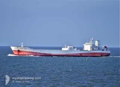
CARLOS FISCHER
Cargo
Current Trip
| Time Travelled | 7 days |
|---|---|
| Remaining Time | 4 days |
| Distance Travelled | 3218.95 морская миля |
| Remaining Distance | 1914.30 морская миля |
| AVG Speed | 17.1 Узлы |
| MAX Speed | 20.5 Узлы |
| AVG Wind | 13.2 knots |
| MAX Wind | 18.6 knots |
| MIN Temp | 23°C / 73.4°F |
| MAX Temp | 28.1°C / 82.58°F |
| Осадка | 7 м |
| Позиция Получена | 3 d тому назад |
Current Position
| Долгота | -61.07737° |
|---|---|
| Широта | 13.53492° |
| Статус | Under way using engine |
| Скорость | 15.8 Узлы |
| Курс | 120° |
| Район | Caribbean Sea |
| Станция | T-AIS |
| Позиция Получена | 3 d тому назад |
Info
Information
The current position of CARLOS FISCHER is in Caribbean Sea with coordinates 13.53492° / -61.07737° as reported on 2024-04-21 20:10 by AIS to our vessel tracker app. The vessel's current speed is 15.8 Узлы and is heading at the port of SANTOS. The estimated time of arrival as calculated by MyShipTracking vessel tracking app is 2024-04-29 13:57 LT
The vessel CARLOS FISCHER (MMSI: 636011561) is a Cargo It's sailing under the flag of [LR] Liberia.
In this page you can find informations about the vessels current position, last detected port calls, and current voyage information. If the vessels is not in coverage by AIS you will find the latest position.
The current position of CARLOS FISCHER is detected by our AIS receivers and we are not responsible for the reliability of the data. The last position was recorded while the vessel was in Coverage by the Ais receivers of our vessel tracking app.
The current draught of CARLOS FISCHER as reported by AIS is 7 meters
Weather
| Temperature | 28°C / 82.4°F |
|---|---|
| Wind Speed | 9 knots |
| Direction | 117° ESE |
| Pressure | 1012.5 hPa |
| Humidity | 77.4 % |
| Cloud Coverage | 100 % |
Featured Company
Last Port Calls
| Port | Arrival | Departure | Time In Port |
|---|---|---|---|
| 2024-04-09 14:53 | 2024-04-17 18:50 | 8 d | |
| 2024-03-24 14:34 | 2024-03-27 20:48 | 3 d | |
| 2024-03-05 22:20 | 2024-03-11 05:21 | 5 d | |
| 2024-02-19 11:51 | 2024-02-22 14:27 | 3 d | |
| 2024-02-07 09:20 |
Most Visited Ports (Last year)
| Port | Arrivals | |
|---|---|---|
| 9 | ||
| 6 | ||
| 3 | ||
| 2 | ||
| 2 | ||
| 1 |
Last Trips
| Origin | Departure | Destination | Arrival | Distance | |
|---|---|---|---|---|---|
| 2024-03-27 17:48 | 2024-04-09 10:53 | 5149.97 морская миля | |||
| 2024-03-11 01:21 | 2024-03-24 11:34 | 5257.25 морская миля | |||
| 2024-02-22 11:27 | 2024-03-05 17:20 | 5102.94 морская миля | |||
| 2024-02-07 04:20 | 2024-02-19 08:51 | 5169.91 морская миля |
Events
| Время | Событие | Детали | Позиция / Направление | Информация |
|---|---|---|---|---|
| 2024-04-25 11:50 | Окончание движения |
-.16156 / -39.89709
BRSSZ
|
Скорость: 0.3 kn Курс: 80° |
|
| 2024-04-21 20:10 | Статус изменился | Default Under way using engine |
13.53357 / -61.07505
BRSSZ
|
Скорость: 15.8 kn Курс: 120° |
| 2024-04-21 20:10 | Статус изменился | Under way using engine Default |
13.53492 / -61.07737
BRSSZ
|
Скорость: 15.8 kn Курс: 120° |
| 2024-04-21 20:10 | В покрытии |
13.53492 / -61.07737
Caribbean Sea
|
Скорость: 15.8 kn Курс: 120° |
|
| 2024-04-21 20:10 | Вне покрытия |
13.53492 / -61.07737
Caribbean Sea
|
Скорость: 15.8 kn Курс: 120° |
|
| 2024-04-21 20:10 | Изменение морского района | Saint Vincent and the Grenadines part of the Caribbean Sea United States part of the Gulf of Mexico |
13.53492 / -61.07737
Caribbean Sea
|
Скорость: 15.8 kn Курс: 120° |
| 2024-04-17 21:09 | Статус изменился | Default Under way using engine |
27.52922 / -83.00494
BRSSZ
|
Скорость: 15 kn Курс: 184.5° |
| 2024-04-17 21:03 | Вне покрытия |
27.55451 / -83.00278
Gulf of Mexico
|
Скорость: 15 kn Курс: 184.5° |
|
| 2024-04-17 20:52 | Статус изменился | Under way using engine Default |
27.58921 / -82.99152
BRSSZ
|
Скорость: 11.8 kn Курс: 263° |
| 2024-04-17 20:32 | Статус изменился | Default Under way using engine |
27.59839 / -82.91737
BRSSZ
|
Скорость: 11.8 kn Курс: 264.5° |