
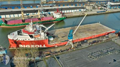
BIGROLL BERING
Cargo
Current Trip
| Time Travelled | 17 days |
|---|---|
| Remaining Time | --- |
| Distance Travelled | 3227.23 морская миля |
| Remaining Distance | --- |
| AVG Speed | 8.9 Узлы |
| MAX Speed | 13.3 Узлы |
| AVG Wind | 6.9 knots |
| MAX Wind | 18 knots |
| MIN Temp | 27.3°C / 81.14°F |
| MAX Temp | 30°C / 86°F |
| Осадка | 5.4 м |
| Позиция Получена | 4 d тому назад |
Current Position
| Долгота | 104.22440° |
|---|---|
| Широта | 1.21917° |
| Статус | Under way using engine |
| Скорость | 10.1 Узлы |
| Курс | 12.2° |
| Район | Singapore Strait |
| Станция | T-AIS |
| Позиция Получена | 4 d тому назад |
Info
Information
The current position of BIGROLL BERING is in Singapore Strait with coordinates 1.21917° / 104.22440° as reported on 2024-04-21 10:22 by AIS to our vessel tracker app. The vessel's current speed is 10.1 Узлы and is heading at the port of ZHUHAI. The estimated time of arrival as calculated by MyShipTracking vessel tracking app is 2024-04-28 23:00 LT
The vessel BIGROLL BERING (IMO: 9710476, MMSI: 244830431) is a Cargo It's sailing under the flag of [NL] Netherlands.
In this page you can find informations about the vessels current position, last detected port calls, and current voyage information. If the vessels is not in coverage by AIS you will find the latest position.
The current position of BIGROLL BERING is detected by our AIS receivers and we are not responsible for the reliability of the data. The last position was recorded while the vessel was in Coverage by the Ais receivers of our vessel tracking app.
The current draught of BIGROLL BERING as reported by AIS is 5.4 meters
Weather
| Temperature | 27.6°C / 81.68°F |
|---|---|
| Wind Speed | 24 knots |
| Direction | 180° S |
| Pressure | 1002.8 hPa |
| Humidity | 90.1 % |
| Cloud Coverage | --- |
Featured Company
Most Visited Ports (Last year)
| Port | Arrivals | |
|---|---|---|
| 2 | ||
| 2 | ||
| 2 | ||
| 2 | ||
| 1 | ||
| 1 |
Events
| Время | Событие | Детали | Позиция / Направление | Информация |
|---|---|---|---|---|
| 2024-04-21 10:28 | Статус изменился | Default Under way using engine |
1.23557 / 104.22775
CN ZUH
|
Скорость: 10.1 kn Курс: 12.2° |
| 2024-04-21 10:22 | Статус изменился | Under way using engine Default |
1.21917 / 104.22440
CN ZUH
|
Скорость: 10.1 kn Курс: 13° |
| 2024-04-21 10:22 | Вне покрытия |
1.21917 / 104.22440
Singapore Strait
CN ZUH
|
Скорость: 10.1 kn Курс: 12.2° |
|
| 2024-04-21 10:20 | Статус изменился | Default Under way using engine |
1.21363 / 104.22325
CN ZUH
|
Скорость: 10.3 kn Курс: 13.5° |
| 2024-04-21 10:07 | Изменение морского района | Indonesian part of the Singapore Strait Indonesian part of the South China Sea |
1.17713 / 104.21435
Singapore Strait
CN ZUH
|
Скорость: 10.4 kn Курс: 13.9° |
| 2024-04-21 08:58 | Осадка изменилась | 5.4 5.3 |
1.01492 / 104.22792
CN ZUH
|
Скорость: 7.1 kn Курс: 312.9° |
| 2024-04-21 08:58 | Пункт назначения изменился | CN ZUH BINTAN |
1.01492 / 104.22792
CN ZUH
|
Скорость: 7.1 kn Курс: 312.9° |
| 2024-04-21 08:58 | ETA изменился | 2024/04/28 23:00 2024/04/19 03:00 |
1.01492 / 104.22792
CN ZUH
|
Скорость: 7.1 kn Курс: 312.9° |
| 2024-04-21 08:50 | Статус изменился | Under way using engine Default |
1.00705 / 104.23753
BINTAN
|
Скорость: 6 kn Курс: 300° |
| 2024-04-21 08:44 | Начало движения | 4.23 nm, South East of TANJUNGUBAN |
1.00255 / 104.24541
BINTAN
|
Скорость: 4.5 kn Курс: 297° |