
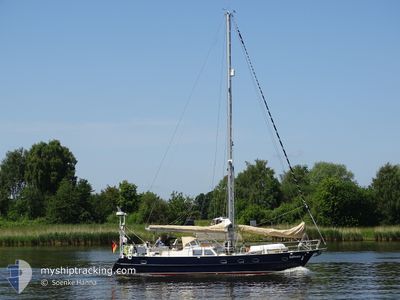
BALTHASAR
Sailing
Current Trip
BALTHASAR is out of coverage. Learn how you can join the community and extend the coverage to your area by clicking here!
Unknown
Destination Port
ETA*
---
| Time Travelled | 17 h, 55 mins |
|---|---|
| Remaining Time | --- |
| Distance Travelled | 10.10 морская миля |
| Remaining Distance | --- |
| AVG Speed | 4.8 Узлы |
| MAX Speed | 5.9 Узлы |
| AVG Wind | 17.7 knots |
| MAX Wind | 20 knots |
| MIN Temp | 5.2°C / 41.36°F |
| MAX Temp | 6.1°C / 42.98°F |
| Осадка | --- |
| Позиция Получена | 15 h, 19 m тому назад |
Current Position
| Долгота | -1.37509° |
|---|---|
| Широта | 55.13641° |
| Статус | Default |
| Скорость | 5.9 Узлы |
| Курс | 269.6° |
| Район | North Sea |
| Станция | T-AIS |
| Позиция Получена | 15 h, 19 m тому назад |
Info
info
Information
The current position of BALTHASAR is in North Sea with coordinates 55.13641° / -1.37509° as reported on 2024-04-24 09:37 by AIS to our vessel tracker app. The vessel's current speed is 5.9 Узлы
The vessel BALTHASAR (MMSI: 211488320) is a Sailing It's sailing under the flag of [DE] Germany.
In this page you can find informations about the vessels current position, last detected port calls, and current voyage information. If the vessels is not in coverage by AIS you will find the latest position.
The current position of BALTHASAR is detected by our AIS receivers and we are not responsible for the reliability of the data. The last position was recorded while the vessel was in Coverage by the Ais receivers of our vessel tracking app.
Weather
| Temperature | 6°C / 42.8°F |
|---|---|
| Wind Speed | 17 knots |
| Direction | 354° N |
| Pressure | 1018.8 hPa |
| Humidity | 69.5 % |
| Cloud Coverage | 100 % |
Featured Company
Limited time offer - Install a base station receiver to your area and list your company on MyShipTracking Free forever!
Last Port Calls
| Port | Arrival | Departure | Time In Port |
|---|---|---|---|
| 2024-04-23 14:47 | 2024-04-24 07:01 | 16 h | |
| 2024-04-21 14:59 | 2024-04-23 06:41 | 1 d | |
| 2024-04-15 06:46 |
Most Visited Ports (Last year)
| Port | Arrivals | |
|---|---|---|
| 2 | ||
| 2 | ||
| 1 | ||
| 1 | ||
| 1 | ||
| 1 |
Last Trips
| Origin | Departure | Destination | Arrival | Distance | |
|---|---|---|---|---|---|
| 2024-04-23 07:41 | 2024-04-23 15:47 | 34.42 морская миля | |||
| 2024-04-15 08:46 | 2024-04-21 15:59 | 367.18 морская миля |
Events
| Время | Событие | Детали | Позиция / Направление | Информация |
|---|---|---|---|---|
| 2024-04-24 09:37 | Вне покрытия |
55.13641 / -1.37509
North Sea
|
Скорость: 5.9 kn Курс: 269.6° |
|
| 2024-04-24 07:01 | ПОРТ ОТПРАВЛЕНИЯ |
|
55.01878 / -1.39092
|
Скорость: 7 kn Курс: 69.6° |
| 2024-04-24 06:37 | Начало движения |
54.99636 / -1.44753
[GB] TYNE
|
Скорость: 4 kn Курс: 69.4° |
|
| 2024-04-23 22:28 | В покрытии |
54.99595 / -1.45359
North Sea
[GB] TYNE
|
Скорость: Курс: 511° |
|
| 2024-04-23 20:58 | Вне покрытия |
54.99596 / -1.45357
North Sea
[GB] TYNE
|
Скорость: Курс: 511° |
|
| 2024-04-23 14:47 | Окончание движения |
54.99606 / -1.45061
[GB] TYNE
|
Скорость: 0.1 kn Курс: 511° |
|
| 2024-04-23 14:47 | Порт |
|
54.99606 / -1.45061
[GB] TYNE
|
Скорость: 2.4 kn Курс: 511° |
| 2024-04-23 06:41 | ПОРТ ОТПРАВЛЕНИЯ |
|
54.68671 / -1.18834
|
Скорость: 4 kn Курс: 116.7° |
| 2024-04-23 06:37 | Начало движения |
54.68924 / -1.19511
[GB] HARTLEPOOL
|
Скорость: 3.6 kn Курс: 130° |
|
| 2024-04-21 15:04 | Окончание движения |
54.69053 / -1.19846
[GB] HARTLEPOOL
|
Скорость: 0.1 kn Курс: 511° |