
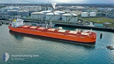
BAIACU
Cargo
Current Trip
SIKKA, INDIA
| Time Travelled | 2 days |
|---|---|
| Remaining Time | --- |
| Distance Travelled | 787.39 морская миля |
| Remaining Distance | --- |
| AVG Speed | 12.7 Узлы |
| MAX Speed | 16 Узлы |
| AVG Wind | 9.7 knots |
| MAX Wind | 16 knots |
| MIN Temp | 26.2°C / 79.16°F |
| MAX Temp | 29.2°C / 84.56°F |
| Осадка | 10.3 м |
| Позиция Получена | 9 d тому назад |
Current Position
| Долгота | 57.14814° |
|---|---|
| Широта | 24.84295° |
| Статус | Under way using engine |
| Скорость | 14.3 Узлы |
| Курс | 129.9° |
| Район | Gulf of Oman |
| Станция | T-AIS |
| Позиция Получена | 9 d тому назад |
Info
Information
The current position of BAIACU is in Gulf of Oman with coordinates 24.84295° / 57.14814° as reported on 2024-04-15 21:00 by AIS to our vessel tracker app. The vessel's current speed is 14.3 Узлы
The vessel BAIACU (IMO: 9872353, MMSI: 538008807) is a Cargo It's sailing under the flag of [MH] Marshall Is.
In this page you can find informations about the vessels current position, last detected port calls, and current voyage information. If the vessels is not in coverage by AIS you will find the latest position.
The current position of BAIACU is detected by our AIS receivers and we are not responsible for the reliability of the data. The last position was recorded while the vessel was in Coverage by the Ais receivers of our vessel tracking app.
The current draught of BAIACU as reported by AIS is 10.3 meters
Weather
| Temperature | 29.2°C / 84.56°F |
|---|---|
| Wind Speed | 10 knots |
| Direction | 58° ENE |
| Pressure | 1009.2 hPa |
| Humidity | 69.7 % |
| Cloud Coverage | 81 % |
Featured Company
Last Trips
| Origin | Departure | Destination | Arrival | Distance | |
|---|---|---|---|---|---|
| 2024-04-13 00:34 | 2024-04-19 22:34 | 1572.08 морская миля | |||
| 2024-03-12 04:27 | 2024-04-09 11:48 | 8318.96 морская миля | |||
| 2024-03-09 12:05 | 2024-03-10 20:30 | 59.97 морская миля | |||
| 2024-01-20 17:12 | 2024-03-09 11:15 | 3686.98 морская миля |
Events
| Время | Событие | Детали | Позиция / Направление | Информация |
|---|---|---|---|---|
| 2024-04-22 16:18 | Начало движения | 0.96 nm, North West of SIKKA |
22.50667 / 69.82833
SIKKA, INDIA
|
Скорость: 5 kn Курс: -1° |
| 2024-04-22 16:18 | ПОРТ ОТПРАВЛЕНИЯ |
|
22.50667 / 69.82833
SIKKA, INDIA
|
Скорость: 2.3 kn Курс: 307° |
| 2024-04-19 17:35 | Окончание движения |
22.49788 / 69.83860
[IN] SIKKA
|
Скорость: 0.1 kn Курс: 309° |
|
| 2024-04-19 17:04 | Порт |
|
22.50466 / 69.83379
[IN] SIKKA
|
Скорость: 5.5 kn Курс: 117° |
| 2024-04-15 21:05 | Статус изменился | Default Under way using engine |
24.83133 / 57.16432
SIKKA, INDIA
|
Скорость: 14.3 kn Курс: 129.9° |
| 2024-04-15 21:00 | Вне покрытия |
24.84295 / 57.14814
Gulf of Oman
SIKKA, INDIA
|
Скорость: 14.3 kn Курс: 129.9° |
|
| 2024-04-15 20:56 | Статус изменился | Under way using engine Default |
24.85402 / 57.13378
SIKKA, INDIA
|
Скорость: 14.2 kn Курс: 130° |
| 2024-04-15 20:27 | Статус изменился | Default Under way using engine |
24.93167 / 57.03833
SIKKA, INDIA
|
Скорость: 14.3 kn Курс: 134.3° |
| 2024-04-15 20:26 | Статус изменился | Under way using engine Default |
24.93278 / 57.03637
SIKKA, INDIA
|
Скорость: 14.2 kn Курс: 134° |
| 2024-04-15 20:17 | Статус изменился | Default Under way using engine |
24.95948 / 57.00616
SIKKA, INDIA
|
Скорость: 14.2 kn Курс: 134.3° |