
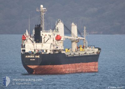
AURORA ONE
Bulk Carrier
Current Trip
| Time Travelled | 1 day |
|---|---|
| Remaining Time | 1 day |
| Distance Travelled | 343.35 морская миля |
| Remaining Distance | 356.38 морская миля |
| AVG Speed | 9.6 Узлы |
| MAX Speed | 10.6 Узлы |
| AVG Wind | 14.7 knots |
| MAX Wind | 19.2 knots |
| MIN Temp | 2.9°C / 37.22°F |
| MAX Temp | 6.9°C / 44.42°F |
| Осадка | 8.4 м |
| Позиция Получена | 9 h, 1 m тому назад |
Current Position
| Долгота | --- |
|---|---|
| Широта | --- |
| Статус | Under way using engine |
| Скорость | 9.5 Узлы |
| Курс | 230.1° |
| Район | Baltic Sea |
| Станция | T-AIS |
| Позиция Получена | 9 h, 1 m тому назад |
Info
Information
The current position of AURORA ONE is in Baltic Sea with coordinates 59.26026° / 21.89540° as reported on 2025-12-07 00:58 by AIS to our vessel tracker app. The vessel's current speed is 9.5 Узлы and is heading at the port of SZCZECIN. The estimated time of arrival as calculated by MyShipTracking vessel tracking app is 2025-12-09 00:53 LT
The vessel AURORA ONE (IMO: 9343819, MMSI: 538005792) is a Bulk Carrier that was built in 2007 ( 18 лет ). It's sailing under the flag of [MH] Marshall Is.
In this page you can find informations about the vessels current position, last detected port calls, and current voyage information. If the vessels is not in coverage by AIS you will find the latest position.
The current position of AURORA ONE is detected by our AIS receivers and we are not responsible for the reliability of the data. The last position was recorded while the vessel was in Coverage by the Ais receivers of our vessel tracking app.
The current draught of AURORA ONE as reported by AIS is 8.4 meters
Weather
| Temperature | 6.1°C / 42.98°F |
|---|---|
| Wind Speed | 15 knots |
| Direction | 167° SSE |
| Pressure | 1012.1 hPa |
| Humidity | 89.8 % |
| Cloud Coverage | 100 % |
Featured Company
Last Port Calls
| Port | Arrival | Departure | Time In Port |
|---|---|---|---|
| 2025-12-03 19:20 | 2025-12-06 00:53 | 2 d | |
| 2025-11-29 17:54 | 2025-12-01 07:25 | 1 d | |
| 2025-11-24 08:05 | 2025-11-26 12:45 | 2 d | |
| 2025-11-16 23:59 | 2025-11-20 11:45 | 3 d | |
| 2025-11-10 19:05 | 2025-11-12 23:20 | 2 d | |
| 2025-10-13 18:29 | 2025-10-15 15:25 | 1 d |
Most Visited Ports (Last year)
| Port | Arrivals | |
|---|---|---|
| 5 | ||
| 1 | ||
| 1 | ||
| 1 | ||
| 1 |
Last Trips
| Origin | Departure | Destination | Arrival | Distance | |
|---|---|---|---|---|---|
| 2025-12-01 07:25 | 2025-12-03 19:20 | 580.19 морская миля | |||
| 2025-11-26 12:45 | 2025-11-29 17:54 | 596.58 морская миля | |||
| 2025-11-20 11:45 | 2025-11-24 08:05 | 717.50 морская миля | |||
| 2025-11-12 23:20 | 2025-11-16 23:59 | 735.36 морская миля | |||
| 2025-10-15 15:25 | 2025-11-10 19:05 | 4308.21 морская миля | |||
| 2025-09-18 12:44 | 2025-10-13 18:29 | 4329.86 морская миля |
Events
| Время | Событие | Детали | Позиция / Направление | Информация |
|---|---|---|---|---|
| 2025-12-07 01:05 | Статус изменился | Default Under way using engine |
59.24894 / 21.86800
PLSZZ
|
Скорость: 9.5 kn Курс: 230.1° |
| 2025-12-07 00:58 | Вне покрытия |
59.26026 / 21.89540
Baltic Sea
PLSZZ
|
Скорость: 9.5 kn Курс: 230.1° |
|
| 2025-12-06 23:48 | Изменение морского района | Estonian part of the Baltic Sea Finnish part of the Baltic Sea |
59.37632 / 22.17038
Baltic Sea
PLSZZ
|
Скорость: 9.3 kn Курс: 230.7° |
| 2025-12-06 23:48 | Статус изменился | Under way using engine Default |
59.37632 / 22.17038
PLSZZ
|
Скорость: 9.3 kn Курс: 232° |
| 2025-12-06 23:33 | В покрытии |
59.37632 / 22.17038
Baltic Sea
PLSZZ
|
Скорость: 9.3 kn Курс: 230.7° |
|
| 2025-12-06 21:57 | Статус изменился | Default Under way using engine |
59.53611 / 22.62616
PLSZZ
|
Скорость: 9.5 kn Курс: 259.1° |
| 2025-12-06 21:51 | Вне покрытия |
59.54000 / 22.65726
Baltic Sea
PLSZZ
|
Скорость: 9.5 kn Курс: 259.1° |
|
| 2025-12-06 20:22 | Изменение морского района | Finnish part of the Baltic Sea Finnish part of the Gulf of Finland |
59.60118 / 23.08880
Baltic Sea
PLSZZ
|
Скорость: 9.1 kn Курс: 256.3° |
| 2025-12-06 17:53 | Статус изменился | Under way using engine Default |
59.70843 / 23.82869
PLSZZ
|
Скорость: 9.8 kn Курс: 251° |
| 2025-12-06 17:49 | Статус изменился | Default Under way using engine |
59.71133 / 23.84936
PLSZZ
|
Скорость: 9.8 kn Курс: 249.1° |