
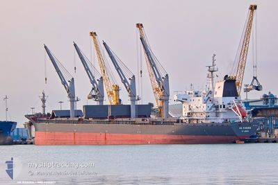
AK KHAIRA
Bulk Carrier
Current Trip
MA CAS
| Time Travelled | 2 days |
|---|---|
| Remaining Time | --- |
| Distance Travelled | 551.23 морская миля |
| Remaining Distance | --- |
| AVG Speed | 12.6 Узлы |
| MAX Speed | 13.2 Узлы |
| AVG Wind | 23.3 knots |
| MAX Wind | 26.7 knots |
| MIN Temp | 16°C / 60.8°F |
| MAX Temp | 16.5°C / 61.7°F |
| Осадка | 9.7 м |
| Позиция Получена | 9 d тому назад |
Current Position
| Долгота | --- |
|---|---|
| Широта | --- |
| Статус | Under way using engine |
| Скорость | 4.7 Узлы |
| Курс | 201° |
| Район | North Atlantic Ocean |
| Станция | T-AIS |
| Позиция Получена | 9 d тому назад |
Info
Information
The current position of AK KHAIRA is in North Atlantic Ocean with coordinates 33.63603° / -7.56883° as reported on 2025-11-28 05:37 by AIS to our vessel tracker app. The vessel's current speed is 4.7 Узлы
The vessel AK KHAIRA (IMO: 9300831, MMSI: 305385000) is a Bulk Carrier that was built in 2006 ( 19 лет ). It's sailing under the flag of [AG] Antigua Barbuda.
In this page you can find informations about the vessels current position, last detected port calls, and current voyage information. If the vessels is not in coverage by AIS you will find the latest position.
The current position of AK KHAIRA is detected by our AIS receivers and we are not responsible for the reliability of the data. The last position was recorded while the vessel was in Coverage by the Ais receivers of our vessel tracking app.
The current draught of AK KHAIRA as reported by AIS is 9.7 meters
Weather
| Temperature | 16.3°C / 61.34°F |
|---|---|
| Wind Speed | 27 knots |
| Direction | 204° SSW |
| Pressure | 1015.6 hPa |
| Humidity | 84.4 % |
| Cloud Coverage | 100 % |
Featured Company
Last Port Calls
| Port | Arrival | Departure | Time In Port |
|---|---|---|---|
| 2025-11-28 06:55 | 2025-12-05 11:09 | 7 d | |
| 2025-11-10 16:33 | 2025-11-14 03:37 | 3 d | |
| 2025-10-12 08:12 | 2025-10-17 14:52 | 5 d | |
| 2025-10-02 06:16 | 2025-10-09 15:36 | 7 d |
Last Trips
| Origin | Departure | Destination | Arrival | Distance | |
|---|---|---|---|---|---|
| 2025-11-14 03:37 | 2025-11-28 06:55 | 2846.23 морская миля | |||
| 2025-10-17 14:52 | 2025-11-10 16:33 | 3950.30 морская миля | |||
| 2025-10-09 15:36 | 2025-10-12 08:12 | 607.45 морская миля | |||
| 2025-09-02 17:10 | 2025-10-02 06:16 | 1860.13 морская миля |
Events
| Время | Событие | Детали | Позиция / Направление | Информация |
|---|---|---|---|---|
| 2025-12-05 10:09 | ПОРТ ОТПРАВЛЕНИЯ |
|
33.62552 / -7.57835
MA CAS
|
Скорость: 8.7 kn Курс: 59° |
| 2025-12-05 09:59 | Начало движения |
33.61296 / -7.60234
[MA] CASABLANCA
|
Скорость: 5 kn Курс: 68° |
|
| 2025-11-28 06:42 | Окончание движения |
33.60667 / -7.61167
[MA] CASABLANCA
|
Скорость: Курс: -1° |
|
| 2025-11-28 05:55 | Порт |
|
33.61780 / -7.58995
[MA] CASABLANCA
|
Скорость: 5.8 kn Курс: 234° |
| 2025-11-28 05:43 | Статус изменился | Default Under way using engine |
33.62899 / -7.57345
MA CAS
|
Скорость: 4.7 kn Курс: 201° |
| 2025-11-28 05:37 | Вне покрытия |
33.63603 / -7.56883
North Atlantic Ocean
[MA] CASABLANCA
|
Скорость: 4.7 kn Курс: 201.3° |
|
| 2025-11-28 05:36 | Статус изменился | Under way using engine Default |
33.63664 / -7.56852
MA CAS
|
Скорость: 4.8 kn Курс: 197° |
| 2025-11-28 05:35 | В покрытии |
33.63603 / -7.56883
North Atlantic Ocean
|
Скорость: 4.7 kn Курс: 201.3° |
|
| 2025-11-28 04:27 | Начало движения | 4.82 nm, North of CASABLANCA |
33.69187 / -7.62284
MA CAS
|
Скорость: 5 kn Курс: 52° |
| 2025-11-28 01:20 | Вне покрытия |
33.68311 / -7.62878
North Atlantic Ocean
|
Скорость: 0.2 kn Курс: 54° |