
ZUIDERZEE
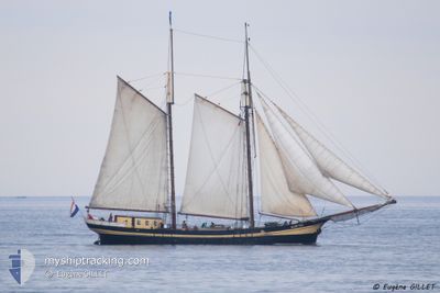
Passengers Ship
Current Trip
| Time Travelled | 1 day |
|---|---|
| Remaining Time | --- |
| Distance Travelled | 32.71 nm |
| Remaining Distance | --- |
| AVG Speed | 5.8 Knopen |
| MAX Speed | 7.6 Knopen |
| AVG Wind | 7.9 knots |
| MAX Wind | 11 knots |
| MIN Temp | 2.6°C / 36.68°F |
| MAX Temp | 4.5°C / 40.1°F |
| Diepgang | 2.4 M |
| Positie ontvangen | 1 m geleden |
Current Position
| Lengtegraad | 11.72978° |
|---|---|
| Breedtegraat | 54.66278° |
| Status | Moored |
| Snelheid | |
| Koers | --- |
| Gebied | Baltic Sea |
| Station | T-AIS |
| Positie ontvangen | 1 m geleden |
Info
Information
The current position of ZUIDERZEE is in Baltic Sea with coordinates 54.66278° / 11.72978° as reported on 2024-04-24 03:07 by AIS to our vessel tracker app. The vessel's current speed is 0 Knopen
The vessel ZUIDERZEE (IMO: 9097264, MMSI: 246084000) is a Passengers Ship that was built in 1910 ( 114 Jaar oud ). It's sailing under the flag of [NL] Netherlands.
In this page you can find informations about the vessels current position, last detected port calls, and current voyage information. If the vessels is not in coverage by AIS you will find the latest position.
The current position of ZUIDERZEE is detected by our AIS receivers and we are not responsible for the reliability of the data. The last position was recorded while the vessel was in Coverage by the Ais receivers of our vessel tracking app.
The current draught of ZUIDERZEE as reported by AIS is 2.4 meters
Weather
| Temperature | 3.6°C / 38.48°F |
|---|---|
| Wind Speed | 12 knots |
| Direction | 155° SSE |
| Pressure | 1006.8 hPa |
| Humidity | 96.9 % |
| Cloud Coverage | 100 % |
Featured Company
Last Port Calls
| Port | Arrival | Departure | Time In Port |
|---|---|---|---|
| 2024-04-15 15:51 | 2024-04-22 10:49 | 6 d | |
| 2024-04-13 15:47 | 2024-04-14 17:10 | 1 d | |
| 2024-04-13 11:22 | 2024-04-13 12:08 | 46 m | |
| 2024-04-13 02:19 | 2024-04-13 07:06 | 4 h | |
| 2024-03-18 13:43 | 2024-04-11 23:07 | 24 d | |
| 2024-03-18 08:55 | 2024-03-18 10:43 | 1 h | |
| 2024-02-02 17:19 | 2024-03-18 07:14 | ||
| 2024-02-02 14:00 | 2024-02-02 15:33 | 1 h | |
| 2024-02-02 10:14 |
Last Trips
| Origin | Departure | Destination | Arrival | Distance | |
|---|---|---|---|---|---|
| 2024-04-14 19:10 | 2024-04-15 17:51 | 78.95 nm | |||
| 2024-04-13 14:08 | 2024-04-13 17:47 | 18.12 nm | |||
| 2024-04-13 09:06 | 2024-04-13 13:22 | 30.48 nm | |||
| 2024-04-12 01:07 | 2024-04-13 04:19 | 185.14 nm | |||
| 2024-03-18 11:43 | 2024-03-18 14:43 | 19.16 nm | |||
| 2024-03-18 08:14 | 2024-03-18 09:55 | 11.54 nm | |||
| 2024-02-02 16:33 | 2024-02-02 18:19 | 11.98 nm | |||
| 2024-02-02 11:14 | 2024-02-02 15:00 | 19.14 nm |
Events
| Tijd | Evenement | Details | Positie / Bestemming | Info |
|---|---|---|---|---|
| 2024-04-22 17:01 | Status Changed | Moored Under way sailing |
54.66270 / 11.72974
ROSTOCK
|
Snelheid: Koers: 511° |
| 2024-04-22 16:38 | Stop beweging | 8.75 nm, North West of GEDSER |
54.66231 / 11.72990
ROSTOCK
|
Snelheid: 0.2 kn Koers: 511° |
| 2024-04-22 13:23 | Wijzig zee gebeid | Danish part of the Baltic Sea German part of the Baltic Sea |
54.37118 / 11.94647
Baltic Sea
ROSTOCK
|
Snelheid: 5 kn Koers: 327.8° |
| 2024-04-22 12:52 | Status Changed | Under way sailing Under way using engine |
54.33374 / 11.98415
ROSTOCK
|
Snelheid: 5.2 kn Koers: 327.5° |
| 2024-04-22 12:51 | Destination Changed | ROSTOCK KIEL |
54.33313 / 11.98480
ROSTOCK
|
Snelheid: 5.3 kn Koers: 331.6° |
| 2024-04-22 12:51 | ETA Changed | 2024/04/26 16:00 2024/04/13 16:00 |
54.33313 / 11.98480
ROSTOCK
|
Snelheid: 5.3 kn Koers: 331.6° |
| 2024-04-22 10:59 | Start beweging | 3.88 nm, North of ROSTOCK |
54.19187 / 12.08128
KIEL
|
Snelheid: 3.5 kn Koers: 354.5° |
| 2024-04-22 10:55 | Stop beweging | 3.77 nm, North of ROSTOCK |
54.18999 / 12.08189
KIEL
|
Snelheid: 0.1 kn Koers: 511° |
| 2024-04-22 10:49 | Vertrekhaven |
|
54.18859 / 12.08610
KIEL
|
Snelheid: 6.3 kn Koers: 295.3° |
| 2024-04-22 09:54 | Start beweging |
54.09425 / 12.12321
[DE] ROSTOCK
|
Snelheid: 5.5 kn Koers: 299.8° |