
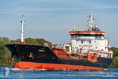
MG DERIN
Oil/Chemical Tanker
Current Trip
| Time Travelled | 3 days |
|---|---|
| Remaining Time | 4 h, 45 mins |
| Distance Travelled | 674.24 nm |
| Remaining Distance | 79.41 nm |
| AVG Speed | 8.8 Knopen |
| MAX Speed | 10.2 Knopen |
| AVG Wind | 12.2 knots |
| MAX Wind | 27.2 knots |
| MIN Temp | 11.4°C / 52.52°F |
| MAX Temp | 16.2°C / 61.16°F |
| Diepgang | 5.2 M |
| Positie ontvangen | 4 h, 26 m geleden |
Current Position
| Lengtegraad | 15.73617° |
|---|---|
| Breedtegraat | 36.78182° |
| Status | Under way using engine |
| Snelheid | 8.5 Knopen |
| Koers | 194° |
| Gebied | Ionian Sea |
| Station | T-AIS |
| Positie ontvangen | 4 h, 26 m geleden |
Info
Information
The current position of MG DERIN is in Ionian Sea with coordinates 36.78182° / 15.73617° as reported on 2024-04-25 12:44 by AIS to our vessel tracker app. The vessel's current speed is 8.5 Knopen and is heading at the port of VALLETTA. The estimated time of arrival as calculated by MyShipTracking vessel tracking app is 2024-04-25 21:56 LT
The vessel MG DERIN (IMO: 9445411, MMSI: 271002601) is a Oil/Chemical Tanker that was built in 2008 ( 16 Jaar oud ). It's sailing under the flag of [TR] Turkey.
In this page you can find informations about the vessels current position, last detected port calls, and current voyage information. If the vessels is not in coverage by AIS you will find the latest position.
The current position of MG DERIN is detected by our AIS receivers and we are not responsible for the reliability of the data. The last position was recorded while the vessel was in Coverage by the Ais receivers of our vessel tracking app.
The current draught of MG DERIN as reported by AIS is 5.2 meters
Weather
| Temperature | 15.4°C / 59.72°F |
|---|---|
| Wind Speed | 21 knots |
| Direction | 279° W |
| Pressure | 1013 hPa |
| Humidity | 75.5 % |
| Cloud Coverage | 45 % |
Featured Company
Last Port Calls
| Port | Arrival | Departure | Time In Port |
|---|---|---|---|
| 2024-04-20 22:46 | 2024-04-21 18:27 | 19 h | |
| 2024-04-13 08:25 | 2024-04-15 01:09 | 1 d | |
| 2024-03-28 15:18 | 2024-03-30 01:07 | 1 d | |
| 2024-03-21 16:54 | 2024-03-22 22:32 | 1 d | |
| 2024-03-12 19:03 | 2024-03-13 17:05 | 22 h | |
| 2024-03-04 21:55 | 2024-03-06 18:22 | 1 d | |
| 2024-02-29 21:23 | 2024-03-02 07:56 | 1 d | |
| 2024-02-17 06:20 | 2024-02-18 06:11 | 23 h | |
| 2024-02-11 04:42 | 2024-02-12 20:26 | 1 d |
Most Visited Ports (Last year)
| Port | Arrivals | |
|---|---|---|
| 7 | ||
| 5 | ||
| 4 | ||
| 4 | ||
| 2 | ||
| 2 |
Last Trips
| Origin | Departure | Destination | Arrival | Distance | |
|---|---|---|---|---|---|
| 2024-04-15 03:09 | 2024-04-21 00:46 | 1303.56 nm | |||
| 2024-03-30 02:07 | 2024-04-13 10:25 | 1866.87 nm | |||
| 2024-03-22 23:32 | 2024-03-28 16:18 | 553.18 nm | |||
| 2024-03-13 19:05 | 2024-03-21 17:54 | 1466.83 nm | |||
| 2024-03-06 22:22 | 2024-03-12 21:03 | 693.14 nm | |||
| 2024-03-02 09:56 | 2024-03-05 01:55 | 595.43 nm | |||
| 2024-02-18 08:11 | 2024-02-29 23:23 | 965.54 nm | |||
| 2024-02-12 22:26 | 2024-02-17 08:20 | 824.80 nm | |||
| 2024-01-06 08:33 | 2024-02-11 06:42 | 1070.58 nm |
Events
| Tijd | Evenement | Details | Positie / Bestemming | Info |
|---|---|---|---|---|
| 2024-04-25 13:03 | Status Changed | Default Under way using engine |
36.73872 / 15.72338
MTMLA
|
Snelheid: 8.5 kn Koers: 194° |
| 2024-04-25 12:44 | Buitenbereik |
36.78182 / 15.73617
Ionian Sea
MTMLA
|
Snelheid: 8.5 kn Koers: 194° |
|
| 2024-04-25 12:09 | Status Changed | Under way using engine Default |
36.86257 / 15.76120
MTMLA
|
Snelheid: 8.9 kn Koers: 191° |
| 2024-04-25 11:54 | Binnenbereik |
36.86257 / 15.76120
Ionian Sea
MTMLA
|
Snelheid: 8.7 kn Koers: 192° |
|
| 2024-04-25 10:43 | Status Changed | Default Under way using engine |
37.07172 / 15.81095
MTMLA
|
Snelheid: 8.9 kn Koers: 195° |
| 2024-04-25 10:42 | Buitenbereik |
37.07410 / 15.81178
Ionian Sea
MTMLA
|
Snelheid: 8.9 kn Koers: 195° |
|
| 2024-04-25 10:19 | Status Changed | Under way using engine Default |
37.12810 / 15.83038
MTMLA
|
Snelheid: 8.7 kn Koers: 195° |
| 2024-04-25 09:53 | Status Changed | Default Under way using engine |
37.19132 / 15.85100
MTMLA
|
Snelheid: 8.6 kn Koers: 194° |
| 2024-04-25 09:48 | Status Changed | Under way using engine Default |
37.20212 / 15.85442
MTMLA
|
Snelheid: 8.6 kn Koers: 193° |
| 2024-04-25 09:29 | Status Changed | Default Under way using engine |
37.24423 / 15.86708
MTMLA
|
Snelheid: 8.6 kn Koers: 193° |