
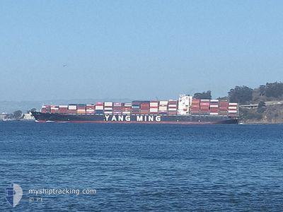
YM UBIQUITY
Container Ship
Current Trip
| Trip Time | 14 days |
|---|---|
| Trip Distance | 5737.35 nm |
| AVG Speed | 14 Knopen |
| MAX Speed | 14 Knopen |
| Diepgang | 13 M |
| AVG Wind | 13.7 knots |
| MAX Wind | 32 knots |
| MIN Temp | 7°C / 44.6°F |
| MAX Temp | 25.7°C / 78.26°F |
| Positie ontvangen | 5 m geleden |
Current Position
| Lengtegraad | 121.75350° |
|---|---|
| Breedtegraat | 25.14750° |
| Status | Moored |
| Snelheid | |
| Koers | 171° |
| Gebied | Eastern China Sea |
| Station | T-AIS |
| Positie ontvangen | 5 m geleden |
Info
Information
The current position of YM UBIQUITY is in Eastern China Sea with coordinates 25.14750° / 121.75350° as reported on 2024-04-19 15:41 by AIS to our vessel tracker app. The vessel's current speed is 0 Knopen and is currently inside the port of KEELUNG.
The vessel YM UBIQUITY (IMO: 9462706, MMSI: 416467000) is a Container Ship that was built in 2012 ( 12 Jaar oud ). It's sailing under the flag of [TW] Taiwan.
In this page you can find informations about the vessels current position, last detected port calls, and current voyage information. If the vessels is not in coverage by AIS you will find the latest position.
The current position of YM UBIQUITY is detected by our AIS receivers and we are not responsible for the reliability of the data. The last position was recorded while the vessel was in Coverage by the Ais receivers of our vessel tracking app.
The current draught of YM UBIQUITY as reported by AIS is 13 meters
Weather
| Temperature | 25°C / 77°F |
|---|---|
| Wind Speed | 2 knots |
| Direction | 184° S |
| Pressure | 1009.9 hPa |
| Humidity | 83.4 % |
| Cloud Coverage | 100 % |
Featured Company
Last Port Calls
| Port | Arrival | Departure | Time In Port |
|---|---|---|---|
| 2024-04-19 07:35 | |||
| 2024-04-03 12:06 | 2024-04-04 23:49 | 1 d | |
| 2024-03-28 12:11 | 2024-04-01 12:14 | 4 d | |
| 2024-03-12 15:45 | 2024-03-13 13:22 | 21 h | |
| 2024-03-11 06:11 | 2024-03-12 00:43 | 18 h | |
| 2024-03-09 07:43 | 2024-03-10 08:39 | 1 d | |
| 2024-03-02 00:08 | 2024-03-02 23:38 | 23 h | |
| 2024-02-29 08:55 | 2024-03-01 01:51 | 16 h | |
| 2024-02-04 13:44 | 2024-02-07 05:49 | 2 d | |
| 2024-02-01 13:13 |
Most Visited Ports (Last year)
| Port | Arrivals | |
|---|---|---|
| 10 | ||
| 9 | ||
| 6 | ||
| 6 | ||
| 6 | ||
| 3 |
Last Trips
| Origin | Departure | Destination | Arrival | Distance | |
|---|---|---|---|---|---|
| 2024-04-04 16:49 | 2024-04-19 15:35 | 5737.35 nm | |||
| 2024-04-01 05:14 | 2024-04-03 05:06 | 439.27 nm | |||
| 2024-03-13 21:22 | 2024-03-28 05:11 | 6172.91 nm | |||
| 2024-03-12 08:43 | 2024-03-12 23:45 | 238.92 nm | |||
| 2024-03-10 16:39 | 2024-03-11 14:11 | 348.83 nm | |||
| 2024-03-03 07:38 | 2024-03-09 15:43 | 593.75 nm | |||
| 2024-03-01 09:51 | 2024-03-02 08:08 | 246.13 nm | |||
| 2024-02-06 21:49 | 2024-02-29 16:55 | 5898.52 nm | |||
| 2024-02-01 05:13 | 2024-02-04 05:44 | 574.09 nm |
Events
| Tijd | Evenement | Details | Positie / Bestemming | Info |
|---|---|---|---|---|
| 2024-04-19 08:10 | Status Changed | Moored Under way using engine |
25.14744 / 121.75350
[TW] KEELUNG
|
Snelheid: Koers: 171° |
| 2024-04-19 07:49 | Stop beweging |
25.14747 / 121.75396
[TW] KEELUNG
|
Snelheid: 0.2 kn Koers: 173° |
|
| 2024-04-19 07:35 | Aankomsthaven |
|
25.16233 / 121.75200
[TW] KEELUNG
|
Snelheid: 7.8 kn Koers: 152.2° |
| 2024-04-19 06:07 | ETA Changed | 2024/04/19 07:15 2024/04/19 08:00 |
25.46583 / 121.84783
US OAK>TW KEL
|
Snelheid: 17.2 kn Koers: 203.6° |
| 2024-04-19 04:43 | ETA Changed | 2024/04/19 08:00 2024/04/18 23:00 |
25.68833 / 122.05500
US OAK>TW KEL
|
Snelheid: 13.2 kn Koers: 233.7° |
| 2024-04-19 04:12 | Wijzig zee gebeid | Taiwanese part of the Eastern China Sea United States part of the North Pacific Ocean |
25.75200 / 122.16150
Eastern China Sea
|
Snelheid: 13 kn Koers: 240° |
| 2024-04-19 04:12 | Binnenbereik |
25.75200 / 122.16150
Eastern China Sea
|
Snelheid: 13 kn Koers: 240° |