
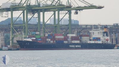
YM HAWK
Container Ship
Current Trip
| Time Travelled | 4 days |
|---|---|
| Remaining Time | --- |
| Distance Travelled | 758.50 nm |
| Remaining Distance | 3.92 nm |
| AVG Speed | 9.6 Knopen |
| MAX Speed | 11.9 Knopen |
| AVG Wind | 13.3 knots |
| MAX Wind | 22.8 knots |
| MIN Temp | 25.5°C / 77.9°F |
| MAX Temp | 34.8°C / 94.64°F |
| Diepgang | 5.6 M |
| Positie ontvangen | 4 d geleden |
Current Position
| Lengtegraad | 120.72395° |
|---|---|
| Breedtegraat | 14.49862° |
| Status | Under way using engine |
| Snelheid | 9.7 Knopen |
| Koers | 228° |
| Gebied | South China Sea |
| Station | T-AIS |
| Positie ontvangen | 4 d geleden |
Info
Information
The current position of YM HAWK is in South China Sea with coordinates 14.49862° / 120.72395° as reported on 2024-04-19 08:37 by AIS to our vessel tracker app. The vessel's current speed is 9.7 Knopen and is heading at the port of DA NANG. The estimated time of arrival as calculated by MyShipTracking vessel tracking app is 2024-04-25 02:00 LT
The vessel YM HAWK (IMO: 9299317, MMSI: 416429000) is a Container Ship that was built in 2005 ( 19 Jaar oud ). It's sailing under the flag of [TW] Taiwan.
In this page you can find informations about the vessels current position, last detected port calls, and current voyage information. If the vessels is not in coverage by AIS you will find the latest position.
The current position of YM HAWK is detected by our AIS receivers and we are not responsible for the reliability of the data. The last position was recorded while the vessel was in Coverage by the Ais receivers of our vessel tracking app.
The current draught of YM HAWK as reported by AIS is 5.6 meters
Weather
| Temperature | 26.1°C / 78.98°F |
|---|---|
| Wind Speed | 7 knots |
| Direction | 154° SSE |
| Pressure | 1008 hPa |
| Humidity | 89.4 % |
| Cloud Coverage | 5 % |
Featured Company
Last Port Calls
| Port | Arrival | Departure | Time In Port |
|---|---|---|---|
| 2024-04-18 13:02 | 2024-04-19 07:07 | 18 h | |
| 2024-04-16 09:18 | 2024-04-16 20:50 | 11 h | |
| 2024-04-15 15:48 | 2024-04-16 02:18 | 10 h | |
| 2024-04-13 23:05 | 2024-04-14 11:22 | 12 h | |
| 2024-04-08 00:01 | 2024-04-08 21:05 | 21 h | |
| 2024-02-07 05:58 | 2024-02-07 19:58 | 14 h | |
| 2024-02-01 05:54 | 2024-02-02 02:26 | 20 h |
Last Trips
| Origin | Departure | Destination | Arrival | Distance | |
|---|---|---|---|---|---|
| 2024-04-17 04:50 | 2024-04-18 21:02 | 547.84 nm | |||
| 2024-04-16 10:18 | 2024-04-16 17:18 | 24.51 nm | |||
| 2024-04-14 19:22 | 2024-04-15 23:48 | 388.91 nm | |||
| 2024-04-09 05:05 | 2024-04-14 07:05 | 1672.38 nm | |||
| 2024-02-08 03:58 | 2024-04-08 08:01 | 250.15 nm | |||
| 2024-02-02 10:26 | 2024-02-07 13:58 | 29.22 nm | |||
| 2024-01-31 22:36 | 2024-02-01 13:54 | 187.31 nm |
Events
| Tijd | Evenement | Details | Positie / Bestemming | Info |
|---|---|---|---|---|
| 2024-04-23 01:55 | Stop beweging | 5.25 nm, North of DA NANG |
16.18138 / 108.18845
PHMNS>VNDAD
|
Snelheid: 0.2 kn Koers: 177° |
| 2024-04-19 08:37 | Buitenbereik |
14.49862 / 120.72395
South China Sea
PHMNS>VNDAD
|
Snelheid: 9.7 kn Koers: 228° |
|
| 2024-04-19 07:07 | Vertrekhaven |
|
14.57122 / 120.95405
PHMNS>VNDAD
|
Snelheid: 5.5 kn Koers: 267° |
| 2024-04-19 06:56 | Start beweging |
14.58108 / 120.96327
[PH] MANILA SOUTH HARBOR
|
Snelheid: 3.1 kn Koers: 190° |
|
| 2024-04-19 06:55 | Draught Changed | 5.6 8.5 |
14.58193 / 120.96247
[PH] MANILA SOUTH HARBOR
|
Snelheid: 2.1 kn Koers: 130° |
| 2024-04-19 06:43 | Status Changed | Under way using engine Moored |
14.58538 / 120.96513
[PH] MANILA SOUTH HARBOR
|
Snelheid: Koers: 46° |
| 2024-04-18 23:19 | Binnenbereik |
14.58545 / 120.96508
South China Sea
[PH] MANILA SOUTH HARBOR
|
Snelheid: Koers: 265° |
|
| 2024-04-18 21:52 | Buitenbereik |
14.58542 / 120.96510
South China Sea
[PH] MANILA SOUTH HARBOR
|
Snelheid: Koers: 154° |
|
| 2024-04-18 21:52 | Binnenbereik |
14.58542 / 120.96510
South China Sea
[PH] MANILA SOUTH HARBOR
|
Snelheid: Koers: 154° |
|
| 2024-04-18 20:46 | Buitenbereik |
14.58542 / 120.96517
South China Sea
[PH] MANILA SOUTH HARBOR
|
Snelheid: Koers: 177° |