
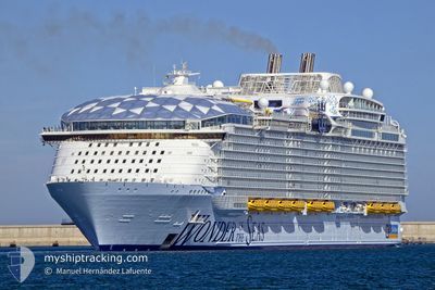
WONDER OF THE SEAS
Passenger
Current Trip
| Time Travelled | 21 h, 59 mins |
|---|---|
| Remaining Time | 1 day |
| Distance Travelled | 455.43 nm |
| Remaining Distance | 704.94 nm |
| AVG Speed | 20.2 Knopen |
| MAX Speed | 22.3 Knopen |
| AVG Wind | 9.1 knots |
| MAX Wind | 13 knots |
| MIN Temp | 24.1°C / 75.38°F |
| MAX Temp | 26.8°C / 80.24°F |
| Diepgang | 9.3 M |
| Positie ontvangen | 16 h, 31 m geleden |
Current Position
| Lengtegraad | -64.48364° |
|---|---|
| Breedtegraat | 19.16914° |
| Status | Under way using engine |
| Snelheid | 21.3 Knopen |
| Koers | 300.9° |
| Gebied | North Atlantic Ocean |
| Station | T-AIS |
| Positie ontvangen | 16 h, 31 m geleden |
Info
Information
The current position of WONDER OF THE SEAS is in North Atlantic Ocean with coordinates 19.16914° / -64.48364° as reported on 2024-04-19 04:05 by AIS to our vessel tracker app. The vessel's current speed is 21.3 Knopen and is heading at the port of CAPE CANAVERAL. The estimated time of arrival as calculated by MyShipTracking vessel tracking app is 2024-04-21 05:43 LT
The vessel WONDER OF THE SEAS (IMO: 9838345, MMSI: 311001033) is a Passenger It's sailing under the flag of [BS] Bahamas.
In this page you can find informations about the vessels current position, last detected port calls, and current voyage information. If the vessels is not in coverage by AIS you will find the latest position.
The current position of WONDER OF THE SEAS is detected by our AIS receivers and we are not responsible for the reliability of the data. The last position was recorded while the vessel was in Coverage by the Ais receivers of our vessel tracking app.
The current draught of WONDER OF THE SEAS as reported by AIS is 9.3 meters
Weather
| Temperature | 24.4°C / 75.92°F |
|---|---|
| Wind Speed | 12 knots |
| Direction | 34° NE |
| Pressure | 1015.1 hPa |
| Humidity | 67.2 % |
| Cloud Coverage | 3 % |
Featured Company
Last Port Calls
| Port | Arrival | Departure | Time In Port |
|---|---|---|---|
| 2024-04-18 11:19 | 2024-04-18 22:37 | 11 h | |
| 2024-04-14 09:03 | 2024-04-14 20:45 | 11 h | |
| 2024-04-12 11:25 | 2024-04-12 19:59 | 8 h | |
| 2024-04-11 12:30 | 2024-04-11 22:23 | 9 h | |
| 2024-04-10 11:26 | 2024-04-10 23:02 | 11 h | |
| 2024-04-07 09:00 | 2024-04-07 20:59 | 11 h | |
| 2024-04-04 11:16 | 2024-04-04 22:19 | 11 h | |
| 2024-03-31 09:10 | 2024-03-31 20:54 | 11 h | |
| 2024-03-29 11:26 | 2024-03-29 20:07 | 8 h | |
| 2024-03-28 12:29 | 2024-03-28 22:16 | 9 h |
Most Visited Ports (Last year)
| Port | Arrivals | |
|---|---|---|
| 52 | ||
| 31 | ||
| 21 | ||
| 19 | ||
| 19 | ||
| 2 |
Last Trips
| Origin | Departure | Destination | Arrival | Distance | |
|---|---|---|---|---|---|
| 2024-04-14 16:45 | 2024-04-18 07:19 | 1196.40 nm | |||
| 2024-04-12 14:59 | 2024-04-14 05:03 | 806.30 nm | |||
| 2024-04-11 16:23 | 2024-04-12 06:25 | 166.28 nm | |||
| 2024-04-10 18:02 | 2024-04-11 06:30 | 261.93 nm | |||
| 2024-04-07 16:59 | 2024-04-10 06:26 | 847.98 nm | |||
| 2024-04-04 18:19 | 2024-04-07 05:00 | 1171.10 nm | |||
| 2024-03-31 16:54 | 2024-04-04 07:16 | 1193.80 nm | |||
| 2024-03-29 15:07 | 2024-03-31 05:10 | 804.42 nm | |||
| 2024-03-28 16:16 | 2024-03-29 06:26 | 163.40 nm | |||
| 2024-03-27 17:53 | 2024-03-28 06:29 | 262.16 nm |
Events
| Tijd | Evenement | Details | Positie / Bestemming | Info |
|---|---|---|---|---|
| 2024-04-19 04:07 | Status Changed | Default Under way using engine |
19.17729 / -64.49803
US PCV
|
Snelheid: 21.3 kn Koers: 300.9° |
| 2024-04-19 04:05 | Status Changed | Under way using engine Default |
19.16914 / -64.48364
US PCV
|
Snelheid: 20.9 kn Koers: 302° |
| 2024-04-19 04:05 | Binnenbereik |
19.16914 / -64.48364
North Atlantic Ocean
US PCV
|
Snelheid: 21.3 kn Koers: 300.9° |
|
| 2024-04-19 04:05 | Buitenbereik |
19.16914 / -64.48364
North Atlantic Ocean
US PCV
|
Snelheid: 21.3 kn Koers: 300.9° |
|
| 2024-04-19 04:05 | Gevonden in zee | British Virgin Islands part of the North Atlantic Ocean |
19.16914 / -64.48364
North Atlantic Ocean
US PCV
|
Snelheid: 21.3 kn Koers: 300.9° |
| 2024-04-19 01:56 | Status Changed | Default Under way using engine |
18.72667 / -63.85667
US PCV
|
Snelheid: 20.3 kn Koers: 315.2° |
| 2024-04-19 01:50 | Status Changed | Under way using engine Default |
18.70522 / -63.83555
US PCV
|
Snelheid: 20 kn Koers: 318° |
| 2024-04-19 01:50 | Binnenbereik |
18.70522 / -63.83555
Caribbean Sea
US PCV
|
Snelheid: 20.3 kn Koers: 315.2° |
|
| 2024-04-19 01:50 | Buitenbereik |
18.70522 / -63.83555
Caribbean Sea
US PCV
|
Snelheid: 20.3 kn Koers: 315.2° |
|
| 2024-04-18 23:52 | Buitenbereik |
18.22173 / -63.35546
Caribbean Sea
US PCV
|
Snelheid: 20 kn Koers: 314.4° |