
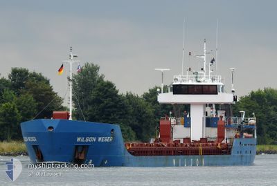
WILSON WESER
General Cargo
Current Trip
| Time Travelled | 10 days |
|---|---|
| Remaining Time | --- |
| Distance Travelled | 1508.75 nm |
| Remaining Distance | --- |
| AVG Speed | 9.5 Knopen |
| MAX Speed | 13.1 Knopen |
| AVG Wind | 18.7 knots |
| MAX Wind | 32.6 knots |
| MIN Temp | 4°C / 39.2°F |
| MAX Temp | 10.3°C / 50.54°F |
| Diepgang | 3 M |
| Positie ontvangen | 14 h, 44 m geleden |
Current Position
| Lengtegraad | -1.27111° |
|---|---|
| Breedtegraat | 57.21829° |
| Status | Under way using engine |
| Snelheid | 10.2 Knopen |
| Koers | 158.3° |
| Gebied | North Sea |
| Station | T-AIS |
| Positie ontvangen | 14 h, 44 m geleden |
Info
Information
The current position of WILSON WESER is in North Sea with coordinates 57.21829° / -1.27111° as reported on 2024-04-19 13:25 by AIS to our vessel tracker app. The vessel's current speed is 10.2 Knopen and is heading at the port of SLUISKIL. The estimated time of arrival as calculated by MyShipTracking vessel tracking app is 2024-04-21 08:00 LT
The vessel WILSON WESER (IMO: 9198446, MMSI: 314020000) is a General Cargo that was built in 2005 ( 19 Jaar oud ). It's sailing under the flag of [BB] Barbados.
In this page you can find informations about the vessels current position, last detected port calls, and current voyage information. If the vessels is not in coverage by AIS you will find the latest position.
The current position of WILSON WESER is detected by our AIS receivers and we are not responsible for the reliability of the data. The last position was recorded while the vessel was in Coverage by the Ais receivers of our vessel tracking app.
The current draught of WILSON WESER as reported by AIS is 3 meters
Weather
| Temperature | 6°C / 42.8°F |
|---|---|
| Wind Speed | 25 knots |
| Direction | 346° NNW |
| Pressure | 1024.9 hPa |
| Humidity | 65.6 % |
| Cloud Coverage | 80 % |
Featured Company
Last Port Calls
| Port | Arrival | Departure | Time In Port |
|---|---|---|---|
| 2024-04-05 15:13 | 2024-04-09 06:12 | 3 d | |
| 2024-03-26 07:09 | 2024-03-27 12:15 | 1 d | |
| 2024-03-25 05:07 | 2024-03-25 11:53 | 6 h | |
| 2024-03-21 01:56 | 2024-03-21 19:10 | 17 h | |
| 2024-03-18 06:51 | 2024-03-20 00:19 | 1 d | |
| 2024-03-15 12:08 | 2024-03-16 15:03 | 1 d | |
| 2024-03-13 12:55 | 2024-03-14 11:51 | 22 h | |
| 2024-03-08 17:20 | 2024-03-12 18:56 | 4 d | |
| 2024-03-08 16:57 | 2024-03-08 17:01 | 4 m | |
| 2024-02-24 10:01 | 2024-02-29 17:25 | 5 d |
Last Trips
| Origin | Departure | Destination | Arrival | Distance | |
|---|---|---|---|---|---|
| 2024-03-27 13:15 | 2024-04-05 16:13 | 979.06 nm | |||
| 2024-03-25 12:53 | 2024-03-26 08:09 | 214.32 nm | |||
| 2024-03-21 20:10 | 2024-03-25 06:07 | 522.57 nm | |||
| 2024-03-20 00:19 | 2024-03-21 02:56 | 283.23 nm | |||
| 2024-03-16 16:03 | 2024-03-18 06:51 | 274.55 nm | |||
| 2024-03-14 11:51 | 2024-03-15 13:08 | 265.55 nm | |||
| 2024-03-12 18:56 | 2024-03-13 12:55 | 169.77 nm | |||
| 2024-03-08 17:01 | 2024-03-08 17:20 | 0.93 nm | |||
| 2024-02-29 18:25 | 2024-03-08 16:57 | 401.41 nm | |||
| 2024-02-19 15:31 | 2024-02-24 11:01 | 992.33 nm |
Events
| Tijd | Evenement | Details | Positie / Bestemming | Info |
|---|---|---|---|---|
| 2024-04-19 13:53 | Status Changed | Default Under way using engine |
57.14667 / -1.22167
SLUISKIL
|
Snelheid: 10.2 kn Koers: 158.3° |
| 2024-04-19 13:25 | Buitenbereik |
57.21829 / -1.27112
North Sea
SLUISKIL
|
Snelheid: 10.2 kn Koers: 158.3° |
|
| 2024-04-19 08:46 | Status Changed | Under way using engine Default |
57.94815 / -1.96657
SLUISKIL
|
Snelheid: 10.2 kn Koers: 140° |
| 2024-04-19 08:46 | Binnenbereik |
57.94815 / -1.96657
North Sea
SLUISKIL
|
Snelheid: 9.3 kn Koers: 139.2° |
|
| 2024-04-19 04:55 | Status Changed | Default Under way using engine |
58.49549 / -2.73106
SLUISKIL
|
Snelheid: 9.7 kn Koers: 145.4° |
| 2024-04-19 04:25 | Buitenbereik |
58.56192 / -2.81685
North Sea
SLUISKIL
|
Snelheid: 9.7 kn Koers: 145.4° |
|
| 2024-04-19 01:47 | Gevonden in zee | United Kingdom part of the North Sea |
58.70343 / -3.39823
North Sea
SLUISKIL
|
Snelheid: 7.2 kn Koers: 87.3° |
| 2024-04-18 23:38 | Status Changed | Under way using engine Default |
58.68623 / -3.90912
SLUISKIL
|
Snelheid: 7.2 kn Koers: 88° |
| 2024-04-18 23:38 | Binnenbereik |
58.68623 / -3.90912
North Atlantic Ocean
SLUISKIL
|
Snelheid: 6.7 kn Koers: 92.1° |
|
| 2024-04-18 22:31 | Buitenbereik |
58.68383 / -4.16577
North Atlantic Ocean
SLUISKIL
|
Snelheid: 7.7 kn Koers: 92.4° |