
WIDE INDIA
Cargo
Current Trip
| Time Travelled | 17 days |
|---|---|
| Remaining Time | 2 h, 28 mins |
| Distance Travelled | 6160.74 nm |
| Remaining Distance | 45.12 nm |
| AVG Speed | 14.6 Knopen |
| MAX Speed | 17.7 Knopen |
| AVG Wind | 10.4 knots |
| MAX Wind | 23 knots |
| MIN Temp | 7.8°C / 46.04°F |
| MAX Temp | 29.9°C / 85.82°F |
| Diepgang | 11 M |
| Positie ontvangen | Nu |
Current Position
| Lengtegraad | -122.86065° |
|---|---|
| Breedtegraat | 48.18424° |
| Status | Under way using engine |
| Snelheid | 17.8 Knopen |
| Koers | 97.7° |
| Gebied | The Coastal Waters of Southeast Alaska and British Columbia |
| Station | T-AIS |
| Positie ontvangen | Nu |
Info
Information
The current position of WIDE INDIA is in The Coastal Waters of Southeast Alaska and British Columbia with coordinates 48.18424° / -122.86065° as reported on 2024-04-25 10:16 by AIS to our vessel tracker app. The vessel's current speed is 17.8 Knopen and is heading at the port of SEATTLE. The estimated time of arrival as calculated by MyShipTracking vessel tracking app is 2024-04-25 12:45 LT
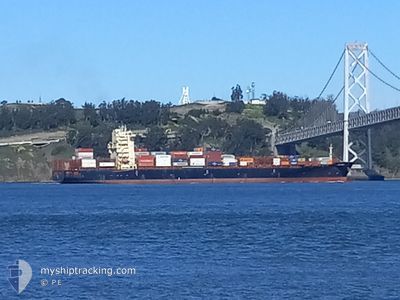
The vessel WIDE INDIA (IMO: 9698252, MMSI: 538005751) is a Cargo It's sailing under the flag of [MH] Marshall Is.
In this page you can find informations about the vessels current position, last detected port calls, and current voyage information. If the vessels is not in coverage by AIS you will find the latest position.
The current position of WIDE INDIA is detected by our AIS receivers and we are not responsible for the reliability of the data. The last position was recorded while the vessel was in Coverage by the Ais receivers of our vessel tracking app.
The current draught of WIDE INDIA as reported by AIS is 11 meters
Weather
| Temperature | 9°C / 48.2°F |
|---|---|
| Wind Speed | 10 knots |
| Direction | 130° SE |
| Pressure | 1012.7 hPa |
| Humidity | 92.3 % |
| Cloud Coverage | 99 % |
Featured Company
Last Port Calls
| Port | Arrival | Departure | Time In Port |
|---|---|---|---|
| 2024-04-06 23:30 | 2024-04-08 00:41 | 1 d | |
| 2024-03-30 03:05 | 2024-04-01 02:01 | 1 d | |
| 2024-03-26 14:55 | 2024-03-27 18:16 | 1 d | |
| 2024-03-21 07:14 | 2024-03-23 03:11 | 1 d | |
| 2024-03-14 13:58 | 2024-03-15 10:09 | 20 h | |
| 2024-02-27 23:30 | 2024-02-28 12:56 | 13 h | |
| 2024-02-15 12:20 | 2024-02-19 12:59 | 4 d | |
| 2024-02-09 17:58 | 2024-02-10 17:49 | 23 h |
Last Trips
| Origin | Departure | Destination | Arrival | Distance | |
|---|---|---|---|---|---|
| 2024-04-01 12:31 | 2024-04-07 11:30 | 2140.35 nm | |||
| 2024-03-28 05:16 | 2024-03-30 13:35 | 520.10 nm | |||
| 2024-03-23 14:11 | 2024-03-27 01:55 | 798.50 nm | |||
| 2024-03-15 23:09 | 2024-03-21 18:14 | 1496.21 nm | |||
| 2024-02-28 04:56 | 2024-03-15 02:58 | 5706.27 nm | |||
| 2024-02-19 04:59 | 2024-02-27 15:30 | 820.54 nm | |||
| 2024-02-10 09:49 | 2024-02-15 04:20 | 1236.87 nm | |||
| 2024-01-18 19:05 | 2024-02-09 09:58 | 6590.83 nm |
Events
| Tijd | Evenement | Details | Positie / Bestemming | Info |
|---|---|---|---|---|
| 2024-04-25 04:05 | Wijzig zee gebeid | United States part of the The Coastal Waters of Southeast Alaska and British Columbia United States part of the North Pacific Ocean |
48.46346 / -124.70287
The Coastal Waters of Southeast Alaska and British Columbia
NZTRG=>USSEA
|
Snelheid: 11.3 kn Koers: 114.2° |
| 2024-04-25 04:00 | Status Changed | Under way using engine Default |
48.46888 / -124.72170
NZTRG=>USSEA
|
Snelheid: 11.4 kn Koers: 98° |
| 2024-04-25 03:58 | Status Changed | Default Under way using engine |
48.47036 / -124.73139
NZTRG=>USSEA
|
Snelheid: 11.5 kn Koers: 89.6° |
| 2024-04-25 03:39 | Status Changed | Under way using engine Default |
48.47130 / -124.82206
NZTRG=>USSEA
|
Snelheid: 11.6 kn Koers: 90° |
| 2024-04-25 03:34 | Status Changed | Default Under way using engine |
48.47142 / -124.84646
NZTRG=>USSEA
|
Snelheid: 11.4 kn Koers: 90.4° |
| 2024-04-25 03:27 | Status Changed | Under way using engine Default |
48.47161 / -124.87882
NZTRG=>USSEA
|
Snelheid: 11.5 kn Koers: 91° |
| 2024-04-25 03:16 | Status Changed | Default Under way using engine |
48.47114 / -124.93540
NZTRG=>USSEA
|
Snelheid: 11.6 kn Koers: 93.6° |
| 2024-04-25 03:13 | Status Changed | Under way using engine Default |
48.47084 / -124.95083
NZTRG=>USSEA
|
Snelheid: 11.4 kn Koers: 87° |
| 2024-04-25 02:58 | Status Changed | Default Under way using engine |
48.46861 / -125.01937
NZTRG=>USSEA
|
Snelheid: 11.3 kn Koers: 87.9° |
| 2024-04-25 02:46 | Wijzig zee gebeid | United States part of the North Pacific Ocean Canadian part of the North Pacific Ocean |
48.46696 / -125.07574
North Pacific Ocean
NZTRG=>USSEA
|
Snelheid: 12 kn Koers: 86.6° |