
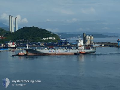
WAN HAI 288
Cargo
Current Trip
| Time Travelled | 20 h, 34 mins |
|---|---|
| Remaining Time | 1 day |
| Distance Travelled | 307.62 nm |
| Remaining Distance | 406.59 nm |
| AVG Speed | 14 Knopen |
| MAX Speed | 16.4 Knopen |
| AVG Wind | 9.4 knots |
| MAX Wind | 17.7 knots |
| MIN Temp | 15.4°C / 59.72°F |
| MAX Temp | 19°C / 66.2°F |
| Diepgang | 10 M |
| Positie ontvangen | 9 h, 39 m geleden |
Current Position
| Lengtegraad | 127.42104° |
|---|---|
| Breedtegraat | 32.70870° |
| Status | Under way using engine |
| Snelheid | 16.2 Knopen |
| Koers | 212.6° |
| Gebied | Eastern China Sea |
| Station | T-AIS |
| Positie ontvangen | 9 h, 39 m geleden |
Info
Information
The current position of WAN HAI 288 is in Eastern China Sea with coordinates 32.70870° / 127.42104° as reported on 2024-04-19 10:09 by AIS to our vessel tracker app. The vessel's current speed is 16.2 Knopen and is heading at the port of KEELUNG. The estimated time of arrival as calculated by MyShipTracking vessel tracking app is 2024-04-20 20:07 LT
The vessel WAN HAI 288 (IMO: 9871359, MMSI: 563134400) is a Cargo It's sailing under the flag of [SG] Singapore.
In this page you can find informations about the vessels current position, last detected port calls, and current voyage information. If the vessels is not in coverage by AIS you will find the latest position.
The current position of WAN HAI 288 is detected by our AIS receivers and we are not responsible for the reliability of the data. The last position was recorded while the vessel was in Coverage by the Ais receivers of our vessel tracking app.
The current draught of WAN HAI 288 as reported by AIS is 10 meters
Weather
| Temperature | 16.7°C / 62.06°F |
|---|---|
| Wind Speed | 17 knots |
| Direction | 147° SSE |
| Pressure | 1007.9 hPa |
| Humidity | 93.8 % |
| Cloud Coverage | 100 % |
Featured Company
Last Port Calls
| Port | Arrival | Departure | Time In Port |
|---|---|---|---|
| 2024-04-18 12:06 | 2024-04-18 23:15 | 11 h | |
| 2024-04-17 11:11 | 2024-04-18 08:08 | 20 h | |
| 2024-04-15 08:13 | 2024-04-15 21:22 | 13 h | |
| 2024-04-14 22:31 | 2024-04-15 07:03 | 8 h | |
| 2024-04-12 20:55 | 2024-04-13 06:31 | 9 h | |
| 2024-04-10 17:46 | 2024-04-11 02:32 | 8 h | |
| 2024-04-10 01:29 | 2024-04-10 12:17 | 10 h | |
| 2024-04-09 01:09 | 2024-04-09 16:49 | 15 h | |
| 2024-04-03 05:31 | 2024-04-03 20:32 | 15 h | |
| 2024-03-27 02:44 | 2024-03-27 15:10 | 12 h |
Last Trips
| Origin | Departure | Destination | Arrival | Distance | |
|---|---|---|---|---|---|
| 2024-04-18 17:08 | 2024-04-18 21:06 | 28.88 nm | |||
| 2024-04-16 06:22 | 2024-04-17 20:11 | 466.14 nm | |||
| 2024-04-15 16:03 | 2024-04-15 17:13 | 8.61 nm | |||
| 2024-04-13 15:31 | 2024-04-15 07:31 | 399.64 nm | |||
| 2024-04-11 10:32 | 2024-04-13 05:55 | 718.36 nm | |||
| 2024-04-10 20:17 | 2024-04-11 01:46 | 83.30 nm | |||
| 2024-04-10 00:49 | 2024-04-10 09:29 | 123.88 nm | |||
| 2024-04-04 03:32 | 2024-04-09 09:09 | 1577.16 nm | |||
| 2024-03-27 23:10 | 2024-04-03 12:31 | 1781.51 nm | |||
| 2024-03-24 22:56 | 2024-03-27 10:44 | 7.85 nm |
Events
| Tijd | Evenement | Details | Positie / Bestemming | Info |
|---|---|---|---|---|
| 2024-04-19 10:09 | Buitenbereik |
32.70870 / 127.42104
Eastern China Sea
TW KEL
|
Snelheid: 16.2 kn Koers: 212.6° |
|
| 2024-04-19 09:52 | Wijzig zee gebeid | Joint Japan - Korea part of the Eastern China Sea South Korean part of the Eastern China Sea |
32.77466 / 127.47052
Eastern China Sea
TW KEL
|
Snelheid: 16.3 kn Koers: 212° |
| 2024-04-19 09:04 | Gevonden in zee | South Korean part of the Eastern China Sea |
32.95733 / 127.61209
Eastern China Sea
TW KEL
|
Snelheid: 16 kn Koers: 215.1° |
| 2024-04-19 09:04 | Binnenbereik |
32.95733 / 127.61209
Eastern China Sea
TW KEL
|
Snelheid: 16 kn Koers: 215.1° |
|
| 2024-04-19 07:17 | Buitenbereik |
33.35475 / 127.93652
Japan Sea
TW KEL
|
Snelheid: 16.3 kn Koers: 213.9° |
|
| 2024-04-19 07:17 | Binnenbereik |
33.35475 / 127.93652
Japan Sea
TW KEL
|
Snelheid: 16.3 kn Koers: 213.9° |
|
| 2024-04-19 05:35 | Buitenbereik |
33.73320 / 128.24237
Japan Sea
TW KEL
|
Snelheid: 15.8 kn Koers: 214.5° |
|
| 2024-04-19 03:18 | Binnenbereik |
34.23746 / 128.64013
Japan Sea
TW KEL
|
Snelheid: 16 kn Koers: 211.1° |
|
| 2024-04-19 02:14 | Buitenbereik |
34.46467 / 128.83336
Japan Sea
TW KEL
|
Snelheid: 15.6 kn Koers: 214.7° |
|
| 2024-04-18 23:35 | ETA Changed | 2024/04/21 07:00 2024/04/21 06:00 |
35.05250 / 129.12550
TW KEL
|
Snelheid: 9 kn Koers: 148.8° |