
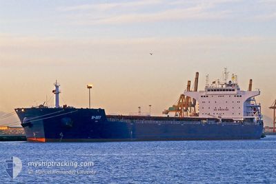
W-SKY
Bulk Carrier
Current Trip
BRISA
| Time Travelled | 8 days |
|---|---|
| Remaining Time | --- |
| Distance Travelled | 2344.72 nm |
| Remaining Distance | --- |
| AVG Speed | 10.6 Knopen |
| MAX Speed | 17.5 Knopen |
| AVG Wind | 14.1 knots |
| MAX Wind | 28.9 knots |
| MIN Temp | 7.4°C / 45.32°F |
| MAX Temp | 17.1°C / 62.78°F |
| Diepgang | 7.4 M |
| Positie ontvangen | 5 d geleden |
Current Position
| Lengtegraad | -5.24341° |
|---|---|
| Breedtegraat | 49.82948° |
| Status | Under way using engine |
| Snelheid | 11.3 Knopen |
| Koers | 235.8° |
| Gebied | English Channel |
| Station | T-AIS |
| Positie ontvangen | 5 d geleden |
Info
Information
The current position of W-SKY is in English Channel with coordinates 49.82948° / -5.24341° as reported on 2024-04-14 20:05 by AIS to our vessel tracker app. The vessel's current speed is 11.3 Knopen
The vessel W-SKY (IMO: 9476666, MMSI: 636014568) is a Bulk Carrier that was built in 2011 ( 13 Jaar oud ). It's sailing under the flag of [LR] Liberia.
In this page you can find informations about the vessels current position, last detected port calls, and current voyage information. If the vessels is not in coverage by AIS you will find the latest position.
The current position of W-SKY is detected by our AIS receivers and we are not responsible for the reliability of the data. The last position was recorded while the vessel was in Coverage by the Ais receivers of our vessel tracking app.
The current draught of W-SKY as reported by AIS is 7.4 meters
Weather
| Temperature | 16.5°C / 61.7°F |
|---|---|
| Wind Speed | 18 knots |
| Direction | 287° WNW |
| Pressure | 1015.5 hPa |
| Humidity | 72.8 % |
| Cloud Coverage | 15 % |
Featured Company
Most Visited Ports (Last year)
| Port | Arrivals | |
|---|---|---|
| 5 | ||
| 4 | ||
| 4 | ||
| 3 | ||
| 2 | ||
| 1 |
Events
| Tijd | Evenement | Details | Positie / Bestemming | Info |
|---|---|---|---|---|
| 2024-04-14 20:12 | Status Changed | Default Under way using engine |
49.81714 / -5.27093
BRISA
|
Snelheid: 11.3 kn Koers: 235.8° |
| 2024-04-14 20:05 | Status Changed | Under way using engine Default |
49.82948 / -5.24341
BRISA
|
Snelheid: 11.3 kn Koers: 236° |
| 2024-04-14 20:05 | Buitenbereik |
49.82948 / -5.24341
English Channel
BRISA
|
Snelheid: 11.3 kn Koers: 235.8° |
|
| 2024-04-14 20:04 | Status Changed | Default Under way using engine |
49.83129 / -5.23936
BRISA
|
Snelheid: 11.5 kn Koers: 235.8° |
| 2024-04-14 19:58 | Status Changed | Under way using engine Default |
49.84253 / -5.21427
BRISA
|
Snelheid: 11.3 kn Koers: 236° |
| 2024-04-14 19:52 | Status Changed | Default Under way using engine |
49.85296 / -5.19081
BRISA
|
Snelheid: 11.6 kn Koers: 233.6° |
| 2024-04-14 19:30 | Status Changed | Under way using engine Default |
49.89471 / -5.10109
BRISA
|
Snelheid: 11.8 kn Koers: 234° |
| 2024-04-14 19:28 | Status Changed | Default Under way using engine |
49.89885 / -5.09206
BRISA
|
Snelheid: 12.4 kn Koers: 223.2° |
| 2024-04-14 18:23 | Destination Changed | BRISA FALMOUTH |
50.07879 / -4.85465
BRISA
|
Snelheid: 12.4 kn Koers: 212.2° |
| 2024-04-14 18:23 | ETA Changed | 2024/04/28 15:00 2024/04/28 03:30 |
50.07879 / -4.85465
BRISA
|
Snelheid: 12.4 kn Koers: 212.2° |