
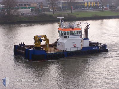
VOE VIKING
Tug
Current Trip
| Trip Time | 4 mins |
|---|---|
| Trip Distance | 0.21 nm |
| AVG Speed | --- |
| MAX Speed | --- |
| Diepgang | 2.5 M |
| AVG Wind | 14.7 knots |
| MAX Wind | 14.7 knots |
| MIN Temp | 9.7°C / 49.46°F |
| MAX Temp | 9.7°C / 49.46°F |
| Positie ontvangen | Nu |
Current Position
| Lengtegraad | 4.42457° |
|---|---|
| Breedtegraat | 51.89942° |
| Status | Under way using engine |
| Snelheid | |
| Koers | --- |
| Gebied | North Sea |
| Station | T-AIS |
| Positie ontvangen | Nu |
Info
Information
The current position of VOE VIKING is in North Sea with coordinates 51.89942° / 4.42457° as reported on 2024-04-24 20:15 by AIS to our vessel tracker app. The vessel's current speed is 0 Knopen and is currently inside the port of ROTTERDAM WAALHAVEN.
The vessel VOE VIKING (IMO: 933113900, MMSI: 235008930) is a Tug It's sailing under the flag of [GB] United Kingdom.
In this page you can find informations about the vessels current position, last detected port calls, and current voyage information. If the vessels is not in coverage by AIS you will find the latest position.
The current position of VOE VIKING is detected by our AIS receivers and we are not responsible for the reliability of the data. The last position was recorded while the vessel was in Coverage by the Ais receivers of our vessel tracking app.
The current draught of VOE VIKING as reported by AIS is 2.5 meters
Weather
| Temperature | 6.1°C / 42.98°F |
|---|---|
| Wind Speed | 7 knots |
| Direction | 331° NNW |
| Pressure | 1009.8 hPa |
| Humidity | 67 % |
| Cloud Coverage | 8 % |
Featured Company
Last Port Calls
| Port | Arrival | Departure | Time In Port |
|---|---|---|---|
| 2024-04-24 14:26 | |||
| 2024-04-24 01:58 | 2024-04-24 14:22 | 12 h | |
| 2024-03-31 13:08 | 2024-04-23 12:26 | 22 d | |
| 2024-03-26 06:44 | 2024-03-30 21:12 | 4 d | |
| 2024-03-25 14:48 |
Most Visited Ports (Last year)
| Port | Arrivals | |
|---|---|---|
| 42 | ||
| 12 | ||
| 12 | ||
| 6 | ||
| 6 | ||
| 5 |
Last Trips
| Origin | Departure | Destination | Arrival | Distance | |
|---|---|---|---|---|---|
| 2024-04-24 16:22 | 2024-04-24 16:26 | 0.21 nm | |||
| 2024-04-23 14:26 | 2024-04-24 03:58 | 113.31 nm | |||
| 2024-03-30 22:12 | 2024-03-31 15:08 | 98.92 nm | |||
| 2024-03-25 15:48 | 2024-03-26 07:44 | 128.89 nm |
Events
| Tijd | Evenement | Details | Positie / Bestemming | Info |
|---|---|---|---|---|
| 2024-04-24 14:26 | Stop beweging |
51.89958 / 4.42431
[NL] ROTTERDAM WAALHAVEN
|
Snelheid: 0.2 kn Koers: 511° |
|
| 2024-04-24 14:26 | Aankomsthaven |
|
51.89958 / 4.42431
[NL] ROTTERDAM WAALHAVEN
|
Snelheid: 0.6 kn Koers: 511° |
| 2024-04-24 14:22 | Vertrekhaven |
|
51.90204 / 4.42486
NLRTM
|
Snelheid: 6.8 kn Koers: 239.5° |
| 2024-04-24 14:19 | Start beweging |
51.90427 / 4.42804
[NL] DELFSHAVEN
|
Snelheid: 3.6 kn Koers: 205.7° |
|
| 2024-04-24 01:58 | Stop beweging |
51.90538 / 4.43135
[NL] DELFSHAVEN
|
Snelheid: 0.2 kn Koers: 511° |
|
| 2024-04-24 01:58 | Aankomsthaven |
|
51.90538 / 4.43135
[NL] DELFSHAVEN
|
Snelheid: 1.1 kn Koers: 511° |
| 2024-04-23 21:00 | Status Changed | Under way using engine Default |
52.31044 / 3.79876
NLRTM
|
Snelheid: 9.3 kn Koers: 191° |
| 2024-04-23 20:53 | Status Changed | Default Under way using engine |
52.32871 / 3.80548
NLRTM
|
Snelheid: 9.4 kn Koers: 192.1° |
| 2024-04-23 20:39 | Status Changed | Under way using engine Default |
52.36585 / 3.81768
NLRTM
|
Snelheid: 9.7 kn Koers: 189° |
| 2024-04-23 20:30 | Status Changed | Default Under way using engine |
52.38833 / 3.82500
NLRTM
|
Snelheid: 10.1 kn Koers: 192.7° |