
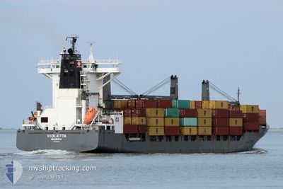
VIOLETTA
Container Ship
Current Trip
| Time Travelled | 3 days |
|---|---|
| Remaining Time | --- |
| Distance Travelled | 1344.30 nm |
| Remaining Distance | 53.87 nm |
| AVG Speed | 15.4 Knopen |
| MAX Speed | 15.4 Knopen |
| AVG Wind | 12.7 knots |
| MAX Wind | 27.1 knots |
| MIN Temp | 0.9°C / 33.62°F |
| MAX Temp | 9.5°C / 49.1°F |
| Diepgang | 10.8 M |
| Positie ontvangen | Nu |
Current Position
| Lengtegraad | 3.08211° |
|---|---|
| Breedtegraat | 51.40127° |
| Status | Constrained by her draught |
| Snelheid | 14.7 Knopen |
| Koers | 106.2° |
| Gebied | North Sea |
| Station | T-AIS |
| Positie ontvangen | Nu |
Info
Information
The current position of VIOLETTA is in North Sea with coordinates 51.40127° / 3.08211° as reported on 2024-04-19 14:22 by AIS to our vessel tracker app. The vessel's current speed is 14.7 Knopen and is heading at the port of ANTWERP. The estimated time of arrival as calculated by MyShipTracking vessel tracking app is 2024-04-19 12:30 LT
The vessel VIOLETTA (IMO: 9344710, MMSI: 255806258) is a Container Ship that was built in 2007 ( 17 Jaar oud ). It's sailing under the flag of [PT] Portugal.
In this page you can find informations about the vessels current position, last detected port calls, and current voyage information. If the vessels is not in coverage by AIS you will find the latest position.
The current position of VIOLETTA is detected by our AIS receivers and we are not responsible for the reliability of the data. The last position was recorded while the vessel was in Coverage by the Ais receivers of our vessel tracking app.
The current draught of VIOLETTA as reported by AIS is 10.8 meters
Weather
| Temperature | 8.8°C / 47.84°F |
|---|---|
| Wind Speed | 27 knots |
| Direction | 338° NNW |
| Pressure | 1014 hPa |
| Humidity | 74 % |
| Cloud Coverage | 93 % |
Featured Company
Last Port Calls
| Port | Arrival | Departure | Time In Port |
|---|---|---|---|
| 2024-04-14 14:13 | 2024-04-16 02:43 | 1 d | |
| 2024-04-12 01:55 | 2024-04-13 09:13 | 1 d | |
| 2024-04-02 10:05 | 2024-04-08 06:40 | 5 d | |
| 2024-03-26 15:46 | 2024-03-27 15:09 | 23 h | |
| 2024-03-25 10:25 | 2024-03-25 17:37 | 7 h | |
| 2024-03-21 18:49 | 2024-03-22 17:48 | 22 h | |
| 2024-03-14 02:42 | 2024-03-14 07:29 | 4 h | |
| 2024-03-10 11:51 | 2024-03-11 17:54 | 1 d | |
| 2024-03-07 06:31 | 2024-03-08 08:31 | 1 d | |
| 2024-03-04 18:44 | 2024-03-05 01:27 | 6 h |
Last Trips
| Origin | Departure | Destination | Arrival | Distance | |
|---|---|---|---|---|---|
| 2024-04-13 12:13 | 2024-04-14 17:13 | 322.22 nm | |||
| 2024-04-08 08:40 | 2024-04-12 04:55 | 1389.14 nm | |||
| 2024-03-27 16:09 | 2024-04-02 12:05 | 1104.12 nm | |||
| 2024-03-25 19:37 | 2024-03-26 16:46 | 122.04 nm | |||
| 2024-03-22 19:48 | 2024-03-25 12:25 | 372.70 nm | |||
| 2024-03-14 08:29 | 2024-03-21 20:49 | 972.11 nm | |||
| 2024-03-11 18:54 | 2024-03-14 03:42 | 654.98 nm | |||
| 2024-03-08 09:31 | 2024-03-10 12:51 | 590.88 nm | |||
| 2024-03-05 03:27 | 2024-03-07 07:31 | 582.27 nm | |||
| 2024-03-03 20:16 | 2024-03-04 20:44 | 362.27 nm |
Events
| Tijd | Evenement | Details | Positie / Bestemming | Info |
|---|---|---|---|---|
| 2024-04-19 13:38 | Wijzig zee gebeid | Belgian part of the North Sea Dutch part of the North Sea |
51.53128 / 3.10168
North Sea
BEANR
|
Snelheid: 18.5 kn Koers: 220.3° |
| 2024-04-19 12:40 | Status Changed | Constrained by her draught Under way using engine |
51.72109 / 3.26217
BEANR
|
Snelheid: 5.2 kn Koers: 175.4° |
| 2024-04-19 10:40 | ETA Changed | 2024/04/19 12:30 2024/04/19 13:00 |
52.14737 / 3.37623
BEANR
|
Snelheid: 12.8 kn Koers: 193° |
| 2024-04-19 09:18 | Binnenbereik |
52.42704 / 3.47041
North Sea
BEANR
|
Snelheid: 13.4 kn Koers: 187.6° |
|
| 2024-04-19 05:18 | Buitenbereik |
53.09801 / 4.27034
North Sea
BEANR
|
Snelheid: 15.7 kn Koers: 230.3° |
|
| 2024-04-19 03:27 | Gevonden in zee | Dutch part of the North Sea |
53.54872 / 4.61538
North Sea
BEANR
|
Snelheid: 15.7 kn Koers: 199.1° |
| 2024-04-19 03:27 | Binnenbereik |
53.54872 / 4.61538
North Sea
BEANR
|
Snelheid: 15.7 kn Koers: 199.1° |
|
| 2024-04-18 18:04 | Buitenbereik |
55.77029 / 6.63796
North Sea
BEANR
|
Snelheid: 16.6 kn Koers: 212.1° |
|
| 2024-04-18 11:41 | Wijzig zee gebeid | Danish part of the North Sea Danish part of the Skaggerak |
57.29515 / 8.26492
North Sea
BEANR
|
Snelheid: 17 kn Koers: 193.6° |
| 2024-04-18 05:50 | Wijzig zee gebeid | Danish part of the Skaggerak Danish part of the Kattegat |
57.80423 / 10.93928
Skaggerak
BEANR
|
Snelheid: 16.5 kn Koers: 320.1° |