
US GOV VESSEL
Not available
Current Trip
| Trip Time | 1 day |
|---|---|
| Trip Distance | 40.88 nm |
| AVG Speed | 14.3 Knopen |
| MAX Speed | 18.9 Knopen |
| Diepgang | 0 M |
| AVG Wind | 11.7 knots |
| MAX Wind | 18.8 knots |
| MIN Temp | 11°C / 51.8°F |
| MAX Temp | 14.5°C / 58.1°F |
| Positie ontvangen | 20 h, 14 m geleden |
Current Position
| Lengtegraad | -76.32969° |
|---|---|
| Breedtegraat | 36.94594° |
| Status | Under way using engine |
| Snelheid | |
| Koers | --- |
| Gebied | North Atlantic Ocean |
| Station | T-AIS |
| Positie ontvangen | 20 h, 14 m geleden |
Info
Information
The current position of US GOV VESSEL is in North Atlantic Ocean with coordinates 36.94594° / -76.32969° as reported on 2024-04-24 14:00 by AIS to our vessel tracker app. The vessel's current speed is 0 Knopen and is currently inside the port of NORFOLK.
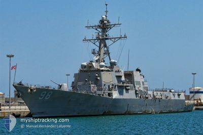
The vessel US GOV VESSEL (MMSI: 369980000) is a Not available It's sailing under the flag of [US] USA.
In this page you can find informations about the vessels current position, last detected port calls, and current voyage information. If the vessels is not in coverage by AIS you will find the latest position.
The current position of US GOV VESSEL is detected by our AIS receivers and we are not responsible for the reliability of the data. The last position was recorded while the vessel was in Coverage by the Ais receivers of our vessel tracking app.
Weather
| Temperature | 15.4°C / 59.72°F |
|---|---|
| Wind Speed | 13 knots |
| Direction | 244° WSW |
| Pressure | 1016.1 hPa |
| Humidity | 65.3 % |
| Cloud Coverage | 100 % |
Featured Company
Most Visited Ports (Last year)
| Port | Arrivals | |
|---|---|---|
| 9 |
Events
| Tijd | Evenement | Details | Positie / Bestemming | Info |
|---|---|---|---|---|
| 2024-04-24 14:00 | Buitenbereik |
36.94594 / -76.32969
North Atlantic Ocean
[US] NORFOLK
|
Snelheid: Koers: 511° |
|
| 2024-04-24 13:52 | Stop beweging |
36.94574 / -76.32979
[US] NORFOLK
|
Snelheid: 0.3 kn Koers: 511° |
|
| 2024-04-24 12:54 | Aankomsthaven |
|
37.00549 / -76.27014
[US] NORFOLK
|
Snelheid: 10.2 kn Koers: 256° |
| 2024-04-24 11:25 | Binnenbereik |
36.88773 / -75.87692
North Atlantic Ocean
|
Snelheid: 18.4 kn Koers: 313.5° |
|
| 2024-04-23 13:31 | Buitenbereik |
36.90168 / -75.91892
North Atlantic Ocean
|
Snelheid: 17.2 kn Koers: 137.6° |
|
| 2024-04-23 12:18 | Vertrekhaven |
|
37.00561 / -76.26730
|
Snelheid: 9.7 kn Koers: 75.2° |
| 2024-04-23 11:37 | Start beweging |
36.94507 / -76.33191
[US] NORFOLK
|
Snelheid: 3.1 kn Koers: 261.2° |
|
| 2024-04-23 10:52 | Binnenbereik |
36.94589 / -76.32966
North Atlantic Ocean
[US] NORFOLK
|
Snelheid: Koers: 511° |
|
| 2024-04-19 18:32 | Buitenbereik |
36.94588 / -76.32972
North Atlantic Ocean
[US] NORFOLK
|
Snelheid: 0.3 kn Koers: 511° |
|
| 2024-04-19 18:30 | Stop beweging |
36.94581 / -76.32978
[US] NORFOLK
|
Snelheid: 0.1 kn Koers: 511° |