
US GOVERMENT VESSEL
Cargo
Current Trip
| Trip Time | --- |
|---|---|
| Trip Distance | --- |
| AVG Speed | --- |
| MAX Speed | --- |
| Diepgang | --- |
| AVG Wind | --- |
| MAX Wind | --- |
| MIN Temp | --- |
| MAX Temp | --- |
| Positie ontvangen | 3 h, 52 m geleden |
Current Position
| Lengtegraad | 24.10045° |
|---|---|
| Breedtegraat | 35.49906° |
| Status | Under way using engine |
| Snelheid | 0.4 Knopen |
| Koers | 246° |
| Gebied | Aegean Sea |
| Station | T-AIS |
| Positie ontvangen | 3 h, 52 m geleden |
Info
Information
The current position of US GOVERMENT VESSEL is in Aegean Sea with coordinates 35.49906° / 24.10045° as reported on 2024-04-25 06:10 by AIS to our vessel tracker app. The vessel's current speed is 0.4 Knopen and is currently inside the port of SOUDA.
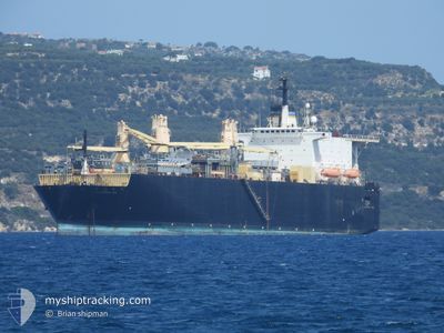
The vessel US GOVERMENT VESSEL (IMO: 8302442, MMSI: 367348000) is a Cargo It's sailing under the flag of [US] USA.
In this page you can find informations about the vessels current position, last detected port calls, and current voyage information. If the vessels is not in coverage by AIS you will find the latest position.
The current position of US GOVERMENT VESSEL is detected by our AIS receivers and we are not responsible for the reliability of the data. The last position was recorded while the vessel was in Coverage by the Ais receivers of our vessel tracking app.
The current draught of US GOVERMENT VESSEL as reported by AIS is 9.8 meters
Weather
| Temperature | 20.2°C / 68.36°F |
|---|---|
| Wind Speed | 16 knots |
| Direction | 284° WNW |
| Pressure | 1008.4 hPa |
| Humidity | 48.9 % |
| Cloud Coverage | 34 % |
Featured Company
Most Visited Ports (Last year)
| Port | Arrivals | |
|---|---|---|
| 1 |
Last Trips
| Origin | Departure | Destination | Arrival | Distance |
|---|
Events
| Tijd | Evenement | Details | Positie / Bestemming | Info |
|---|---|---|---|---|
| 2024-04-25 06:13 | Status Changed | Default Under way using engine |
35.49931 / 24.10104
[GR] SOUDA
|
Snelheid: 0.4 kn Koers: 246° |
| 2024-04-25 06:10 | Buitenbereik |
35.49906 / 24.10045
Aegean Sea
[GR] SOUDA
|
Snelheid: 0.4 kn Koers: 50° |
|
| 2024-04-25 06:08 | Stop beweging |
35.49892 / 24.10024
[GR] SOUDA
|
Snelheid: 0.3 kn Koers: 252° |
|
| 2024-04-25 05:45 | Aankomsthaven |
|
35.49144 / 24.11615
[GR] SOUDA
|
Snelheid: 4.8 kn Koers: 294° |
| 2024-04-24 05:45 | Status Changed | Under way using engine Default |
35.51344 / 24.41717
NUNYA
|
Snelheid: 8 kn Koers: 95° |
| 2024-04-24 05:35 | Status Changed | Default Under way using engine |
35.51333 / 24.38667
NUNYA
|
Snelheid: 8.4 kn Koers: 93.1° |
| 2024-04-24 05:24 | Status Changed | Under way using engine Default |
35.51529 / 24.35645
NUNYA
|
Snelheid: 7 kn Koers: 82° |
| 2024-04-24 05:14 | Status Changed | Default Under way using engine |
35.51500 / 24.32833
NUNYA
|
Snelheid: 6.3 kn Koers: 4.4° |
| 2024-04-23 20:11 | Status Changed | Under way using engine Default |
35.74972 / 24.58055
NUNYA
|
Snelheid: 8.6 kn Koers: 271° |
| 2024-04-23 19:51 | Status Changed | Default Under way using engine |
35.74867 / 24.64144
NUNYA
|
Snelheid: 8.7 kn Koers: 274.2° |