
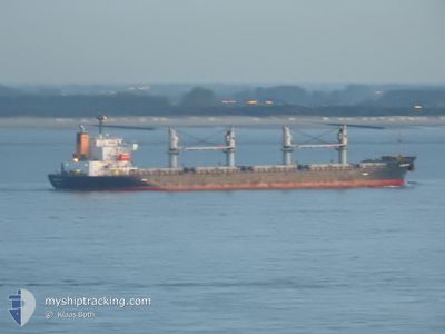
KALLISTI GS
Bulk Carrier
Current Trip
| Time Travelled | 7 days |
|---|---|
| Remaining Time | --- |
| Distance Travelled | 788.43 nm |
| Remaining Distance | --- |
| AVG Speed | 10.4 Knopen |
| MAX Speed | 13.6 Knopen |
| AVG Wind | 12.5 knots |
| MAX Wind | 31.7 knots |
| MIN Temp | 12.7°C / 54.86°F |
| MAX Temp | 19.4°C / 66.92°F |
| Diepgang | 5.8 M |
| Positie ontvangen | 2 m geleden |
Current Position
| Lengtegraad | 23.55108° |
|---|---|
| Breedtegraat | 37.86911° |
| Status | At anchor |
| Snelheid | 0.2 Knopen |
| Koers | 288° |
| Gebied | Aegean Sea |
| Station | T-AIS |
| Positie ontvangen | 2 m geleden |
Info
Information
The current position of KALLISTI GS is in Aegean Sea with coordinates 37.86911° / 23.55108° as reported on 2024-04-25 20:08 by AIS to our vessel tracker app. The vessel's current speed is 0.2 Knopen
The vessel KALLISTI GS (IMO: 9494814, MMSI: 538008362) is a Bulk Carrier that was built in 2010 ( 14 Jaar oud ). It's sailing under the flag of [MH] Marshall Is.
In this page you can find informations about the vessels current position, last detected port calls, and current voyage information. If the vessels is not in coverage by AIS you will find the latest position.
The current position of KALLISTI GS is detected by our AIS receivers and we are not responsible for the reliability of the data. The last position was recorded while the vessel was in Coverage by the Ais receivers of our vessel tracking app.
The current draught of KALLISTI GS as reported by AIS is 5.8 meters
Weather
| Temperature | 16.7°C / 62.06°F |
|---|---|
| Wind Speed | 17 knots |
| Direction | 302° WNW |
| Pressure | 1009.5 hPa |
| Humidity | 60.8 % |
| Cloud Coverage | --- |
Featured Company
Last Port Calls
| Port | Arrival | Departure | Time In Port |
|---|---|---|---|
| 2024-04-09 10:59 | 2024-04-17 20:26 | 8 d | |
| 2024-02-08 08:03 | 2024-02-16 04:47 | 7 d |
Most Visited Ports (Last year)
| Port | Arrivals | |
|---|---|---|
| 2 | ||
| 2 | ||
| 2 | ||
| 1 | ||
| 1 | ||
| 1 |
Last Trips
| Origin | Departure | Destination | Arrival | Distance | |
|---|---|---|---|---|---|
| 2024-02-15 22:47 | 2024-04-09 11:59 | 5262.51 nm | |||
| 2023-12-29 20:47 | 2024-02-08 02:03 | 7641.43 nm |
Events
| Tijd | Evenement | Details | Positie / Bestemming | Info |
|---|---|---|---|---|
| 2024-04-25 06:05 | Destination Changed | BOSPHORUS TURKEY DARDANELLES |
37.86781 / 23.54953
BOSPHORUS TURKEY
|
Snelheid: Koers: 332° |
| 2024-04-25 05:35 | ETA Changed | 2024/04/27 21:01 2025/01/01 21:01 |
37.86777 / 23.54999
DARDANELLES
|
Snelheid: Koers: 322° |
| 2024-04-25 05:29 | ETA Changed | 2025/01/01 21:01 2024/04/27 21:01 |
37.86768 / 23.54995
DARDANELLES
|
Snelheid: Koers: 327° |
| 2024-04-24 15:29 | ETA Changed | 2024/04/27 21:01 2025/01/01 21:01 |
37.86930 / 23.55067
DARDANELLES
|
Snelheid: Koers: 268° |
| 2024-04-24 15:23 | ETA Changed | 2025/01/01 21:01 2024/04/27 21:01 |
37.86929 / 23.55082
DARDANELLES
|
Snelheid: 0.1 kn Koers: 271° |
| 2024-04-24 11:47 | Destination Changed | DARDANELLES CANAKALLE |
37.86800 / 23.55050
DARDANELLES
|
Snelheid: 0.1 kn Koers: 312° |
| 2024-04-24 11:41 | ETA Changed | 2024/04/27 21:01 2024/04/28 00:01 |
37.86817 / 23.55071
CANAKALLE
|
Snelheid: Koers: 295° |
| 2024-04-24 11:39 | ETA Changed | 2024/04/28 00:01 2024/04/20 11:00 |
37.86817 / 23.55071
CANAKALLE
|
Snelheid: Koers: 295° |
| 2024-04-24 11:36 | Destination Changed | CANAKALLE GR PIR |
37.86820 / 23.55078
CANAKALLE
|
Snelheid: 0.1 kn Koers: 295° |
| 2024-04-24 10:05 | ETA Changed | 2024/04/20 11:00 2025/01/01 11:00 |
37.86808 / 23.55071
GR PIR
|
Snelheid: Koers: 293° |