
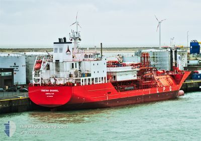
TRISTAR SHAMAL
Tanker
Current Trip
MARGATE ANCH.
| Time Travelled | 18 h, 24 mins |
|---|---|
| Remaining Time | --- |
| Distance Travelled | 118.13 nm |
| Remaining Distance | --- |
| AVG Speed | 12.1 Knopen |
| MAX Speed | 15.4 Knopen |
| AVG Wind | 21.5 knots |
| MAX Wind | 27.9 knots |
| MIN Temp | 6.9°C / 44.42°F |
| MAX Temp | 10.5°C / 50.9°F |
| Diepgang | 5.7 M |
| Positie ontvangen | 4 m geleden |
Current Position
| Lengtegraad | 1.47173° |
|---|---|
| Breedtegraat | 51.50532° |
| Status | At anchor |
| Snelheid | 0.2 Knopen |
| Koers | 11° |
| Gebied | North Sea |
| Station | T-AIS |
| Positie ontvangen | 4 m geleden |
Info
Information
The current position of TRISTAR SHAMAL is in North Sea with coordinates 51.50532° / 1.47173° as reported on 2024-04-19 18:54 by AIS to our vessel tracker app. The vessel's current speed is 0.2 Knopen
The vessel TRISTAR SHAMAL (IMO: 950619800, MMSI: 236567000) is a Tanker It's sailing under the flag of [GI] Gibraltar.
In this page you can find informations about the vessels current position, last detected port calls, and current voyage information. If the vessels is not in coverage by AIS you will find the latest position.
The current position of TRISTAR SHAMAL is detected by our AIS receivers and we are not responsible for the reliability of the data. The last position was recorded while the vessel was in Coverage by the Ais receivers of our vessel tracking app.
The current draught of TRISTAR SHAMAL as reported by AIS is 5.7 meters
Weather
| Temperature | 8.7°C / 47.66°F |
|---|---|
| Wind Speed | 25 knots |
| Direction | 353° N |
| Pressure | 1019.1 hPa |
| Humidity | 62.7 % |
| Cloud Coverage | 39 % |
Featured Company
Last Port Calls
| Port | Arrival | Departure | Time In Port |
|---|---|---|---|
| 2024-04-17 06:52 | 2024-04-19 00:34 | 1 d | |
| 2024-04-12 15:18 | 2024-04-13 21:31 | 1 d | |
| 2024-04-03 02:58 | 2024-04-05 17:18 | 2 d | |
| 2024-03-17 14:18 | 2024-03-18 18:56 | 1 d | |
| 2024-03-14 10:49 | 2024-03-15 18:44 | 1 d | |
| 2024-02-29 16:42 | 2024-03-01 23:43 | 1 d | |
| 2024-02-17 02:00 | 2024-02-19 23:14 | 2 d | |
| 2024-02-11 06:33 | 2024-02-13 08:44 | 2 d | |
| 2024-02-07 09:19 | 2024-02-08 09:30 | 1 d | |
| 2024-02-02 00:32 | 2024-02-02 01:21 | 49 m |
Last Trips
| Origin | Departure | Destination | Arrival | Distance | |
|---|---|---|---|---|---|
| 2024-04-13 22:31 | 2024-04-17 08:52 | 460.19 nm | |||
| 2024-04-05 19:18 | 2024-04-12 16:18 | 801.83 nm | |||
| 2024-03-18 18:56 | 2024-04-03 04:58 | 625.57 nm | |||
| 2024-03-15 19:44 | 2024-03-17 14:18 | 592.48 nm | |||
| 2024-03-02 00:43 | 2024-03-14 11:49 | 291.63 nm | |||
| 2024-02-20 00:14 | 2024-02-29 17:42 | 405.26 nm | |||
| 2024-02-13 08:44 | 2024-02-17 03:00 | 179.01 nm | |||
| 2024-02-08 09:30 | 2024-02-11 06:33 | 368.44 nm | |||
| 2024-02-02 02:21 | 2024-02-07 09:19 | 395.60 nm | |||
| 2024-02-02 00:21 | 2024-02-02 01:32 | 4.32 nm |
Events
| Tijd | Evenement | Details | Positie / Bestemming | Info |
|---|---|---|---|---|
| 2024-04-19 13:27 | Status Changed | At anchor Under way using engine |
51.50603 / 1.47508
MARGATE ANCH.
|
Snelheid: 0.2 kn Koers: 332° |
| 2024-04-19 10:25 | Stop beweging | 11.07 nm, North of RAMSGATE |
51.50720 / 1.47256
MARGATE ANCH.
|
Snelheid: 0.1 kn Koers: 305° |
| 2024-04-19 08:19 | Gevonden in zee | United Kingdom part of the North Sea |
51.41124 / 2.06081
North Sea
MARGATE ANCH.
|
Snelheid: 11.5 kn Koers: 298.2° |
| 2024-04-19 07:19 | Wijzig zee gebeid | French part of the North Sea Belgian part of the North Sea |
51.35136 / 2.34242
North Sea
MARGATE ANCH.
|
Snelheid: 11.8 kn Koers: 253.2° |
| 2024-04-19 04:10 | Wijzig zee gebeid | Belgian part of the North Sea Dutch part of the North Sea |
51.40817 / 3.32273
North Sea
MARGATE ANCH.
|
Snelheid: 13.2 kn Koers: 273° |
| 2024-04-19 00:34 | Vertrekhaven |
|
51.36879 / 4.22083
MARGATE ANCH.
|
Snelheid: 13.9 kn Koers: 344° |
| 2024-04-19 00:13 | ETA Changed | 2024/04/19 11:00 2024/04/19 17:30 |
51.31764 / 4.27161
[BE] ANTWERP
|
Snelheid: 13.3 kn Koers: 2° |
| 2024-04-18 23:44 | Start beweging |
51.26388 / 4.27986
[BE] ANTWERP
|
Snelheid: 3.1 kn Koers: 87° |
|
| 2024-04-18 22:51 | Stop beweging |
51.26384 / 4.27684
[BE] ANTWERP
|
Snelheid: 0.3 kn Koers: 91° |
|
| 2024-04-18 22:35 | Start beweging |
51.26315 / 4.25353
[BE] ANTWERP
|
Snelheid: 4.9 kn Koers: 47° |