
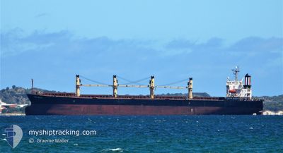
THOR INSUVI
Bulk Carrier
Current Trip
| Time Travelled | 26 days |
|---|---|
| Remaining Time | 6 days |
| Distance Travelled | 4175.60 nm |
| Remaining Distance | 1899.53 nm |
| AVG Speed | 10.5 Knopen |
| MAX Speed | 15.6 Knopen |
| AVG Wind | 10.5 knots |
| MAX Wind | 28.9 knots |
| MIN Temp | 10.4°C / 50.72°F |
| MAX Temp | 22.4°C / 72.32°F |
| Diepgang | 11.3 M |
| Positie ontvangen | 1 d geleden |
Current Position
| Lengtegraad | -25.28523° |
|---|---|
| Breedtegraat | 35.94935° |
| Status | Under way using engine |
| Snelheid | 12.3 Knopen |
| Koers | 267.1° |
| Gebied | North Atlantic Ocean |
| Station | T-AIS |
| Positie ontvangen | 1 d geleden |
Info
Information
The current position of THOR INSUVI is in North Atlantic Ocean with coordinates 35.94935° / -25.28523° as reported on 2024-04-23 23:21 by AIS to our vessel tracker app. The vessel's current speed is 12.3 Knopen and is heading at the port of NEW YORK. The estimated time of arrival as calculated by MyShipTracking vessel tracking app is 2024-05-02 03:52 LT
The vessel THOR INSUVI (IMO: 9298533, MMSI: 566636000) is a Bulk Carrier that was built in 2005 ( 19 Jaar oud ). It's sailing under the flag of [SG] Singapore.
In this page you can find informations about the vessels current position, last detected port calls, and current voyage information. If the vessels is not in coverage by AIS you will find the latest position.
The current position of THOR INSUVI is detected by our AIS receivers and we are not responsible for the reliability of the data. The last position was recorded while the vessel was in Coverage by the Ais receivers of our vessel tracking app.
The current draught of THOR INSUVI as reported by AIS is 11.3 meters
Weather
| Temperature | 16.9°C / 62.42°F |
|---|---|
| Wind Speed | 14 knots |
| Direction | 60° ENE |
| Pressure | 1028.8 hPa |
| Humidity | 74.8 % |
| Cloud Coverage | 100 % |
Featured Company
Last Port Calls
| Port | Arrival | Departure | Time In Port |
|---|---|---|---|
| 2024-03-27 06:19 | 2024-03-30 06:57 | 3 d | |
| 2024-03-26 15:36 | 2024-03-26 17:08 | 1 h | |
| 2024-02-27 03:34 | 2024-03-03 16:42 | 5 d | |
| 2024-02-10 14:49 | 2024-02-21 13:57 | 10 d |
Most Visited Ports (Last year)
| Port | Arrivals | |
|---|---|---|
| 2 | ||
| 2 | ||
| 2 | ||
| 2 | ||
| 2 | ||
| 1 |
Last Trips
| Origin | Departure | Destination | Arrival | Distance | |
|---|---|---|---|---|---|
| 2024-03-26 20:08 | 2024-03-27 09:19 | 106.91 nm | |||
| 2024-03-03 11:42 | 2024-03-26 18:36 | 5980.51 nm | |||
| 2024-02-21 07:57 | 2024-02-26 22:34 | 1684.33 nm | |||
| 2024-01-11 21:29 | 2024-02-10 08:49 | 6944.42 nm |
Events
| Tijd | Evenement | Details | Positie / Bestemming | Info |
|---|---|---|---|---|
| 2024-04-23 23:28 | Status Changed | Default Under way using engine |
35.94667 / -25.31333
NEWARK, U.S.A.
|
Snelheid: 12.3 kn Koers: 267.1° |
| 2024-04-23 23:21 | Buitenbereik |
35.94935 / -25.28523
North Atlantic Ocean
NEWARK, U.S.A.
|
Snelheid: 12.3 kn Koers: 267.1° |
|
| 2024-04-23 23:15 | Status Changed | Under way using engine Default |
35.94967 / -25.25837
NEWARK, U.S.A.
|
Snelheid: 12.4 kn Koers: 269° |
| 2024-04-23 23:04 | Status Changed | Default Under way using engine |
35.94833 / -25.21167
NEWARK, U.S.A.
|
Snelheid: 12.4 kn Koers: 270.6° |
| 2024-04-23 22:49 | Status Changed | Under way using engine Default |
35.94833 / -25.14709
NEWARK, U.S.A.
|
Snelheid: 12 kn Koers: 270° |
| 2024-04-23 22:22 | Status Changed | Default Under way using engine |
35.94833 / -25.03500
NEWARK, U.S.A.
|
Snelheid: 11.9 kn Koers: 269.5° |
| 2024-04-23 21:27 | Status Changed | Under way using engine Default |
35.94959 / -24.80753
NEWARK, U.S.A.
|
Snelheid: 12 kn Koers: 269° |
| 2024-04-23 21:07 | Status Changed | Default Under way using engine |
35.94833 / -24.72500
NEWARK, U.S.A.
|
Snelheid: 11.9 kn Koers: 269.7° |
| 2024-04-23 21:03 | Wijzig zee gebeid | Portuguese (Azores) part of the North Atlantic Ocean High seas of the North Atlantic Ocean |
35.94996 / -24.70784
North Atlantic Ocean
NEWARK, U.S.A.
|
Snelheid: 11.9 kn Koers: 269.7° |
| 2024-04-23 21:03 | Status Changed | Under way using engine Default |
35.94996 / -24.70784
NEWARK, U.S.A.
|
Snelheid: 12 kn Koers: 270° |