
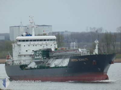
THERESA SCHULTE
Tanker C
Current Trip
| Time Travelled | 46 days |
|---|---|
| Remaining Time | 4 days |
| Distance Travelled | 10507.11 nm |
| Remaining Distance | 1124.09 nm |
| AVG Speed | 11.8 Knopen |
| MAX Speed | 15.4 Knopen |
| AVG Wind | 12.9 knots |
| MAX Wind | 32 knots |
| MIN Temp | 14.7°C / 58.46°F |
| MAX Temp | 29.6°C / 85.28°F |
| Diepgang | 7 M |
| Positie ontvangen | Nu |
Current Position
| Lengtegraad | -11.89680° |
|---|---|
| Breedtegraat | 38.20863° |
| Status | Under way using engine |
| Snelheid | 10.1 Knopen |
| Koers | 19.4° |
| Gebied | North Atlantic Ocean |
| Station | T-AIS |
| Positie ontvangen | Nu |
Info
Information
The current position of THERESA SCHULTE is in North Atlantic Ocean with coordinates 38.20863° / -11.89680° as reported on 2024-04-16 07:51 by AIS to our vessel tracker app. The vessel's current speed is 10.1 Knopen and is heading at the port of ANTWERP. The estimated time of arrival as calculated by MyShipTracking vessel tracking app is 2024-04-21 00:21 LT
The vessel THERESA SCHULTE (IMO: 9553622, MMSI: 563087500) is a Tanker C It's sailing under the flag of [SG] Singapore.
In this page you can find informations about the vessels current position, last detected port calls, and current voyage information. If the vessels is not in coverage by AIS you will find the latest position.
The current position of THERESA SCHULTE is detected by our AIS receivers and we are not responsible for the reliability of the data. The last position was recorded while the vessel was in Coverage by the Ais receivers of our vessel tracking app.
The current draught of THERESA SCHULTE as reported by AIS is 7 meters
Weather
| Temperature | 14.7°C / 58.46°F |
|---|---|
| Wind Speed | 21 knots |
| Direction | 17° NNE |
| Pressure | 1022.3 hPa |
| Humidity | 84.3 % |
| Cloud Coverage | 16 % |
Featured Company
Events
| Tijd | Evenement | Details | Positie / Bestemming | Info |
|---|---|---|---|---|
| 2024-04-15 17:44 | Wijzig zee gebeid | Portuguese part of the North Atlantic Ocean High seas of the North Atlantic Ocean |
35.84641 / -12.85917
North Atlantic Ocean
BEANR
|
Snelheid: 11.1 kn Koers: 14.1° |
| 2024-04-15 13:59 | Gevonden in zee | High seas of the North Atlantic Ocean |
35.18256 / -13.13052
North Atlantic Ocean
BEANR
|
Snelheid: 11.5 kn Koers: 23.5° |
| 2024-04-15 12:38 | Status Changed | Under way using engine Default |
34.93794 / -13.25019
BEANR
|
Snelheid: 11.7 kn Koers: 18° |
| 2024-04-15 12:36 | Status Changed | Default Under way using engine |
34.93337 / -13.25214
BEANR
|
Snelheid: 11.6 kn Koers: 21.3° |
| 2024-04-15 11:42 | Status Changed | Under way using engine Default |
34.77052 / -13.33156
BEANR
|
Snelheid: 11.8 kn Koers: 5° |
| 2024-04-15 11:35 | Status Changed | Default Under way using engine |
34.74931 / -13.33707
BEANR
|
Snelheid: 11.9 kn Koers: 2.4° |
| 2024-04-15 11:28 | Status Changed | Under way using engine Default |
34.72518 / -13.33887
BEANR
|
Snelheid: 12 kn Koers: 4° |
| 2024-04-15 11:24 | Status Changed | Default Under way using engine |
34.71399 / -13.33965
BEANR
|
Snelheid: 12.1 kn Koers: 2.4° |
| 2024-04-15 09:28 | Status Changed | Under way using engine Default |
34.34482 / -13.46800
BEANR
|
Snelheid: 11.6 kn Koers: 15° |
| 2024-04-15 09:00 | Status Changed | Default Under way using engine |
34.25719 / -13.49898
BEANR
|
Snelheid: 11.6 kn Koers: 16.4° |